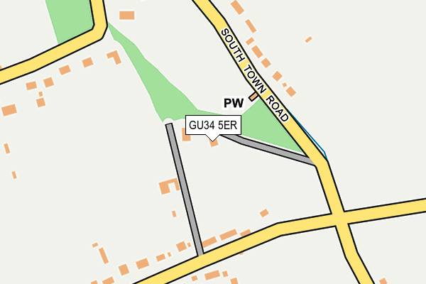
GU34 5ER is located in the Four Marks & Medstead electoral ward, within the local authority district of East Hampshire and the English Parliamentary constituency of East Hampshire. The Sub Integrated Care Board (ICB) Location is NHS Hampshire and Isle of Wight ICB - D9Y0V and the police force is Hampshire. This postcode has been in use since January 1980.


GetTheData
Source: OS OpenMap – Local (Ordnance Survey)
Source: OS VectorMap District (Ordnance Survey)
Licence: Open Government Licence (requires attribution)
| Easting | 465826 |
| Northing | 135879 |
| Latitude | 51.118427 |
| Longitude | -1.060902 |
GetTheData
Source: Open Postcode Geo
Licence: Open Government Licence
| Country | England |
| Postcode District | GU34 |
➜ See where GU34 is on a map ➜ Where is Soldridge? | |
GetTheData
Source: Land Registry Price Paid Data
Licence: Open Government Licence
Elevation or altitude of GU34 5ER as distance above sea level:
| Metres | Feet | |
|---|---|---|
| Elevation | 190m | 623ft |
Elevation is measured from the approximate centre of the postcode, to the nearest point on an OS contour line from OS Terrain 50, which has contour spacing of ten vertical metres.
➜ How high above sea level am I? Find the elevation of your current position using your device's GPS.
GetTheData
Source: Open Postcode Elevation
Licence: Open Government Licence
| Ward | Four Marks & Medstead |
| Constituency | East Hampshire |
GetTheData
Source: ONS Postcode Database
Licence: Open Government Licence
| High Street (South Town Road) | Medstead | 1,142m |
| High Street (South Town Road) | Medstead | 1,147m |
| Lymington Bottom (Winchester Road) | Four Marks | 1,247m |
| Lymington Bottom (Winchester Road) | Four Marks | 1,249m |
| Kingswood Rise (Winchester Road) | Four Marks | 1,257m |
| Medstead & Four Marks (Mid Hants Railway) | Four Marks | 1,195m |
GetTheData
Source: NaPTAN
Licence: Open Government Licence
| Percentage of properties with Next Generation Access | 100.0% |
| Percentage of properties with Superfast Broadband | 100.0% |
| Percentage of properties with Ultrafast Broadband | 0.0% |
| Percentage of properties with Full Fibre Broadband | 0.0% |
Superfast Broadband is between 30Mbps and 300Mbps
Ultrafast Broadband is > 300Mbps
| Percentage of properties unable to receive 2Mbps | 0.0% |
| Percentage of properties unable to receive 5Mbps | 0.0% |
| Percentage of properties unable to receive 10Mbps | 0.0% |
| Percentage of properties unable to receive 30Mbps | 0.0% |
GetTheData
Source: Ofcom
Licence: Ofcom Terms of Use (requires attribution)
GetTheData
Source: ONS Postcode Database
Licence: Open Government Licence


➜ Get more ratings from the Food Standards Agency
GetTheData
Source: Food Standards Agency
Licence: FSA terms & conditions
| Last Collection | |||
|---|---|---|---|
| Location | Mon-Fri | Sat | Distance |
| Five Ash Road | 16:00 | 08:00 | 811m |
| Lymington Bottom Road | 16:30 | 08:45 | 1,197m |
| Mestead Post Office | 16:15 | 09:30 | 1,267m |
GetTheData
Source: Dracos
Licence: Creative Commons Attribution-ShareAlike
The below table lists the International Territorial Level (ITL) codes (formerly Nomenclature of Territorial Units for Statistics (NUTS) codes) and Local Administrative Units (LAU) codes for GU34 5ER:
| ITL 1 Code | Name |
|---|---|
| TLJ | South East (England) |
| ITL 2 Code | Name |
| TLJ3 | Hampshire and Isle of Wight |
| ITL 3 Code | Name |
| TLJ36 | Central Hampshire |
| LAU 1 Code | Name |
| E07000085 | East Hampshire |
GetTheData
Source: ONS Postcode Directory
Licence: Open Government Licence
The below table lists the Census Output Area (OA), Lower Layer Super Output Area (LSOA), and Middle Layer Super Output Area (MSOA) for GU34 5ER:
| Code | Name | |
|---|---|---|
| OA | E00114872 | |
| LSOA | E01022596 | East Hampshire 007E |
| MSOA | E02004703 | East Hampshire 007 |
GetTheData
Source: ONS Postcode Directory
Licence: Open Government Licence
| GU34 5ES | South Town Road | 190m |
| GU34 5PR | Paice Lane | 322m |
| GU34 5EP | Lymington Bottom Road | 466m |
| GU34 5JF | Soldridge Road | 481m |
| GU34 5EJ | Five Ash Road | 540m |
| GU34 5PP | South Town Road | 558m |
| GU34 5PW | Homestead Road | 763m |
| GU34 5EH | Five Ash Road | 779m |
| GU34 5PN | South Town Road | 797m |
| GU34 5FN | Lymington Bottom Road | 800m |
GetTheData
Source: Open Postcode Geo; Land Registry Price Paid Data
Licence: Open Government Licence