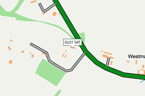
GU31 5AT lies on Midhurst Road in Petersfield. GU31 5AT is located in the Froxfield, Sheet & Steep electoral ward, within the local authority district of East Hampshire and the English Parliamentary constituency of East Hampshire. The Sub Integrated Care Board (ICB) Location is NHS Hampshire and Isle of Wight ICB - D9Y0V and the police force is Hampshire. This postcode has been in use since January 1980.


GetTheData
Source: OS OpenMap – Local (Ordnance Survey)
Source: OS VectorMap District (Ordnance Survey)
Licence: Open Government Licence (requires attribution)
| Easting | 476691 |
| Northing | 124237 |
| Latitude | 51.012410 |
| Longitude | -0.908164 |
GetTheData
Source: Open Postcode Geo
Licence: Open Government Licence
| Street | Midhurst Road |
| Town/City | Petersfield |
| Country | England |
| Postcode District | GU31 |
➜ See where GU31 is on a map | |
GetTheData
Source: Land Registry Price Paid Data
Licence: Open Government Licence
Elevation or altitude of GU31 5AT as distance above sea level:
| Metres | Feet | |
|---|---|---|
| Elevation | 60m | 197ft |
Elevation is measured from the approximate centre of the postcode, to the nearest point on an OS contour line from OS Terrain 50, which has contour spacing of ten vertical metres.
➜ How high above sea level am I? Find the elevation of your current position using your device's GPS.
GetTheData
Source: Open Postcode Elevation
Licence: Open Government Licence
| Ward | Froxfield, Sheet & Steep |
| Constituency | East Hampshire |
GetTheData
Source: ONS Postcode Database
Licence: Open Government Licence
| Adhurst St Mary Junction (A272) | Sheet | 295m |
| Adhurst St Mary Junction (A272) | Sheet | 305m |
| Adhurst St Mary Junction (B2070 London Road) | Sheet | 354m |
| Adhurst St Mary Junction (B2070 London Road) | Sheet | 380m |
| The Half Moon | Sheet | 661m |
| Petersfield Station | 2.4km |
| Liss Station | 3.6km |
GetTheData
Source: NaPTAN
Licence: Open Government Licence
| Percentage of properties with Next Generation Access | 100.0% |
| Percentage of properties with Superfast Broadband | 27.3% |
| Percentage of properties with Ultrafast Broadband | 0.0% |
| Percentage of properties with Full Fibre Broadband | 0.0% |
Superfast Broadband is between 30Mbps and 300Mbps
Ultrafast Broadband is > 300Mbps
| Median download speed | 18.0Mbps |
| Average download speed | 18.1Mbps |
| Maximum download speed | 33.63Mbps |
| Median upload speed | 2.0Mbps |
| Average upload speed | 2.9Mbps |
| Maximum upload speed | 8.71Mbps |
| Percentage of properties unable to receive 2Mbps | 0.0% |
| Percentage of properties unable to receive 5Mbps | 0.0% |
| Percentage of properties unable to receive 10Mbps | 0.0% |
| Percentage of properties unable to receive 30Mbps | 72.7% |
GetTheData
Source: Ofcom
Licence: Ofcom Terms of Use (requires attribution)
Estimated total energy consumption in GU31 5AT by fuel type, 2015.
| Consumption (kWh) | 87,227 |
|---|---|
| Meter count | 12 |
| Mean (kWh/meter) | 7,269 |
| Median (kWh/meter) | 5,326 |
GetTheData
Source: Postcode level gas estimates: 2015 (experimental)
Source: Postcode level electricity estimates: 2015 (experimental)
Licence: Open Government Licence
GetTheData
Source: ONS Postcode Database
Licence: Open Government Licence


➜ Get more ratings from the Food Standards Agency
GetTheData
Source: Food Standards Agency
Licence: FSA terms & conditions
| Last Collection | |||
|---|---|---|---|
| Location | Mon-Fri | Sat | Distance |
| Adhurst | 16:00 | 08:45 | 435m |
| Pulens Crescent | 17:30 | 12:00 | 845m |
| Village Street | 17:30 | 12:00 | 904m |
GetTheData
Source: Dracos
Licence: Creative Commons Attribution-ShareAlike
The below table lists the International Territorial Level (ITL) codes (formerly Nomenclature of Territorial Units for Statistics (NUTS) codes) and Local Administrative Units (LAU) codes for GU31 5AT:
| ITL 1 Code | Name |
|---|---|
| TLJ | South East (England) |
| ITL 2 Code | Name |
| TLJ3 | Hampshire and Isle of Wight |
| ITL 3 Code | Name |
| TLJ36 | Central Hampshire |
| LAU 1 Code | Name |
| E07000085 | East Hampshire |
GetTheData
Source: ONS Postcode Directory
Licence: Open Government Licence
The below table lists the Census Output Area (OA), Lower Layer Super Output Area (LSOA), and Middle Layer Super Output Area (MSOA) for GU31 5AT:
| Code | Name | |
|---|---|---|
| OA | E00115018 | |
| LSOA | E01022625 | East Hampshire 011E |
| MSOA | E02004707 | East Hampshire 011 |
GetTheData
Source: ONS Postcode Directory
Licence: Open Government Licence
| GU31 5AB | London Road | 486m |
| GU31 4DL | Copse Close | 590m |
| GU31 5AD | 645m | |
| GU31 4DN | Rother Close | 648m |
| GU31 4DA | Old Mill Lane | 699m |
| GU31 4DJ | Geddes Way | 702m |
| GU31 4BG | London Road | 726m |
| GU31 4DB | Pulens Lane | 730m |
| GU31 4BE | London Road | 741m |
| GU32 2AJ | Mill Lane | 747m |
GetTheData
Source: Open Postcode Geo; Land Registry Price Paid Data
Licence: Open Government Licence