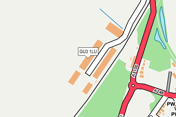
GU3 1LU lies on Quadrum Park in Peasmarsh, Guildford. GU3 1LU is located in the Shalford electoral ward, within the local authority district of Guildford and the English Parliamentary constituency of Guildford. The Sub Integrated Care Board (ICB) Location is NHS Surrey Heartlands ICB - 92A and the police force is Surrey. This postcode has been in use since March 2004.


GetTheData
Source: OS OpenMap – Local (Ordnance Survey)
Source: OS VectorMap District (Ordnance Survey)
Licence: Open Government Licence (requires attribution)
| Easting | 498886 |
| Northing | 146615 |
| Latitude | 51.210190 |
| Longitude | -0.585744 |
GetTheData
Source: Open Postcode Geo
Licence: Open Government Licence
| Street | Quadrum Park |
| Locality | Peasmarsh |
| Town/City | Guildford |
| Country | England |
| Postcode District | GU3 |
➜ See where GU3 is on a map ➜ Where is Peasmarsh? | |
GetTheData
Source: Land Registry Price Paid Data
Licence: Open Government Licence
Elevation or altitude of GU3 1LU as distance above sea level:
| Metres | Feet | |
|---|---|---|
| Elevation | 40m | 131ft |
Elevation is measured from the approximate centre of the postcode, to the nearest point on an OS contour line from OS Terrain 50, which has contour spacing of ten vertical metres.
➜ How high above sea level am I? Find the elevation of your current position using your device's GPS.
GetTheData
Source: Open Postcode Elevation
Licence: Open Government Licence
| Ward | Shalford |
| Constituency | Guildford |
GetTheData
Source: ONS Postcode Database
Licence: Open Government Licence
| The Green (Old Portsmouth Road) | Peasmarsh | 186m |
| The Green (Old Portsmouth Road) | Peasmarsh | 203m |
| Filling Station (Old Portsmouth Road) | Peasmarsh | 487m |
| Filling Station (Old Portsmouth Road) | Peasmarsh | 497m |
| Loseley Park (Old Portsmouth Road) | Artington | 546m |
| Shalford (Surrey) Station | 1.4km |
| Farncombe Station | 2km |
| Guildford Station | 3km |
GetTheData
Source: NaPTAN
Licence: Open Government Licence
| Median download speed | 10.0Mbps |
| Average download speed | 9.6Mbps |
| Maximum download speed | 15.00Mbps |
| Median upload speed | 0.9Mbps |
| Average upload speed | 1.0Mbps |
| Maximum upload speed | 1.30Mbps |
GetTheData
Source: Ofcom
Licence: Ofcom Terms of Use (requires attribution)
GetTheData
Source: ONS Postcode Database
Licence: Open Government Licence


➜ Get more ratings from the Food Standards Agency
GetTheData
Source: Food Standards Agency
Licence: FSA terms & conditions
| Last Collection | |||
|---|---|---|---|
| Location | Mon-Fri | Sat | Distance |
| Oakdene Road | 17:00 | 12:00 | 283m |
| Broadford Road, Shalford | 17:00 | 12:00 | 916m |
| Artington | 17:30 | 12:00 | 1,151m |
GetTheData
Source: Dracos
Licence: Creative Commons Attribution-ShareAlike
The below table lists the International Territorial Level (ITL) codes (formerly Nomenclature of Territorial Units for Statistics (NUTS) codes) and Local Administrative Units (LAU) codes for GU3 1LU:
| ITL 1 Code | Name |
|---|---|
| TLJ | South East (England) |
| ITL 2 Code | Name |
| TLJ2 | Surrey, East and West Sussex |
| ITL 3 Code | Name |
| TLJ25 | West Surrey |
| LAU 1 Code | Name |
| E07000209 | Guildford |
GetTheData
Source: ONS Postcode Directory
Licence: Open Government Licence
The below table lists the Census Output Area (OA), Lower Layer Super Output Area (LSOA), and Middle Layer Super Output Area (MSOA) for GU3 1LU:
| Code | Name | |
|---|---|---|
| OA | E00155454 | |
| LSOA | E01030478 | Guildford 017C |
| MSOA | E02006360 | Guildford 017 |
GetTheData
Source: ONS Postcode Directory
Licence: Open Government Licence
| GU3 1LY | Old Portsmouth Road | 149m |
| GU3 1LX | Old Portsmouth Road | 189m |
| GU3 1ND | Oakdene Road | 317m |
| GU3 1NJ | Oakdene Place | 386m |
| GU3 1NF | James Road | 396m |
| GU3 1NG | Unstead Wood | 398m |
| GU3 1NE | The Astolat Business Park | 414m |
| GU3 1NB | Mill Lane | 428m |
| GU3 1HR | Littleton Lane | 487m |
| GU3 1LZ | Portsmouth Road | 631m |
GetTheData
Source: Open Postcode Geo; Land Registry Price Paid Data
Licence: Open Government Licence