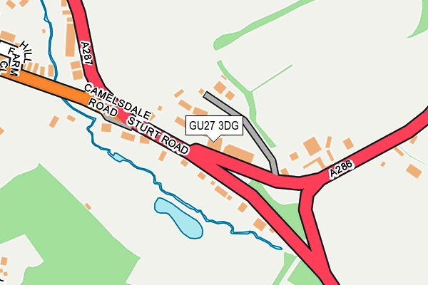
GU27 3DG is located in the Haslemere West electoral ward, within the local authority district of Waverley and the English Parliamentary constituency of South West Surrey. The Sub Integrated Care Board (ICB) Location is NHS Surrey Heartlands ICB - 92A and the police force is Surrey. This postcode has been in use since January 1980.


GetTheData
Source: OS OpenMap – Local (Ordnance Survey)
Source: OS VectorMap District (Ordnance Survey)
Licence: Open Government Licence (requires attribution)
| Easting | 489239 |
| Northing | 131962 |
| Latitude | 51.080050 |
| Longitude | -0.727437 |
GetTheData
Source: Open Postcode Geo
Licence: Open Government Licence
| Country | England |
| Postcode District | GU27 |
➜ See where GU27 is on a map ➜ Where is Haslemere? | |
GetTheData
Source: Land Registry Price Paid Data
Licence: Open Government Licence
Elevation or altitude of GU27 3DG as distance above sea level:
| Metres | Feet | |
|---|---|---|
| Elevation | 140m | 459ft |
Elevation is measured from the approximate centre of the postcode, to the nearest point on an OS contour line from OS Terrain 50, which has contour spacing of ten vertical metres.
➜ How high above sea level am I? Find the elevation of your current position using your device's GPS.
GetTheData
Source: Open Postcode Elevation
Licence: Open Government Licence
| Ward | Haslemere West |
| Constituency | South West Surrey |
GetTheData
Source: ONS Postcode Database
Licence: Open Government Licence
| Bridge (Camelsdale Road) | Shottermill | 116m |
| Bridge (Camelsdale Road) | Shottermill | 127m |
| Dale View (Sun Brow) | Shottermill | 509m |
| Bell Road (A286) | Camelsdale | 510m |
| School Road (Camelsdale Road) | Camelsdale | 544m |
| Haslemere Station | 1.1km |
GetTheData
Source: NaPTAN
Licence: Open Government Licence
GetTheData
Source: ONS Postcode Database
Licence: Open Government Licence


➜ Get more ratings from the Food Standards Agency
GetTheData
Source: Food Standards Agency
Licence: FSA terms & conditions
| Last Collection | |||
|---|---|---|---|
| Location | Mon-Fri | Sat | Distance |
| Camelsdale Road | 16:45 | 12:00 | 333m |
| Fernden Lane | 17:15 | 09:30 | 498m |
| Sickle Hill | 17:15 | 12:00 | 617m |
GetTheData
Source: Dracos
Licence: Creative Commons Attribution-ShareAlike
The below table lists the International Territorial Level (ITL) codes (formerly Nomenclature of Territorial Units for Statistics (NUTS) codes) and Local Administrative Units (LAU) codes for GU27 3DG:
| ITL 1 Code | Name |
|---|---|
| TLJ | South East (England) |
| ITL 2 Code | Name |
| TLJ2 | Surrey, East and West Sussex |
| ITL 3 Code | Name |
| TLJ25 | West Surrey |
| LAU 1 Code | Name |
| E07000216 | Waverley |
GetTheData
Source: ONS Postcode Directory
Licence: Open Government Licence
The below table lists the Census Output Area (OA), Lower Layer Super Output Area (LSOA), and Middle Layer Super Output Area (MSOA) for GU27 3DG:
| Code | Name | |
|---|---|---|
| OA | E00157693 | |
| LSOA | E01030931 | Waverley 016B |
| MSOA | E02006454 | Waverley 016 |
GetTheData
Source: ONS Postcode Directory
Licence: Open Government Licence
| GU27 3DF | Bell Road | 28m |
| GU27 3DQ | Bell Road | 70m |
| GU27 3SF | Bell Road | 124m |
| GU27 3AA | Midhurst Road | 188m |
| GU27 3SD | Sturt Road | 255m |
| GU27 3SG | Camelsdale Road | 310m |
| GU27 3SU | Hill Farm Close | 321m |
| GU27 3SQ | Camelsdale Road | 340m |
| GU27 3SA | Orchard Close | 367m |
| GU27 3SS | The Old Quarry | 378m |
GetTheData
Source: Open Postcode Geo; Land Registry Price Paid Data
Licence: Open Government Licence