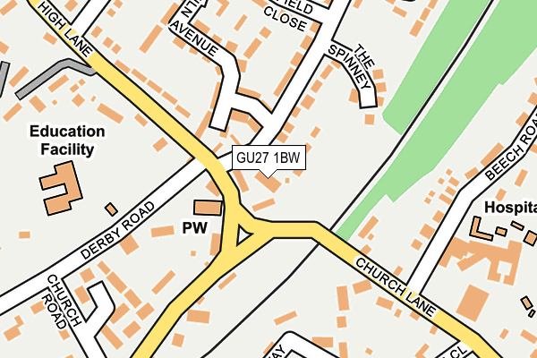
GU27 1BW is located in the Haslemere East electoral ward, within the local authority district of Waverley and the English Parliamentary constituency of South West Surrey. The Sub Integrated Care Board (ICB) Location is NHS Surrey Heartlands ICB - 92A and the police force is Surrey. This postcode has been in use since January 1980.


GetTheData
Source: OS OpenMap – Local (Ordnance Survey)
Source: OS VectorMap District (Ordnance Survey)
Licence: Open Government Licence (requires attribution)
| Easting | 490375 |
| Northing | 133454 |
| Latitude | 51.093285 |
| Longitude | -0.710852 |
GetTheData
Source: Open Postcode Geo
Licence: Open Government Licence
| Country | England |
| Postcode District | GU27 |
➜ See where GU27 is on a map ➜ Where is Haslemere? | |
GetTheData
Source: Land Registry Price Paid Data
Licence: Open Government Licence
Elevation or altitude of GU27 1BW as distance above sea level:
| Metres | Feet | |
|---|---|---|
| Elevation | 150m | 492ft |
Elevation is measured from the approximate centre of the postcode, to the nearest point on an OS contour line from OS Terrain 50, which has contour spacing of ten vertical metres.
➜ How high above sea level am I? Find the elevation of your current position using your device's GPS.
GetTheData
Source: Open Postcode Elevation
Licence: Open Government Licence
| Ward | Haslemere East |
| Constituency | South West Surrey |
GetTheData
Source: ONS Postcode Database
Licence: Open Government Licence
CHURCH HILL HOUSE, CHURCH HILL, HASLEMERE, GU27 1BW 2020 14 AUG £2,530,000 |
GetTheData
Source: HM Land Registry Price Paid Data
Licence: Contains HM Land Registry data © Crown copyright and database right 2025. This data is licensed under the Open Government Licence v3.0.
| St Barts School (High Lane) | Haslemere | 61m |
| St Barts School (High Lane) | Haslemere | 102m |
| Haslemere Hospital (Beech Road) | Haslemere | 220m |
| Bartholomew Close (Weycombe Road) | Haslemere | 228m |
| High Lane (Chatsworth Avenue) | Haslemere | 271m |
| Haslemere Station | 0.8km |
| Witley Station | 6.4km |
GetTheData
Source: NaPTAN
Licence: Open Government Licence
| Percentage of properties with Next Generation Access | 100.0% |
| Percentage of properties with Superfast Broadband | 100.0% |
| Percentage of properties with Ultrafast Broadband | 0.0% |
| Percentage of properties with Full Fibre Broadband | 0.0% |
Superfast Broadband is between 30Mbps and 300Mbps
Ultrafast Broadband is > 300Mbps
| Percentage of properties unable to receive 2Mbps | 0.0% |
| Percentage of properties unable to receive 5Mbps | 0.0% |
| Percentage of properties unable to receive 10Mbps | 0.0% |
| Percentage of properties unable to receive 30Mbps | 0.0% |
GetTheData
Source: Ofcom
Licence: Ofcom Terms of Use (requires attribution)
GetTheData
Source: ONS Postcode Database
Licence: Open Government Licence


➜ Get more ratings from the Food Standards Agency
GetTheData
Source: Food Standards Agency
Licence: FSA terms & conditions
| Last Collection | |||
|---|---|---|---|
| Location | Mon-Fri | Sat | Distance |
| North End | 16:45 | 12:00 | 402m |
| Grayswood Road | 16:00 | 09:00 | 482m |
| High Street | 17:00 | 12:00 | 505m |
GetTheData
Source: Dracos
Licence: Creative Commons Attribution-ShareAlike
The below table lists the International Territorial Level (ITL) codes (formerly Nomenclature of Territorial Units for Statistics (NUTS) codes) and Local Administrative Units (LAU) codes for GU27 1BW:
| ITL 1 Code | Name |
|---|---|
| TLJ | South East (England) |
| ITL 2 Code | Name |
| TLJ2 | Surrey, East and West Sussex |
| ITL 3 Code | Name |
| TLJ25 | West Surrey |
| LAU 1 Code | Name |
| E07000216 | Waverley |
GetTheData
Source: ONS Postcode Directory
Licence: Open Government Licence
The below table lists the Census Output Area (OA), Lower Layer Super Output Area (LSOA), and Middle Layer Super Output Area (MSOA) for GU27 1BW:
| Code | Name | |
|---|---|---|
| OA | E00157704 | |
| LSOA | E01030933 | Waverley 016D |
| MSOA | E02006454 | Waverley 016 |
GetTheData
Source: ONS Postcode Directory
Licence: Open Government Licence
| GU27 1EL | Weycombe Road | 117m |
| GU27 1BN | Church Green Cottages | 122m |
| GU27 1BE | Kiln Avenue | 151m |
| GU27 2BY | Cuthbert Row | 153m |
| GU27 1SP | The Spinney | 160m |
| GU27 1FB | Derby Road | 173m |
| GU27 2BN | Pathfields | 175m |
| GU27 1BF | Playing Field Close | 198m |
| GU27 1BL | Tanners Lane | 207m |
| GU27 2AU | Fieldway | 210m |
GetTheData
Source: Open Postcode Geo; Land Registry Price Paid Data
Licence: Open Government Licence