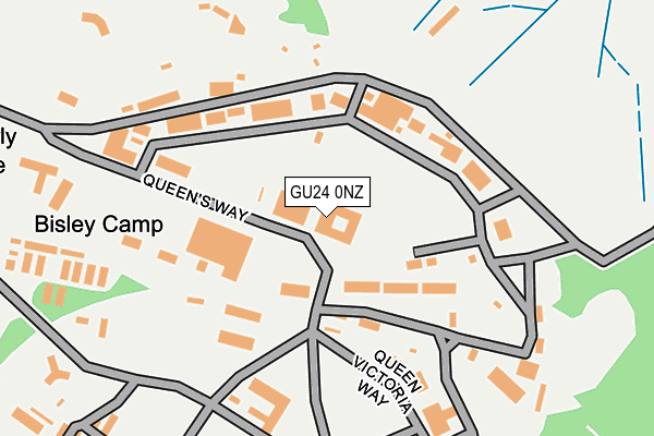
GU24 0NZ is located in the Normandy & Pirbright electoral ward, within the local authority district of Guildford and the English Parliamentary constituency of Woking. The Sub Integrated Care Board (ICB) Location is NHS Surrey Heartlands ICB - 92A and the police force is Surrey. This postcode has been in use since January 1980.


GetTheData
Source: OS OpenMap – Local (Ordnance Survey)
Source: OS VectorMap District (Ordnance Survey)
Licence: Open Government Licence (requires attribution)
| Easting | 493834 |
| Northing | 157789 |
| Latitude | 51.311489 |
| Longitude | -0.655118 |
GetTheData
Source: Open Postcode Geo
Licence: Open Government Licence
| Country | England |
| Postcode District | GU24 |
➜ See where GU24 is on a map | |
GetTheData
Source: Land Registry Price Paid Data
Licence: Open Government Licence
Elevation or altitude of GU24 0NZ as distance above sea level:
| Metres | Feet | |
|---|---|---|
| Elevation | 60m | 197ft |
Elevation is measured from the approximate centre of the postcode, to the nearest point on an OS contour line from OS Terrain 50, which has contour spacing of ten vertical metres.
➜ How high above sea level am I? Find the elevation of your current position using your device's GPS.
GetTheData
Source: Open Postcode Elevation
Licence: Open Government Licence
| Ward | Normandy & Pirbright |
| Constituency | Woking |
GetTheData
Source: ONS Postcode Database
Licence: Open Government Licence
| Manor Crescent (Billesden Road) | Pirbright Camp | 683m |
| Slade Road (Billesden Road) | Pirbright Camp | 700m |
| Gole Road Cottages (Gole Road) | Brookwood | 1,034m |
| Gole Road Cottages (Gole Road) | Brookwood | 1,043m |
| Gole Road | Pirbright Camp | 1,058m |
| Brookwood Station | 1.6km |
| Ash Vale Station | 6.4km |
GetTheData
Source: NaPTAN
Licence: Open Government Licence
GetTheData
Source: ONS Postcode Database
Licence: Open Government Licence


➜ Get more ratings from the Food Standards Agency
GetTheData
Source: Food Standards Agency
Licence: FSA terms & conditions
| Last Collection | |||
|---|---|---|---|
| Location | Mon-Fri | Sat | Distance |
| Queens Way, Bisley Camp | 17:00 | 07:30 | 16m |
| Slade Road | 17:00 | 08:00 | 752m |
| Gole Road | 16:30 | 09:00 | 1,034m |
GetTheData
Source: Dracos
Licence: Creative Commons Attribution-ShareAlike
The below table lists the International Territorial Level (ITL) codes (formerly Nomenclature of Territorial Units for Statistics (NUTS) codes) and Local Administrative Units (LAU) codes for GU24 0NZ:
| ITL 1 Code | Name |
|---|---|
| TLJ | South East (England) |
| ITL 2 Code | Name |
| TLJ2 | Surrey, East and West Sussex |
| ITL 3 Code | Name |
| TLJ25 | West Surrey |
| LAU 1 Code | Name |
| E07000209 | Guildford |
GetTheData
Source: ONS Postcode Directory
Licence: Open Government Licence
The below table lists the Census Output Area (OA), Lower Layer Super Output Area (LSOA), and Middle Layer Super Output Area (MSOA) for GU24 0NZ:
| Code | Name | |
|---|---|---|
| OA | E00155436 | |
| LSOA | E01030474 | Guildford 002D |
| MSOA | E02006345 | Guildford 002 |
GetTheData
Source: ONS Postcode Directory
Licence: Open Government Licence
| GU24 0NW | Queens Road | 415m |
| GU24 0NX | Cowshot Common | 480m |
| GU24 0NR | Brunswick Drive | 622m |
| GU24 9BA | Water Lane | 625m |
| GU24 9AX | Queens Road | 741m |
| GU24 0PH | Cowshot Crescent | 769m |
| GU24 9AU | Queens Road | 877m |
| GU24 9AY | Stafford Lake | 902m |
| GU24 0AQ | Brunswick Road | 935m |
| GU24 0QF | Gole Road | 1049m |
GetTheData
Source: Open Postcode Geo; Land Registry Price Paid Data
Licence: Open Government Licence