GU21 6DH maps, stats, and open data
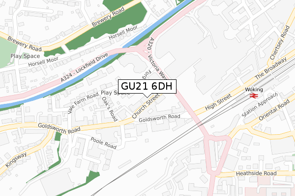
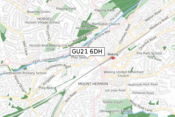
GU21 6DH lies on Church Street West in Woking. GU21 6DH is located in the Canalside electoral ward, within the local authority district of Woking and the English Parliamentary constituency of Woking. The Sub Integrated Care Board (ICB) Location is NHS Surrey Heartlands ICB - 92A and the police force is Surrey. This postcode has been in use since June 2002.
GU21 6DH maps


Licence: Open Government Licence (requires attribution)
Attribution: Contains OS data © Crown copyright and database right 2025
Source: Open Postcode Geo
Licence: Open Government Licence (requires attribution)
Attribution: Contains OS data © Crown copyright and database right 2025; Contains Royal Mail data © Royal Mail copyright and database right 2025; Source: Office for National Statistics licensed under the Open Government Licence v.3.0
GU21 6DH geodata
| Easting | 500253 |
| Northing | 158642 |
| Latitude | 51.318062 |
| Longitude | -0.562794 |
Where is GU21 6DH?
| Street | Church Street West |
| Town/City | Woking |
| Country | England |
| Postcode District | GU21 |
GU21 6DH Elevation
Elevation or altitude of GU21 6DH as distance above sea level:
| Metres | Feet | |
|---|---|---|
| Elevation | 30m | 98ft |
Elevation is measured from the approximate centre of the postcode, to the nearest point on an OS contour line from OS Terrain 50, which has contour spacing of ten vertical metres.
➜ How high above sea level am I? Find the elevation of your current position using your device's GPS.
Politics
| Ward | Canalside |
|---|---|
| Constituency | Woking |
Transport
Nearest bus stops to GU21 6DH
| Cawsey Way | Woking | 146m |
| Cawsey Way | Woking | 157m |
| Cawsey Way | Woking | 161m |
| Cawsey Way | Woking | 187m |
| Poole Road | Woking | 202m |
Nearest railway stations to GU21 6DH
| Woking Station | 0.4km |
| Worplesdon Station | 3.5km |
| West Byfleet Station | 4.6km |
Deprivation
23.3% of English postcodes are less deprived than GU21 6DH:Food Standards Agency
Three nearest food hygiene ratings to GU21 6DH (metres)


➜ Get more ratings from the Food Standards Agency
Nearest post box to GU21 6DH
| Last Collection | |||
|---|---|---|---|
| Location | Mon-Fri | Sat | Distance |
| Goldsworth Road | 18:00 | 12:15 | 148m |
| Woking Branch Office | 18:45 | 12:30 | 166m |
| Woking Branch Office | 18:45 | 12:30 | 167m |
GU21 6DH ITL and GU21 6DH LAU
The below table lists the International Territorial Level (ITL) codes (formerly Nomenclature of Territorial Units for Statistics (NUTS) codes) and Local Administrative Units (LAU) codes for GU21 6DH:
| ITL 1 Code | Name |
|---|---|
| TLJ | South East (England) |
| ITL 2 Code | Name |
| TLJ2 | Surrey, East and West Sussex |
| ITL 3 Code | Name |
| TLJ25 | West Surrey |
| LAU 1 Code | Name |
| E07000217 | Woking |
GU21 6DH census areas
The below table lists the Census Output Area (OA), Lower Layer Super Output Area (LSOA), and Middle Layer Super Output Area (MSOA) for GU21 6DH:
| Code | Name | |
|---|---|---|
| OA | E00157809 | |
| LSOA | E01030954 | Woking 008A |
| MSOA | E02006463 | Woking 008 |
Nearest postcodes to GU21 6DH
| GU21 6HT | Church Street West | 46m |
| GU21 6JY | Goldsworth Road | 98m |
| GU21 6LE | Goldsworth Road | 109m |
| GU21 6DE | Vale Farm Road | 115m |
| GU21 6DN | Vale Farm Road | 148m |
| GU21 6DU | Oaks Road | 154m |
| GU21 6LJ | Goldsworth Road | 195m |
| GU21 6DT | The Oaks | 197m |
| GU21 6LQ | Goldsworth Road | 203m |
| GU21 6DP | Vale Farm Road | 223m |