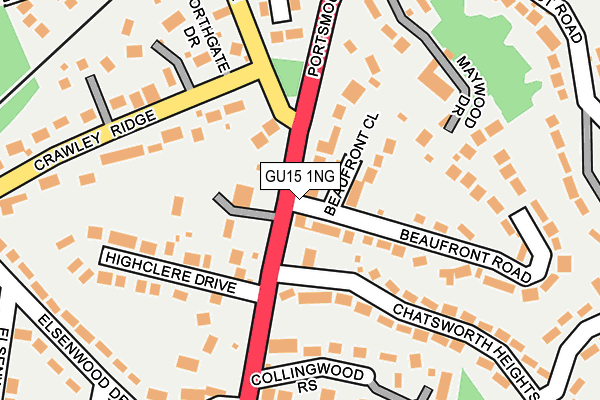
GU15 1NG is located in the Bisley & West End electoral ward, within the local authority district of Surrey Heath and the English Parliamentary constituency of Surrey Heath. The Sub Integrated Care Board (ICB) Location is NHS Surrey Heartlands ICB - 92A and the police force is Surrey. This postcode has been in use since June 2000.


GetTheData
Source: OS OpenMap – Local (Ordnance Survey)
Source: OS VectorMap District (Ordnance Survey)
Licence: Open Government Licence (requires attribution)
| Easting | 490790 |
| Northing | 160763 |
| Latitude | 51.338716 |
| Longitude | -0.698004 |
GetTheData
Source: Open Postcode Geo
Licence: Open Government Licence
| Country | England |
| Postcode District | GU15 |
➜ See where GU15 is on a map | |
GetTheData
Source: Land Registry Price Paid Data
Licence: Open Government Licence
Elevation or altitude of GU15 1NG as distance above sea level:
| Metres | Feet | |
|---|---|---|
| Elevation | 110m | 361ft |
Elevation is measured from the approximate centre of the postcode, to the nearest point on an OS contour line from OS Terrain 50, which has contour spacing of ten vertical metres.
➜ How high above sea level am I? Find the elevation of your current position using your device's GPS.
GetTheData
Source: Open Postcode Elevation
Licence: Open Government Licence
| Ward | Bisley & West End |
| Constituency | Surrey Heath |
GetTheData
Source: ONS Postcode Database
Licence: Open Government Licence
| Greenhill Road (Upper Chobham Road) | Heatherside | 290m |
| Greenhill Road (Upper Chobham Road) | Heatherside | 305m |
| Inglewood Avenue (The Maultway) | Heatherside | 478m |
| Inglewood Avenue (The Maultway) | Heatherside | 490m |
| Wensleydale Drive (Inglewood Avenue) | Heatherside | 491m |
| Bagshot Station | 2.9km |
| Camberley Station | 3.2km |
| Frimley Station | 4.5km |
GetTheData
Source: NaPTAN
Licence: Open Government Licence
GetTheData
Source: ONS Postcode Database
Licence: Open Government Licence


➜ Get more ratings from the Food Standards Agency
GetTheData
Source: Food Standards Agency
Licence: FSA terms & conditions
| Last Collection | |||
|---|---|---|---|
| Location | Mon-Fri | Sat | Distance |
| Heatherside Post Office | 17:00 | 12:00 | 1,157m |
| Corbett Drive | 16:45 | 09:30 | 1,163m |
| Southwell Park Road | 18:00 | 12:15 | 1,194m |
GetTheData
Source: Dracos
Licence: Creative Commons Attribution-ShareAlike
The below table lists the International Territorial Level (ITL) codes (formerly Nomenclature of Territorial Units for Statistics (NUTS) codes) and Local Administrative Units (LAU) codes for GU15 1NG:
| ITL 1 Code | Name |
|---|---|
| TLJ | South East (England) |
| ITL 2 Code | Name |
| TLJ2 | Surrey, East and West Sussex |
| ITL 3 Code | Name |
| TLJ25 | West Surrey |
| LAU 1 Code | Name |
| E07000214 | Surrey Heath |
GetTheData
Source: ONS Postcode Directory
Licence: Open Government Licence
The below table lists the Census Output Area (OA), Lower Layer Super Output Area (LSOA), and Middle Layer Super Output Area (MSOA) for GU15 1NG:
| Code | Name | |
|---|---|---|
| OA | E00157080 | |
| LSOA | E01030806 | Surrey Heath 006C |
| MSOA | E02006421 | Surrey Heath 006 |
GetTheData
Source: ONS Postcode Directory
Licence: Open Government Licence
| GU15 1HF | Beverley Close | 258m |
| GU15 1PG | Greenhill Close | 348m |
| GU15 1HE | Greenhill Road | 352m |
| GU15 1SR | Cherrydale Road | 367m |
| GU15 1SP | Wensleydale Drive | 375m |
| GU15 1PF | Greenhill Road | 410m |
| GU15 1HJ | Upper Chobham Road | 416m |
| GU15 1PE | Greenhill Road | 430m |
| GU15 1QE | The Maultway | 448m |
| GU15 1HH | The Spinney | 449m |
GetTheData
Source: Open Postcode Geo; Land Registry Price Paid Data
Licence: Open Government Licence