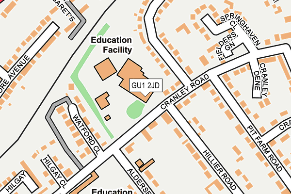
GU1 2JD is located in the Castle electoral ward, within the local authority district of Guildford and the English Parliamentary constituency of Guildford. The Sub Integrated Care Board (ICB) Location is NHS Surrey Heartlands ICB - 92A and the police force is Surrey. This postcode has been in use since January 1980.


GetTheData
Source: OS OpenMap – Local (Ordnance Survey)
Source: OS VectorMap District (Ordnance Survey)
Licence: Open Government Licence (requires attribution)
| Easting | 500934 |
| Northing | 150280 |
| Latitude | 51.242777 |
| Longitude | -0.555404 |
GetTheData
Source: Open Postcode Geo
Licence: Open Government Licence
| Country | England |
| Postcode District | GU1 |
➜ See where GU1 is on a map ➜ Where is Guildford? | |
GetTheData
Source: Land Registry Price Paid Data
Licence: Open Government Licence
Elevation or altitude of GU1 2JD as distance above sea level:
| Metres | Feet | |
|---|---|---|
| Elevation | 60m | 197ft |
Elevation is measured from the approximate centre of the postcode, to the nearest point on an OS contour line from OS Terrain 50, which has contour spacing of ten vertical metres.
➜ How high above sea level am I? Find the elevation of your current position using your device's GPS.
GetTheData
Source: Open Postcode Elevation
Licence: Open Government Licence
| Ward | Castle |
| Constituency | Guildford |
GetTheData
Source: ONS Postcode Database
Licence: Open Government Licence
| Tormead School (Cranley Road) | Guildford | 45m |
| Cranley Road (Aldersey Road) | Guildford | 145m |
| Cranley Road | Guildford | 174m |
| Tormead Road | Merrow | 228m |
| Avonmore Avenue (London Road) | Guildford | 363m |
| London Road (Guildford) Station | 0.7km |
| Guildford Station | 1.9km |
| Shalford (Surrey) Station | 3.3km |
GetTheData
Source: NaPTAN
Licence: Open Government Licence
GetTheData
Source: ONS Postcode Database
Licence: Open Government Licence


➜ Get more ratings from the Food Standards Agency
GetTheData
Source: Food Standards Agency
Licence: FSA terms & conditions
| Last Collection | |||
|---|---|---|---|
| Location | Mon-Fri | Sat | Distance |
| Pit Farm Road | 17:30 | 12:30 | 133m |
| Avonmore Avenue | 17:45 | 12:15 | 360m |
| St Omer Road | 17:30 | 12:30 | 447m |
GetTheData
Source: Dracos
Licence: Creative Commons Attribution-ShareAlike
The below table lists the International Territorial Level (ITL) codes (formerly Nomenclature of Territorial Units for Statistics (NUTS) codes) and Local Administrative Units (LAU) codes for GU1 2JD:
| ITL 1 Code | Name |
|---|---|
| TLJ | South East (England) |
| ITL 2 Code | Name |
| TLJ2 | Surrey, East and West Sussex |
| ITL 3 Code | Name |
| TLJ25 | West Surrey |
| LAU 1 Code | Name |
| E07000209 | Guildford |
GetTheData
Source: ONS Postcode Directory
Licence: Open Government Licence
The below table lists the Census Output Area (OA), Lower Layer Super Output Area (LSOA), and Middle Layer Super Output Area (MSOA) for GU1 2JD:
| Code | Name | |
|---|---|---|
| OA | E00155261 | |
| LSOA | E01030438 | Guildford 013A |
| MSOA | E02006356 | Guildford 013 |
GetTheData
Source: ONS Postcode Directory
Licence: Open Government Licence
| GU1 2JE | Cranley Road | 106m |
| GU1 2EW | Cranley Road | 111m |
| GU1 2EP | Watford Close | 133m |
| GU1 2JF | Cranley Road | 166m |
| GU1 2JY | Fielders Green | 177m |
| GU1 2JL | Pit Farm Road | 188m |
| GU1 2JB | Tormead Road | 193m |
| GU1 2JG | Hillier Road | 211m |
| GU1 2JP | Springhaven Close | 220m |
| GU1 2EN | Hilgay Close | 225m |
GetTheData
Source: Open Postcode Geo; Land Registry Price Paid Data
Licence: Open Government Licence