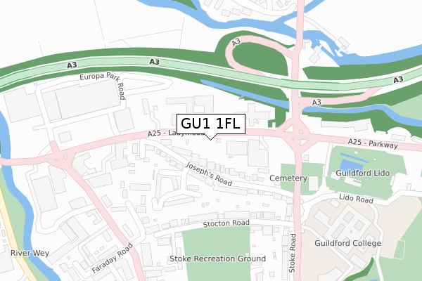
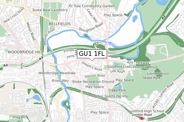
GU1 1FL is located in the Stoke electoral ward, within the local authority district of Guildford and the English Parliamentary constituency of Guildford. The Sub Integrated Care Board (ICB) Location is NHS Surrey Heartlands ICB - 92A and the police force is Surrey. This postcode has been in use since January 2020.


GetTheData
Source: OS Open Zoomstack (Ordnance Survey)
Licence: Open Government Licence (requires attribution)
Attribution: Contains OS data © Crown copyright and database right 2024
Source: Open Postcode Geo
Licence: Open Government Licence (requires attribution)
Attribution: Contains OS data © Crown copyright and database right 2024; Contains Royal Mail data © Royal Mail copyright and database right 2024; Source: Office for National Statistics licensed under the Open Government Licence v.3.0
| Easting | 499587 |
| Northing | 150828 |
| Latitude | 51.247936 |
| Longitude | -0.574521 |
GetTheData
Source: Open Postcode Geo
Licence: Open Government Licence
| Country | England |
| Postcode District | GU1 |
| ➜ GU1 open data dashboard ➜ See where GU1 is on a map ➜ Where is Guildford? | |
GetTheData
Source: Land Registry Price Paid Data
Licence: Open Government Licence
| Ward | Stoke |
| Constituency | Guildford |
GetTheData
Source: ONS Postcode Database
Licence: Open Government Licence
| January 2024 | Other theft | On or near Further/Higher Educational Building | 386m |
| January 2024 | Drugs | On or near Further/Higher Educational Building | 386m |
| January 2024 | Public order | On or near Further/Higher Educational Building | 386m |
| ➜ Get more crime data in our Crime section | |||
GetTheData
Source: data.police.uk
Licence: Open Government Licence
| Woodbridge Retail Park (Woodbridge Road) | Guildford | 300m |
| Guildford College (Stoke Road) | Guildford | 333m |
| Woodbridge Retail Park (Woodbridge Road) | Guildford | 336m |
| Recreation Road (Woodbridge Road) | Guildford | 346m |
| Guildford College (Stoke Road) | Guildford | 382m |
| London Road (Guildford) Station | 1km |
| Guildford Station | 1.3km |
| Shalford (Surrey) Station | 3.8km |
GetTheData
Source: NaPTAN
Licence: Open Government Licence
GetTheData
Source: ONS Postcode Database
Licence: Open Government Licence


➜ Get more ratings from the Food Standards Agency
GetTheData
Source: Food Standards Agency
Licence: FSA terms & conditions
| Last Collection | |||
|---|---|---|---|
| Location | Mon-Fri | Sat | Distance |
| Josephs Road | 18:00 | 12:00 | 234m |
| Faraday Road | 17:30 | 12:00 | 346m |
| Recreation Road | 17:30 | 12:00 | 368m |
GetTheData
Source: Dracos
Licence: Creative Commons Attribution-ShareAlike
| Facility | Distance |
|---|---|
| Stoke Recreation Ground Recreation Road, Guildford Grass Pitches | 275m |
| Guildford Waterside Centre Riverside, Guildford Sports Hall, Health and Fitness Gym | 344m |
| Activzone Stoke Road, Guildford Health and Fitness Gym, Studio | 386m |
GetTheData
Source: Active Places
Licence: Open Government Licence
| School | Phase of Education | Distance |
|---|---|---|
| Weyfield Academy School Close, Off Woking Road, Guildford, GU1 1QJ | Primary | 760m |
| Sandfield Primary School Stoke Road, Guildford, GU1 4DT | Primary | 939m |
| Christ's College, Guildford Larch Avenue, Guildford, GU1 1JY | Secondary | 966m |
GetTheData
Source: Edubase
Licence: Open Government Licence
| Risk of GU1 1FL flooding from rivers and sea | Medium |
| ➜ GU1 1FL flood map | |
GetTheData
Source: Open Flood Risk by Postcode
Licence: Open Government Licence
The below table lists the International Territorial Level (ITL) codes (formerly Nomenclature of Territorial Units for Statistics (NUTS) codes) and Local Administrative Units (LAU) codes for GU1 1FL:
| ITL 1 Code | Name |
|---|---|
| TLJ | South East (England) |
| ITL 2 Code | Name |
| TLJ2 | Surrey, East and West Sussex |
| ITL 3 Code | Name |
| TLJ25 | West Surrey |
| LAU 1 Code | Name |
| E07000209 | Guildford |
GetTheData
Source: ONS Postcode Directory
Licence: Open Government Licence
The below table lists the Census Output Area (OA), Lower Layer Super Output Area (LSOA), and Middle Layer Super Output Area (MSOA) for GU1 1FL:
| Code | Name | |
|---|---|---|
| OA | E00155328 | |
| LSOA | E01030450 | Guildford 013B |
| MSOA | E02006356 | Guildford 013 |
GetTheData
Source: ONS Postcode Directory
Licence: Open Government Licence
| GU1 1DW | Josephs Road | 68m |
| GU1 1DN | Josephs Road | 100m |
| GU1 1BT | Josephs Road | 150m |
| GU1 1HD | Stocton Road | 199m |
| GU1 1HR | Stocton Close | 208m |
| GU1 1HH | Stocton Road | 215m |
| GU1 1HS | Stocton Close | 242m |
| GU1 1DX | Woodbridge Road | 278m |
| GU1 1EY | Stoke Road | 294m |
| GU1 1JA | Bicknell Close | 296m |
GetTheData
Source: Open Postcode Geo; Land Registry Price Paid Data
Licence: Open Government Licence