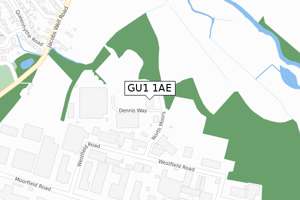
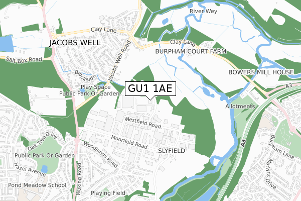
GU1 1AE is located in the Worplesdon electoral ward, within the local authority district of Guildford and the English Parliamentary constituency of Guildford. The Sub Integrated Care Board (ICB) Location is NHS Surrey Heartlands ICB - 92A and the police force is Surrey. This postcode has been in use since June 1996.


GetTheData
Source: OS Open Zoomstack (Ordnance Survey)
Licence: Open Government Licence (requires attribution)
Attribution: Contains OS data © Crown copyright and database right 2025
Source: Open Postcode Geo
Licence: Open Government Licence (requires attribution)
Attribution: Contains OS data © Crown copyright and database right 2025; Contains Royal Mail data © Royal Mail copyright and database right 2025; Source: Office for National Statistics licensed under the Open Government Licence v.3.0
| Easting | 500258 |
| Northing | 152632 |
| Latitude | 51.264038 |
| Longitude | -0.564427 |
GetTheData
Source: Open Postcode Geo
Licence: Open Government Licence
| Country | England |
| Postcode District | GU1 |
➜ See where GU1 is on a map ➜ Where is Guildford? | |
GetTheData
Source: Land Registry Price Paid Data
Licence: Open Government Licence
Elevation or altitude of GU1 1AE as distance above sea level:
| Metres | Feet | |
|---|---|---|
| Elevation | 30m | 98ft |
Elevation is measured from the approximate centre of the postcode, to the nearest point on an OS contour line from OS Terrain 50, which has contour spacing of ten vertical metres.
➜ How high above sea level am I? Find the elevation of your current position using your device's GPS.
GetTheData
Source: Open Postcode Elevation
Licence: Open Government Licence
| Ward | Worplesdon |
| Constituency | Guildford |
GetTheData
Source: ONS Postcode Database
Licence: Open Government Licence
| Queenhythe Road Turn (Jacobs Well Road) | Jacobs Well | 379m |
| Queenhythe Road Turn (Jacobs Well Road) | Jacobs Well | 392m |
| Village Hall (Jacobs Well Road) | Jacobs Well | 425m |
| Village Hall (Jacobs Well Road) | Jacobs Well | 459m |
| Brookside | Jacobs Well | 501m |
| London Road (Guildford) Station | 2.6km |
| Worplesdon Station | 3.1km |
| Guildford Station | 3.2km |
GetTheData
Source: NaPTAN
Licence: Open Government Licence
GetTheData
Source: ONS Postcode Database
Licence: Open Government Licence


➜ Get more ratings from the Food Standards Agency
GetTheData
Source: Food Standards Agency
Licence: FSA terms & conditions
| Last Collection | |||
|---|---|---|---|
| Location | Mon-Fri | Sat | Distance |
| Streamline | 18:30 | 11:45 | 450m |
| Slyfield Industrial Estate | 18:30 | 451m | |
| Jacobs Well Road | 16:30 | 08:30 | 598m |
GetTheData
Source: Dracos
Licence: Creative Commons Attribution-ShareAlike
The below table lists the International Territorial Level (ITL) codes (formerly Nomenclature of Territorial Units for Statistics (NUTS) codes) and Local Administrative Units (LAU) codes for GU1 1AE:
| ITL 1 Code | Name |
|---|---|
| TLJ | South East (England) |
| ITL 2 Code | Name |
| TLJ2 | Surrey, East and West Sussex |
| ITL 3 Code | Name |
| TLJ25 | West Surrey |
| LAU 1 Code | Name |
| E07000209 | Guildford |
GetTheData
Source: ONS Postcode Directory
Licence: Open Government Licence
The below table lists the Census Output Area (OA), Lower Layer Super Output Area (LSOA), and Middle Layer Super Output Area (MSOA) for GU1 1AE:
| Code | Name | |
|---|---|---|
| OA | E00155579 | |
| LSOA | E01030504 | Guildford 005F |
| MSOA | E02006348 | Guildford 005 |
GetTheData
Source: ONS Postcode Directory
Licence: Open Government Licence
| GU4 7PA | Jacobs Well Road | 419m |
| GU4 7NY | Queenhythe Road | 437m |
| GU4 7NZ | Clay Lane | 485m |
| GU4 7PB | Douglas Close | 496m |
| GU4 7PH | Barnett Row | 506m |
| GU4 7PD | Jacobs Well Road | 513m |
| GU4 7BX | Queenhythe Crescent | 551m |
| GU1 1RX | Woodlands Close | 554m |
| GU4 7PG | Holly Lea | 574m |
| GU1 1RN | Woodlands Road | 578m |
GetTheData
Source: Open Postcode Geo; Land Registry Price Paid Data
Licence: Open Government Licence