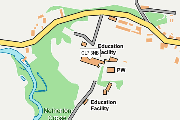
GL7 3NB is located in the Coln Valley electoral ward, within the local authority district of Cotswold and the English Parliamentary constituency of The Cotswolds. The Sub Integrated Care Board (ICB) Location is NHS Gloucestershire ICB - 11M and the police force is Gloucestershire. This postcode has been in use since January 1980.


GetTheData
Source: OS OpenMap – Local (Ordnance Survey)
Source: OS VectorMap District (Ordnance Survey)
Licence: Open Government Licence (requires attribution)
| Easting | 415312 |
| Northing | 205128 |
| Latitude | 51.744646 |
| Longitude | -1.779624 |
GetTheData
Source: Open Postcode Geo
Licence: Open Government Licence
| Country | England |
| Postcode District | GL7 |
➜ See where GL7 is on a map ➜ Where is Hatherop? | |
GetTheData
Source: Land Registry Price Paid Data
Licence: Open Government Licence
Elevation or altitude of GL7 3NB as distance above sea level:
| Metres | Feet | |
|---|---|---|
| Elevation | 120m | 394ft |
Elevation is measured from the approximate centre of the postcode, to the nearest point on an OS contour line from OS Terrain 50, which has contour spacing of ten vertical metres.
➜ How high above sea level am I? Find the elevation of your current position using your device's GPS.
GetTheData
Source: Open Postcode Elevation
Licence: Open Government Licence
| Ward | Coln Valley |
| Constituency | The Cotswolds |
GetTheData
Source: ONS Postcode Database
Licence: Open Government Licence
| Castle School | Hatherop | 167m |
| Castle School | Hatherop | 180m |
| Primary School (Coln Road) | Hatherop | 388m |
| Primary School (Coln Road) | Hatherop | 392m |
| Demand Responsive Area | Hatherop | 458m |
GetTheData
Source: NaPTAN
Licence: Open Government Licence
GetTheData
Source: ONS Postcode Database
Licence: Open Government Licence


➜ Get more ratings from the Food Standards Agency
GetTheData
Source: Food Standards Agency
Licence: FSA terms & conditions
| Last Collection | |||
|---|---|---|---|
| Location | Mon-Fri | Sat | Distance |
| Bibury Court | 16:45 | 09:00 | 3,865m |
| Fairford Post Office | 17:15 | 12:00 | 4,104m |
| Bibury Court | 16:30 | 09:15 | 4,399m |
GetTheData
Source: Dracos
Licence: Creative Commons Attribution-ShareAlike
The below table lists the International Territorial Level (ITL) codes (formerly Nomenclature of Territorial Units for Statistics (NUTS) codes) and Local Administrative Units (LAU) codes for GL7 3NB:
| ITL 1 Code | Name |
|---|---|
| TLK | South West (England) |
| ITL 2 Code | Name |
| TLK1 | Gloucestershire, Wiltshire and Bath/Bristol area |
| ITL 3 Code | Name |
| TLK13 | Gloucestershire CC |
| LAU 1 Code | Name |
| E07000079 | Cotswold |
GetTheData
Source: ONS Postcode Directory
Licence: Open Government Licence
The below table lists the Census Output Area (OA), Lower Layer Super Output Area (LSOA), and Middle Layer Super Output Area (MSOA) for GL7 3NB:
| Code | Name | |
|---|---|---|
| OA | E00112848 | |
| LSOA | E01022202 | Cotswold 009A |
| MSOA | E02004623 | Cotswold 009 |
GetTheData
Source: ONS Postcode Directory
Licence: Open Government Licence
| GL7 5AR | Hatherop Road | 202m |
| GL7 3NA | 374m | |
| GL7 5DD | Netherton | 642m |
| GL7 5AL | Meadowside | 691m |
| GL7 5AB | Hatherop Road | 696m |
| GL7 5AN | Main Street | 718m |
| GL7 5AA | 729m | |
| GL7 5AJ | 781m | |
| GL7 5AW | Bibury Road | 803m |
| GL7 5DB | Fowlers Hill | 813m |
GetTheData
Source: Open Postcode Geo; Land Registry Price Paid Data
Licence: Open Government Licence