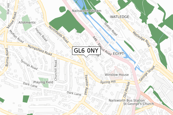
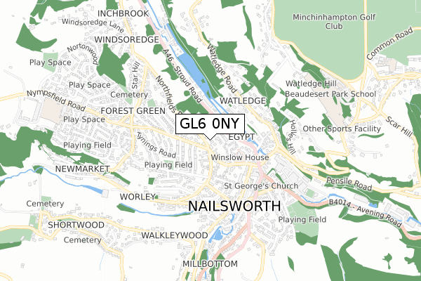
GL6 0NY lies on Old School Close in Forest Green, Stroud. GL6 0NY is located in the Nailsworth electoral ward, within the local authority district of Stroud and the English Parliamentary constituency of Stroud. The Sub Integrated Care Board (ICB) Location is NHS Gloucestershire ICB - 11M and the police force is Gloucestershire. This postcode has been in use since June 2000.


GetTheData
Source: OS Open Zoomstack (Ordnance Survey)
Licence: Open Government Licence (requires attribution)
Attribution: Contains OS data © Crown copyright and database right 2025
Source: Open Postcode Geo
Licence: Open Government Licence (requires attribution)
Attribution: Contains OS data © Crown copyright and database right 2025; Contains Royal Mail data © Royal Mail copyright and database right 2025; Source: Office for National Statistics licensed under the Open Government Licence v.3.0
| Easting | 384732 |
| Northing | 199867 |
| Latitude | 51.697339 |
| Longitude | -2.222308 |
GetTheData
Source: Open Postcode Geo
Licence: Open Government Licence
| Street | Old School Close |
| Locality | Forest Green |
| Town/City | Stroud |
| Country | England |
| Postcode District | GL6 |
➜ See where GL6 is on a map ➜ Where is Nailsworth? | |
GetTheData
Source: Land Registry Price Paid Data
Licence: Open Government Licence
Elevation or altitude of GL6 0NY as distance above sea level:
| Metres | Feet | |
|---|---|---|
| Elevation | 80m | 262ft |
Elevation is measured from the approximate centre of the postcode, to the nearest point on an OS contour line from OS Terrain 50, which has contour spacing of ten vertical metres.
➜ How high above sea level am I? Find the elevation of your current position using your device's GPS.
GetTheData
Source: Open Postcode Elevation
Licence: Open Government Licence
| Ward | Nailsworth |
| Constituency | Stroud |
GetTheData
Source: ONS Postcode Database
Licence: Open Government Licence
2022 14 APR £760,000 |
5, OLD SCHOOL CLOSE, FOREST GREEN, STROUD, GL6 0NY 2008 14 JAN £440,000 |
5, OLD SCHOOL CLOSE, FOREST GREEN, STROUD, GL6 0NY 2003 24 JAN £293,000 |
3, OLD SCHOOL CLOSE, FOREST GREEN, STROUD, GL6 0NY 2003 17 JAN £294,000 |
6, OLD SCHOOL CLOSE, FOREST GREEN, STROUD, GL6 0NY 2000 29 NOV £250,000 |
5, OLD SCHOOL CLOSE, FOREST GREEN, STROUD, GL6 0NY 2000 14 JUL £263,000 |
3, OLD SCHOOL CLOSE, FOREST GREEN, STROUD, GL6 0NY 2000 23 JUN £215,000 |
2, OLD SCHOOL CLOSE, FOREST GREEN, STROUD, GL6 0NY 2000 26 MAY £180,000 |
2000 8 MAY £267,000 |
1, OLD SCHOOL CLOSE, FOREST GREEN, STROUD, GL6 0NY 2000 24 MAR £180,000 |
GetTheData
Source: HM Land Registry Price Paid Data
Licence: Contains HM Land Registry data © Crown copyright and database right 2025. This data is licensed under the Open Government Licence v3.0.
| Northfield Road (Nympsfield Road) | Forest Green | 47m |
| Churchill Road (Nympsfield Road) | Forest Green | 124m |
| Clock Tower School Stop (Bridge Street) | Nailsworth | 297m |
| Clock Tower School Stop (Bridge Street) | Nailsworth | 308m |
| Watledge House (Watledge Road) | Nailsworth | 309m |
GetTheData
Source: NaPTAN
Licence: Open Government Licence
| Percentage of properties with Next Generation Access | 100.0% |
| Percentage of properties with Superfast Broadband | 100.0% |
| Percentage of properties with Ultrafast Broadband | 0.0% |
| Percentage of properties with Full Fibre Broadband | 0.0% |
Superfast Broadband is between 30Mbps and 300Mbps
Ultrafast Broadband is > 300Mbps
| Percentage of properties unable to receive 2Mbps | 0.0% |
| Percentage of properties unable to receive 5Mbps | 0.0% |
| Percentage of properties unable to receive 10Mbps | 0.0% |
| Percentage of properties unable to receive 30Mbps | 0.0% |
GetTheData
Source: Ofcom
Licence: Ofcom Terms of Use (requires attribution)
Estimated total energy consumption in GL6 0NY by fuel type, 2015.
| Consumption (kWh) | 89,560 |
|---|---|
| Meter count | 6 |
| Mean (kWh/meter) | 14,927 |
| Median (kWh/meter) | 15,580 |
GetTheData
Source: Postcode level gas estimates: 2015 (experimental)
Source: Postcode level electricity estimates: 2015 (experimental)
Licence: Open Government Licence
GetTheData
Source: ONS Postcode Database
Licence: Open Government Licence


➜ Get more ratings from the Food Standards Agency
GetTheData
Source: Food Standards Agency
Licence: FSA terms & conditions
| Last Collection | |||
|---|---|---|---|
| Location | Mon-Fri | Sat | Distance |
| Springhill Nailsworth | 16:30 | 11:30 | 73m |
| Nailsworth P.o. | 17:15 | 12:30 | 292m |
| Somerfield Store | 16:40 | 10:30 | 326m |
GetTheData
Source: Dracos
Licence: Creative Commons Attribution-ShareAlike
The below table lists the International Territorial Level (ITL) codes (formerly Nomenclature of Territorial Units for Statistics (NUTS) codes) and Local Administrative Units (LAU) codes for GL6 0NY:
| ITL 1 Code | Name |
|---|---|
| TLK | South West (England) |
| ITL 2 Code | Name |
| TLK1 | Gloucestershire, Wiltshire and Bath/Bristol area |
| ITL 3 Code | Name |
| TLK13 | Gloucestershire CC |
| LAU 1 Code | Name |
| E07000082 | Stroud |
GetTheData
Source: ONS Postcode Directory
Licence: Open Government Licence
The below table lists the Census Output Area (OA), Lower Layer Super Output Area (LSOA), and Middle Layer Super Output Area (MSOA) for GL6 0NY:
| Code | Name | |
|---|---|---|
| OA | E00113812 | |
| LSOA | E01022386 | Stroud 013B |
| MSOA | E02004663 | Stroud 013 |
GetTheData
Source: ONS Postcode Directory
Licence: Open Government Licence
| GL6 0NS | Whitecroft | 50m |
| GL6 0LU | Springhill | 91m |
| GL6 0EA | Nympsfield Road | 113m |
| GL6 0NU | Springhill Crescent | 137m |
| GL6 0DJ | Churchill Road | 144m |
| GL6 0DH | Fewster Road | 152m |
| GL6 0BE | Stroud Road | 152m |
| GL6 0DL | Churchill Road | 154m |
| GL6 0AE | Stroud Road | 182m |
| GL6 0NA | Northfield Road | 191m |
GetTheData
Source: Open Postcode Geo; Land Registry Price Paid Data
Licence: Open Government Licence