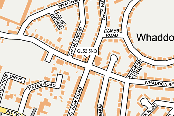
GL52 5NQ lies on Whaddon Road in Cheltenham. GL52 5NQ is located in the Oakley electoral ward, within the local authority district of Cheltenham and the English Parliamentary constituency of Cheltenham. The Sub Integrated Care Board (ICB) Location is NHS Gloucestershire ICB - 11M and the police force is Gloucestershire. This postcode has been in use since January 1980.


GetTheData
Source: OS OpenMap – Local (Ordnance Survey)
Source: OS VectorMap District (Ordnance Survey)
Licence: Open Government Licence (requires attribution)
| Easting | 396204 |
| Northing | 222888 |
| Latitude | 51.904518 |
| Longitude | -2.056582 |
GetTheData
Source: Open Postcode Geo
Licence: Open Government Licence
| Street | Whaddon Road |
| Town/City | Cheltenham |
| Country | England |
| Postcode District | GL52 |
➜ See where GL52 is on a map ➜ Where is Cheltenham? | |
GetTheData
Source: Land Registry Price Paid Data
Licence: Open Government Licence
Elevation or altitude of GL52 5NQ as distance above sea level:
| Metres | Feet | |
|---|---|---|
| Elevation | 60m | 197ft |
Elevation is measured from the approximate centre of the postcode, to the nearest point on an OS contour line from OS Terrain 50, which has contour spacing of ten vertical metres.
➜ How high above sea level am I? Find the elevation of your current position using your device's GPS.
GetTheData
Source: Open Postcode Elevation
Licence: Open Government Licence
| Ward | Oakley |
| Constituency | Cheltenham |
GetTheData
Source: ONS Postcode Database
Licence: Open Government Licence
| The Cat And Fiddle (Whaddon Road) | Whaddon | 34m |
| The Cat And Fiddle (Whaddon Road) | Whaddon | 53m |
| Mersey Road (Whaddon Road) | Whaddon | 123m |
| Windrush Road (Whaddon Road) | Whaddon | 137m |
| Wyman's Road (Whaddon Road) | Whaddon | 211m |
| Cheltenham Spa Station | 3.1km |
GetTheData
Source: NaPTAN
Licence: Open Government Licence
GetTheData
Source: ONS Postcode Database
Licence: Open Government Licence


➜ Get more ratings from the Food Standards Agency
GetTheData
Source: Food Standards Agency
Licence: FSA terms & conditions
| Last Collection | |||
|---|---|---|---|
| Location | Mon-Fri | Sat | Distance |
| Whaddon Road P.o. | 17:15 | 12:30 | 18m |
| Pittville Circus Road | 17:30 | 12:30 | 372m |
| Lynworth Exchange | 17:30 | 12:45 | 470m |
GetTheData
Source: Dracos
Licence: Creative Commons Attribution-ShareAlike
The below table lists the International Territorial Level (ITL) codes (formerly Nomenclature of Territorial Units for Statistics (NUTS) codes) and Local Administrative Units (LAU) codes for GL52 5NQ:
| ITL 1 Code | Name |
|---|---|
| TLK | South West (England) |
| ITL 2 Code | Name |
| TLK1 | Gloucestershire, Wiltshire and Bath/Bristol area |
| ITL 3 Code | Name |
| TLK13 | Gloucestershire CC |
| LAU 1 Code | Name |
| E07000078 | Cheltenham |
GetTheData
Source: ONS Postcode Directory
Licence: Open Government Licence
The below table lists the Census Output Area (OA), Lower Layer Super Output Area (LSOA), and Middle Layer Super Output Area (MSOA) for GL52 5NQ:
| Code | Name | |
|---|---|---|
| OA | E00112473 | |
| LSOA | E01022134 | Cheltenham 006D |
| MSOA | E02004605 | Cheltenham 006 |
GetTheData
Source: ONS Postcode Directory
Licence: Open Government Licence
| GL52 5QA | Severn Road | 54m |
| GL52 5NP | Whaddon Road | 68m |
| GL52 5NL | Whaddon Road | 70m |
| GL52 5NE | Whaddon Road | 76m |
| GL52 5NR | Evenlode Avenue | 76m |
| GL52 5QB | Tamar Road | 103m |
| GL52 5PZ | Severn Road | 110m |
| GL52 5PU | Thames Road | 111m |
| GL52 5PT | Thames Road | 116m |
| GL52 5NF | Whaddon Road | 129m |
GetTheData
Source: Open Postcode Geo; Land Registry Price Paid Data
Licence: Open Government Licence