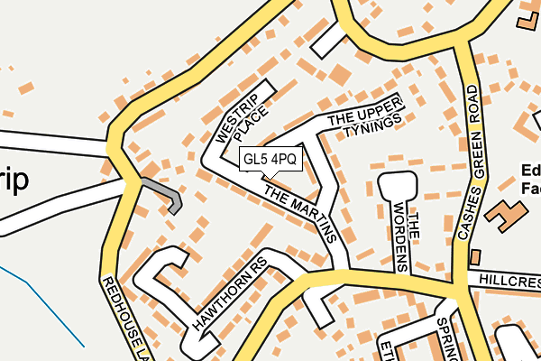
GL5 4PQ lies on The Martins in Stroud. GL5 4PQ is located in the Cainscross electoral ward, within the local authority district of Stroud and the English Parliamentary constituency of Stroud. The Sub Integrated Care Board (ICB) Location is NHS Gloucestershire ICB - 11M and the police force is Gloucestershire. This postcode has been in use since January 1980.


GetTheData
Source: OS OpenMap – Local (Ordnance Survey)
Source: OS VectorMap District (Ordnance Survey)
Licence: Open Government Licence (requires attribution)
| Easting | 382712 |
| Northing | 205890 |
| Latitude | 51.751433 |
| Longitude | -2.251835 |
GetTheData
Source: Open Postcode Geo
Licence: Open Government Licence
| Street | The Martins |
| Town/City | Stroud |
| Country | England |
| Postcode District | GL5 |
➜ See where GL5 is on a map ➜ Where is Stroud? | |
GetTheData
Source: Land Registry Price Paid Data
Licence: Open Government Licence
Elevation or altitude of GL5 4PQ as distance above sea level:
| Metres | Feet | |
|---|---|---|
| Elevation | 100m | 328ft |
Elevation is measured from the approximate centre of the postcode, to the nearest point on an OS contour line from OS Terrain 50, which has contour spacing of ten vertical metres.
➜ How high above sea level am I? Find the elevation of your current position using your device's GPS.
GetTheData
Source: Open Postcode Elevation
Licence: Open Government Licence
| Ward | Cainscross |
| Constituency | Stroud |
GetTheData
Source: ONS Postcode Database
Licence: Open Government Licence
| The Wordens (Westrip Lane) | Cashes Green | 142m |
| Sandpits Lane | Westrip | 153m |
| The Wordens (Westrip Lane) | Cashes Green | 154m |
| Carpenters Arms | Westrip | 157m |
| Carpenters Arms | Westrip | 165m |
| Stonehouse Station | 2km |
| Stroud (Glos) Station | 2.4km |
GetTheData
Source: NaPTAN
Licence: Open Government Licence
| Percentage of properties with Next Generation Access | 100.0% |
| Percentage of properties with Superfast Broadband | 100.0% |
| Percentage of properties with Ultrafast Broadband | 0.0% |
| Percentage of properties with Full Fibre Broadband | 0.0% |
Superfast Broadband is between 30Mbps and 300Mbps
Ultrafast Broadband is > 300Mbps
| Percentage of properties unable to receive 2Mbps | 0.0% |
| Percentage of properties unable to receive 5Mbps | 0.0% |
| Percentage of properties unable to receive 10Mbps | 0.0% |
| Percentage of properties unable to receive 30Mbps | 0.0% |
GetTheData
Source: Ofcom
Licence: Ofcom Terms of Use (requires attribution)
GetTheData
Source: ONS Postcode Database
Licence: Open Government Licence


➜ Get more ratings from the Food Standards Agency
GetTheData
Source: Food Standards Agency
Licence: FSA terms & conditions
| Last Collection | |||
|---|---|---|---|
| Location | Mon-Fri | Sat | Distance |
| More Hall | 16:00 | 07:00 | 282m |
| The Bassetts Cashes Green | 17:15 | 11:45 | 284m |
| Cashes Green P.o. | 17:15 | 11:45 | 438m |
GetTheData
Source: Dracos
Licence: Creative Commons Attribution-ShareAlike
The below table lists the International Territorial Level (ITL) codes (formerly Nomenclature of Territorial Units for Statistics (NUTS) codes) and Local Administrative Units (LAU) codes for GL5 4PQ:
| ITL 1 Code | Name |
|---|---|
| TLK | South West (England) |
| ITL 2 Code | Name |
| TLK1 | Gloucestershire, Wiltshire and Bath/Bristol area |
| ITL 3 Code | Name |
| TLK13 | Gloucestershire CC |
| LAU 1 Code | Name |
| E07000082 | Stroud |
GetTheData
Source: ONS Postcode Directory
Licence: Open Government Licence
The below table lists the Census Output Area (OA), Lower Layer Super Output Area (LSOA), and Middle Layer Super Output Area (MSOA) for GL5 4PQ:
| Code | Name | |
|---|---|---|
| OA | E00113657 | |
| LSOA | E01022357 | Stroud 004C |
| MSOA | E02004654 | Stroud 004 |
GetTheData
Source: ONS Postcode Directory
Licence: Open Government Licence
| GL5 4PG | The Martins | 26m |
| GL5 4PA | The Martins | 42m |
| GL5 4PE | The Martins | 44m |
| GL5 4PF | The Martins | 71m |
| GL5 4PB | The Martins | 78m |
| GL5 4QW | Hawthorn Rise | 99m |
| GL5 4QS | Westrip Place | 107m |
| GL6 6HA | 123m | |
| GL6 6EY | 141m | |
| GL5 4PH | Westrip Lane | 148m |
GetTheData
Source: Open Postcode Geo; Land Registry Price Paid Data
Licence: Open Government Licence