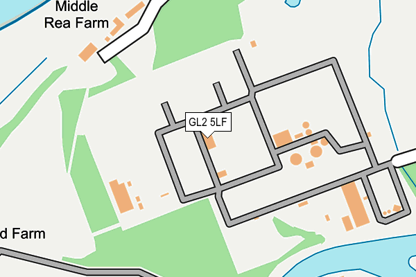
GL2 5LF is located in the Westgate electoral ward, within the local authority district of Gloucester and the English Parliamentary constituency of Gloucester. The Sub Integrated Care Board (ICB) Location is NHS Gloucestershire ICB - 11M and the police force is Gloucestershire. This postcode has been in use since December 1995.


GetTheData
Source: OS OpenMap – Local (Ordnance Survey)
Source: OS VectorMap District (Ordnance Survey)
Licence: Open Government Licence (requires attribution)
| Easting | 380894 |
| Northing | 215801 |
| Latitude | 51.840483 |
| Longitude | -2.278720 |
GetTheData
Source: Open Postcode Geo
Licence: Open Government Licence
| Country | England |
| Postcode District | GL2 |
➜ See where GL2 is on a map | |
GetTheData
Source: Land Registry Price Paid Data
Licence: Open Government Licence
Elevation or altitude of GL2 5LF as distance above sea level:
| Metres | Feet | |
|---|---|---|
| Elevation | 10m | 33ft |
Elevation is measured from the approximate centre of the postcode, to the nearest point on an OS contour line from OS Terrain 50, which has contour spacing of ten vertical metres.
➜ How high above sea level am I? Find the elevation of your current position using your device's GPS.
GetTheData
Source: Open Postcode Elevation
Licence: Open Government Licence
| Ward | Westgate |
| Constituency | Gloucester |
GetTheData
Source: ONS Postcode Database
Licence: Open Government Licence
| Barn Owl Center | Hempsted | 533m |
| Lower Tuffley Lane (Bristol Road) | Gloucester | 639m |
| Meadows | Hempsted | 645m |
| Mcdonalds (Bristol Road) | Gloucester | 652m |
| Goshawk Road (Merlin Drive) | Quedgeley | 665m |
| Gloucester Station | 3.9km |
GetTheData
Source: NaPTAN
Licence: Open Government Licence
GetTheData
Source: ONS Postcode Database
Licence: Open Government Licence


➜ Get more ratings from the Food Standards Agency
GetTheData
Source: Food Standards Agency
Licence: FSA terms & conditions
| Last Collection | |||
|---|---|---|---|
| Location | Mon-Fri | Sat | Distance |
| Lower Tuffley Lane | 17:30 | 12:30 | 681m |
| Gloucester South Do Olympus Bu | 19:00 | 12:45 | 936m |
| Elmgrove | 17:00 | 12:00 | 1,156m |
GetTheData
Source: Dracos
Licence: Creative Commons Attribution-ShareAlike
The below table lists the International Territorial Level (ITL) codes (formerly Nomenclature of Territorial Units for Statistics (NUTS) codes) and Local Administrative Units (LAU) codes for GL2 5LF:
| ITL 1 Code | Name |
|---|---|
| TLK | South West (England) |
| ITL 2 Code | Name |
| TLK1 | Gloucestershire, Wiltshire and Bath/Bristol area |
| ITL 3 Code | Name |
| TLK13 | Gloucestershire CC |
| LAU 1 Code | Name |
| E07000081 | Gloucester |
GetTheData
Source: ONS Postcode Directory
Licence: Open Government Licence
The below table lists the Census Output Area (OA), Lower Layer Super Output Area (LSOA), and Middle Layer Super Output Area (MSOA) for GL2 5LF:
| Code | Name | |
|---|---|---|
| OA | E00113590 | |
| LSOA | E01022348 | Gloucester 004C |
| MSOA | E02004639 | Gloucester 004 |
GetTheData
Source: ONS Postcode Directory
Licence: Open Government Licence
| GL2 5LR | Upper Rea | 331m |
| GL2 5LE | Netheridge Close | 374m |
| GL2 5NL | Woolstrop Way | 440m |
| GL2 3NJ | Sims Lane | 453m |
| GL2 5EJ | Davillian Court | 563m |
| GL2 4NU | Goshawk Road | 597m |
| GL2 4NR | Kestrel Gardens | 604m |
| GL2 4ND | Bristol Road | 622m |
| GL2 4NZ | Sabre Close | 657m |
| GL2 4LG | Peregrine Close | 710m |
GetTheData
Source: Open Postcode Geo; Land Registry Price Paid Data
Licence: Open Government Licence