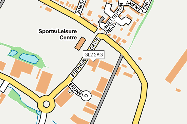
GL2 2AG is located in the Quedgeley Fieldcourt electoral ward, within the local authority district of Gloucester and the English Parliamentary constituency of Gloucester. The Sub Integrated Care Board (ICB) Location is NHS Gloucestershire ICB - 11M and the police force is Gloucestershire. This postcode has been in use since January 2007.


GetTheData
Source: OS OpenMap – Local (Ordnance Survey)
Source: OS VectorMap District (Ordnance Survey)
Licence: Open Government Licence (requires attribution)
| Easting | 381765 |
| Northing | 212755 |
| Latitude | 51.813126 |
| Longitude | -2.265917 |
GetTheData
Source: Open Postcode Geo
Licence: Open Government Licence
| Country | England |
| Postcode District | GL2 |
➜ See where GL2 is on a map ➜ Where is Quedgeley? | |
GetTheData
Source: Land Registry Price Paid Data
Licence: Open Government Licence
Elevation or altitude of GL2 2AG as distance above sea level:
| Metres | Feet | |
|---|---|---|
| Elevation | 30m | 98ft |
Elevation is measured from the approximate centre of the postcode, to the nearest point on an OS contour line from OS Terrain 50, which has contour spacing of ten vertical metres.
➜ How high above sea level am I? Find the elevation of your current position using your device's GPS.
GetTheData
Source: Open Postcode Elevation
Licence: Open Government Licence
| Ward | Quedgeley Fieldcourt |
| Constituency | Gloucester |
GetTheData
Source: ONS Postcode Database
Licence: Open Government Licence
| Needham Avenue (Naas Lane) | Quedgeley | 155m |
| Business Park (Waterwells Drive) | Quedgeley | 239m |
| Business Park (Waterwells Drive) | Quedgeley | 249m |
| Saint Mawgan Street (Rudloe Drive) | Kingsway | 613m |
| Saint Mawgan Street (Rudloe Drive) | Kingsway | 620m |
GetTheData
Source: NaPTAN
Licence: Open Government Licence
GetTheData
Source: ONS Postcode Database
Licence: Open Government Licence


➜ Get more ratings from the Food Standards Agency
GetTheData
Source: Food Standards Agency
Licence: FSA terms & conditions
| Last Collection | |||
|---|---|---|---|
| Location | Mon-Fri | Sat | Distance |
| Munitions Quedgeley | 17:00 | 08:00 | 151m |
| Four Mile Elm Hardwicke | 16:50 | 09:15 | 909m |
| Fieldcourt Dr Quedgeley | 16:30 | 09:15 | 1,322m |
GetTheData
Source: Dracos
Licence: Creative Commons Attribution-ShareAlike
The below table lists the International Territorial Level (ITL) codes (formerly Nomenclature of Territorial Units for Statistics (NUTS) codes) and Local Administrative Units (LAU) codes for GL2 2AG:
| ITL 1 Code | Name |
|---|---|
| TLK | South West (England) |
| ITL 2 Code | Name |
| TLK1 | Gloucestershire, Wiltshire and Bath/Bristol area |
| ITL 3 Code | Name |
| TLK13 | Gloucestershire CC |
| LAU 1 Code | Name |
| E07000081 | Gloucester |
GetTheData
Source: ONS Postcode Directory
Licence: Open Government Licence
The below table lists the Census Output Area (OA), Lower Layer Super Output Area (LSOA), and Middle Layer Super Output Area (MSOA) for GL2 2AG:
| Code | Name | |
|---|---|---|
| OA | E00113532 | |
| LSOA | E01032934 | Gloucester 015F |
| MSOA | E02004650 | Gloucester 015 |
GetTheData
Source: ONS Postcode Directory
Licence: Open Government Licence
| GL2 2AL | Brunel Court | 138m |
| GL2 2HE | Snetterton Heath Kingsway | 165m |
| GL2 2HF | Snetterton Heath Kingsway | 176m |
| GL2 2HG | Snetterton Heath Kingsway | 178m |
| GL2 2SD | Naas Lane | 219m |
| GL2 2HD | Swannington Drive Kingsway | 261m |
| GL2 2SF | Needham Avenue | 266m |
| GL2 2HB | Pucklechurch Close Kingsway | 308m |
| GL2 2GP | Hunts Grove View | 327m |
| GL2 2AP | The Glenmore Centre | 432m |
GetTheData
Source: Open Postcode Geo; Land Registry Price Paid Data
Licence: Open Government Licence