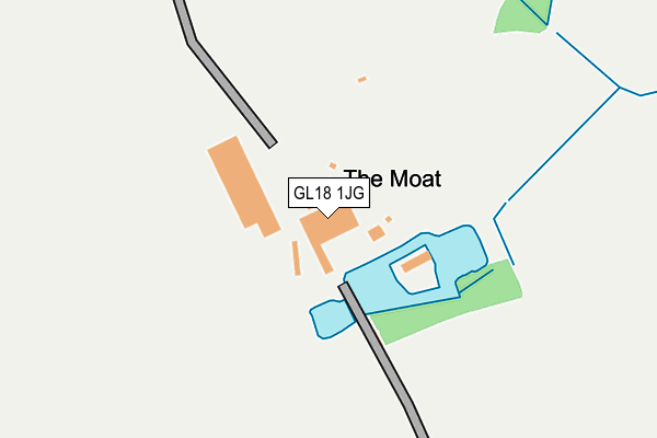
GL18 1JG is located in the Newent & Taynton electoral ward, within the local authority district of Forest of Dean and the English Parliamentary constituency of Forest of Dean. The Sub Integrated Care Board (ICB) Location is NHS Gloucestershire ICB - 11M and the police force is Gloucestershire. This postcode has been in use since January 1980.


GetTheData
Source: OS OpenMap – Local (Ordnance Survey)
Source: OS VectorMap District (Ordnance Survey)
Licence: Open Government Licence (requires attribution)
| Easting | 372219 |
| Northing | 224307 |
| Latitude | 51.916591 |
| Longitude | -2.405319 |
GetTheData
Source: Open Postcode Geo
Licence: Open Government Licence
| Country | England |
| Postcode District | GL18 |
➜ See where GL18 is on a map | |
GetTheData
Source: Land Registry Price Paid Data
Licence: Open Government Licence
Elevation or altitude of GL18 1JG as distance above sea level:
| Metres | Feet | |
|---|---|---|
| Elevation | 40m | 131ft |
Elevation is measured from the approximate centre of the postcode, to the nearest point on an OS contour line from OS Terrain 50, which has contour spacing of ten vertical metres.
➜ How high above sea level am I? Find the elevation of your current position using your device's GPS.
GetTheData
Source: Open Postcode Elevation
Licence: Open Government Licence
| Ward | Newent & Taynton |
| Constituency | Forest Of Dean |
GetTheData
Source: ONS Postcode Database
Licence: Open Government Licence
| Anthony's Cross (B4216) | Anthony's Cross | 539m |
| Anthony's Cross (B4216) | Anthony's Cross | 544m |
| Lower Boulsdon Turn (Culver Street) | Newent | 633m |
| Lower Boulsdon Turn (Culver Street) | Newent | 634m |
| Southend Lane (Culver Street) | Newent | 823m |
GetTheData
Source: NaPTAN
Licence: Open Government Licence
GetTheData
Source: ONS Postcode Database
Licence: Open Government Licence


➜ Get more ratings from the Food Standards Agency
GetTheData
Source: Food Standards Agency
Licence: FSA terms & conditions
| Last Collection | |||
|---|---|---|---|
| Location | Mon-Fri | Sat | Distance |
| Anthonys Cross | 17:05 | 08:00 | 540m |
| Boulsdon Croft | 17:00 | 09:00 | 1,259m |
| Onslow Road | 16:00 | 08:30 | 1,396m |
GetTheData
Source: Dracos
Licence: Creative Commons Attribution-ShareAlike
The below table lists the International Territorial Level (ITL) codes (formerly Nomenclature of Territorial Units for Statistics (NUTS) codes) and Local Administrative Units (LAU) codes for GL18 1JG:
| ITL 1 Code | Name |
|---|---|
| TLK | South West (England) |
| ITL 2 Code | Name |
| TLK1 | Gloucestershire, Wiltshire and Bath/Bristol area |
| ITL 3 Code | Name |
| TLK13 | Gloucestershire CC |
| LAU 1 Code | Name |
| E07000080 | Forest of Dean |
GetTheData
Source: ONS Postcode Directory
Licence: Open Government Licence
The below table lists the Census Output Area (OA), Lower Layer Super Output Area (LSOA), and Middle Layer Super Output Area (MSOA) for GL18 1JG:
| Code | Name | |
|---|---|---|
| OA | E00113217 | |
| LSOA | E01022271 | Forest of Dean 001E |
| MSOA | E02004626 | Forest of Dean 001 |
GetTheData
Source: ONS Postcode Directory
Licence: Open Government Licence
| GL18 1JF | Anthonys Cross | 546m |
| GL18 1JQ | Anthonys Cross | 549m |
| GL18 1JD | Southend Lane | 667m |
| GL18 1JE | Culver Street | 725m |
| GL18 1JH | 817m | |
| GL18 1LA | Connemara Close | 825m |
| GL18 1JZ | Cherry Bank | 878m |
| GL18 1JB | Whitegates | 1015m |
| GL18 1JA | Culver Street | 1026m |
| GL18 1SS | Foley Road | 1062m |
GetTheData
Source: Open Postcode Geo; Land Registry Price Paid Data
Licence: Open Government Licence