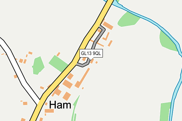
GL13 9QL is located in the Berkeley Vale electoral ward, within the local authority district of Stroud and the English Parliamentary constituency of Stroud. The Sub Integrated Care Board (ICB) Location is NHS Gloucestershire ICB - 11M and the police force is Gloucestershire. This postcode has been in use since January 1980.


GetTheData
Source: OS OpenMap – Local (Ordnance Survey)
Source: OS VectorMap District (Ordnance Survey)
Licence: Open Government Licence (requires attribution)
| Easting | 368159 |
| Northing | 198554 |
| Latitude | 51.684835 |
| Longitude | -2.461972 |
GetTheData
Source: Open Postcode Geo
Licence: Open Government Licence
| Country | England |
| Postcode District | GL13 |
➜ See where GL13 is on a map ➜ Where is Ham? | |
GetTheData
Source: Land Registry Price Paid Data
Licence: Open Government Licence
Elevation or altitude of GL13 9QL as distance above sea level:
| Metres | Feet | |
|---|---|---|
| Elevation | 10m | 33ft |
Elevation is measured from the approximate centre of the postcode, to the nearest point on an OS contour line from OS Terrain 50, which has contour spacing of ten vertical metres.
➜ How high above sea level am I? Find the elevation of your current position using your device's GPS.
GetTheData
Source: Open Postcode Elevation
Licence: Open Government Licence
| Ward | Berkeley Vale |
| Constituency | Stroud |
GetTheData
Source: ONS Postcode Database
Licence: Open Government Licence
| The Salutation Inn (Berkeley Road) | Ham | 213m |
| Post Office (Salter Street) | Berkeley | 726m |
| Post Office (Salter Street) | Berkeley | 749m |
| Square (Canonbury Street) | Berkeley | 763m |
| Square | Berkeley | 765m |
| Lydney Station | 5.8km |
GetTheData
Source: NaPTAN
Licence: Open Government Licence
GetTheData
Source: ONS Postcode Database
Licence: Open Government Licence


➜ Get more ratings from the Food Standards Agency
GetTheData
Source: Food Standards Agency
Licence: FSA terms & conditions
| Last Collection | |||
|---|---|---|---|
| Location | Mon-Fri | Sat | Distance |
| Ham Village | 16:15 | 09:15 | 290m |
| The Post Office | 17:25 | 11:00 | 733m |
| Lynch Road | 17:00 | 08:30 | 784m |
GetTheData
Source: Dracos
Licence: Creative Commons Attribution-ShareAlike
The below table lists the International Territorial Level (ITL) codes (formerly Nomenclature of Territorial Units for Statistics (NUTS) codes) and Local Administrative Units (LAU) codes for GL13 9QL:
| ITL 1 Code | Name |
|---|---|
| TLK | South West (England) |
| ITL 2 Code | Name |
| TLK1 | Gloucestershire, Wiltshire and Bath/Bristol area |
| ITL 3 Code | Name |
| TLK13 | Gloucestershire CC |
| LAU 1 Code | Name |
| E07000082 | Stroud |
GetTheData
Source: ONS Postcode Directory
Licence: Open Government Licence
The below table lists the Census Output Area (OA), Lower Layer Super Output Area (LSOA), and Middle Layer Super Output Area (MSOA) for GL13 9QL:
| Code | Name | |
|---|---|---|
| OA | E00113937 | |
| LSOA | E01022413 | Stroud 012D |
| MSOA | E02004662 | Stroud 012 |
GetTheData
Source: ONS Postcode Directory
Licence: Open Government Licence
| GL13 9BW | Jumpers Lane | 527m |
| GL13 9DE | Lantern Close | 593m |
| GL13 9BJ | High Street | 650m |
| GL13 9BY | Stock Lane | 665m |
| GL13 9QR | Hamfields Lane | 667m |
| GL13 9BH | High Street | 675m |
| GL13 9BN | Church Lane | 678m |
| GL13 9EJ | Coach Close | 683m |
| GL13 9BU | Salter Street | 708m |
| GL13 9TB | Parkview Road | 715m |
GetTheData
Source: Open Postcode Geo; Land Registry Price Paid Data
Licence: Open Government Licence