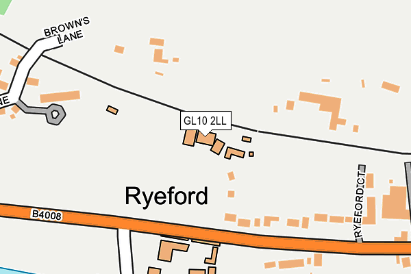
GL10 2LL is located in the Stonehouse electoral ward, within the local authority district of Stroud and the English Parliamentary constituency of Stroud. The Sub Integrated Care Board (ICB) Location is NHS Gloucestershire ICB - 11M and the police force is Gloucestershire. This postcode has been in use since January 1980.


GetTheData
Source: OS OpenMap – Local (Ordnance Survey)
Source: OS VectorMap District (Ordnance Survey)
Licence: Open Government Licence (requires attribution)
| Easting | 381455 |
| Northing | 204871 |
| Latitude | 51.742231 |
| Longitude | -2.269989 |
GetTheData
Source: Open Postcode Geo
Licence: Open Government Licence
| Country | England |
| Postcode District | GL10 |
➜ See where GL10 is on a map ➜ Where is Ryeford? | |
GetTheData
Source: Land Registry Price Paid Data
Licence: Open Government Licence
Elevation or altitude of GL10 2LL as distance above sea level:
| Metres | Feet | |
|---|---|---|
| Elevation | 50m | 164ft |
Elevation is measured from the approximate centre of the postcode, to the nearest point on an OS contour line from OS Terrain 50, which has contour spacing of ten vertical metres.
➜ How high above sea level am I? Find the elevation of your current position using your device's GPS.
GetTheData
Source: Open Postcode Elevation
Licence: Open Government Licence
| Ward | Stonehouse |
| Constituency | Stroud |
GetTheData
Source: ONS Postcode Database
Licence: Open Government Licence
| Garden Centre (Ebley Road) | Ryeford | 155m |
| Garden Centre (Ebley Road) | Ryeford | 244m |
| Ebley Bypass (Ryeford Road South) | King's Stanley | 416m |
| Ebley Bypass (Ryeford Road South) | King's Stanley | 420m |
| Pearcroft Road (Bath Road) | Stonehouse | 572m |
| Stonehouse Station | 0.8km |
| Stroud (Glos) Station | 3.5km |
GetTheData
Source: NaPTAN
Licence: Open Government Licence
| Percentage of properties with Next Generation Access | 100.0% |
| Percentage of properties with Superfast Broadband | 100.0% |
| Percentage of properties with Ultrafast Broadband | 0.0% |
| Percentage of properties with Full Fibre Broadband | 0.0% |
Superfast Broadband is between 30Mbps and 300Mbps
Ultrafast Broadband is > 300Mbps
| Percentage of properties unable to receive 2Mbps | 0.0% |
| Percentage of properties unable to receive 5Mbps | 0.0% |
| Percentage of properties unable to receive 10Mbps | 0.0% |
| Percentage of properties unable to receive 30Mbps | 0.0% |
GetTheData
Source: Ofcom
Licence: Ofcom Terms of Use (requires attribution)
GetTheData
Source: ONS Postcode Database
Licence: Open Government Licence


➜ Get more ratings from the Food Standards Agency
GetTheData
Source: Food Standards Agency
Licence: FSA terms & conditions
| Last Collection | |||
|---|---|---|---|
| Location | Mon-Fri | Sat | Distance |
| Ryeford | 17:30 | 12:15 | 150m |
| Rosedale Avenue | 17:15 | 12:15 | 603m |
| Bath Road | 17:15 | 12:15 | 678m |
GetTheData
Source: Dracos
Licence: Creative Commons Attribution-ShareAlike
The below table lists the International Territorial Level (ITL) codes (formerly Nomenclature of Territorial Units for Statistics (NUTS) codes) and Local Administrative Units (LAU) codes for GL10 2LL:
| ITL 1 Code | Name |
|---|---|
| TLK | South West (England) |
| ITL 2 Code | Name |
| TLK1 | Gloucestershire, Wiltshire and Bath/Bristol area |
| ITL 3 Code | Name |
| TLK13 | Gloucestershire CC |
| LAU 1 Code | Name |
| E07000082 | Stroud |
GetTheData
Source: ONS Postcode Directory
Licence: Open Government Licence
The below table lists the Census Output Area (OA), Lower Layer Super Output Area (LSOA), and Middle Layer Super Output Area (MSOA) for GL10 2LL:
| Code | Name | |
|---|---|---|
| OA | E00113887 | |
| LSOA | E01022404 | Stroud 005E |
| MSOA | E02004655 | Stroud 005 |
GetTheData
Source: ONS Postcode Directory
Licence: Open Government Licence
| GL10 2JN | The Grove | 223m |
| GL10 2LG | 241m | |
| GL10 2LE | Spring Cottages | 295m |
| GL10 2JZ | Browns Lane | 319m |
| GL10 2LA | 365m | |
| GL10 2LQ | Ebley Road | 375m |
| GL10 2LW | Ebley Road | 402m |
| GL10 2JY | Pearcroft Road | 434m |
| GL10 2JX | Pearcroft Road | 560m |
| GL10 2QH | Rosedale Avenue | 562m |
GetTheData
Source: Open Postcode Geo; Land Registry Price Paid Data
Licence: Open Government Licence