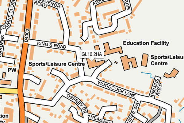
GL10 2HA is located in the Stonehouse electoral ward, within the local authority district of Stroud and the English Parliamentary constituency of Stroud. The Sub Integrated Care Board (ICB) Location is NHS Gloucestershire ICB - 11M and the police force is Gloucestershire. This postcode has been in use since January 1980.


GetTheData
Source: OS OpenMap – Local (Ordnance Survey)
Source: OS VectorMap District (Ordnance Survey)
Licence: Open Government Licence (requires attribution)
| Easting | 380801 |
| Northing | 206049 |
| Latitude | 51.752800 |
| Longitude | -2.279527 |
GetTheData
Source: Open Postcode Geo
Licence: Open Government Licence
| Country | England |
| Postcode District | GL10 |
➜ See where GL10 is on a map ➜ Where is Stonehouse? | |
GetTheData
Source: Land Registry Price Paid Data
Licence: Open Government Licence
Elevation or altitude of GL10 2HA as distance above sea level:
| Metres | Feet | |
|---|---|---|
| Elevation | 50m | 164ft |
Elevation is measured from the approximate centre of the postcode, to the nearest point on an OS contour line from OS Terrain 50, which has contour spacing of ten vertical metres.
➜ How high above sea level am I? Find the elevation of your current position using your device's GPS.
GetTheData
Source: Open Postcode Elevation
Licence: Open Government Licence
| Ward | Stonehouse |
| Constituency | Stroud |
GetTheData
Source: ONS Postcode Database
Licence: Open Government Licence
| Maidenhill School (King's Road) | Stonehouse | 38m |
| Maidenhill School (King's Road) | Stonehouse | 47m |
| Maidenhill School (Woodcock Lane) | Stonehouse | 109m |
| Maidenhill School (Woodcock Lane) | Stonehouse | 115m |
| Gloucester Road (King's Road) | Stonehouse | 183m |
| Stonehouse Station | 0.8km |
| Stroud (Glos) Station | 4.3km |
GetTheData
Source: NaPTAN
Licence: Open Government Licence
GetTheData
Source: ONS Postcode Database
Licence: Open Government Licence


➜ Get more ratings from the Food Standards Agency
GetTheData
Source: Food Standards Agency
Licence: FSA terms & conditions
| Last Collection | |||
|---|---|---|---|
| Location | Mon-Fri | Sat | Distance |
| Woodcock Lane | 17:15 | 12:15 | 261m |
| Gloucester Road | 17:15 | 12:15 | 347m |
| Melbourne Drive | 17:15 | 12:15 | 373m |
GetTheData
Source: Dracos
Licence: Creative Commons Attribution-ShareAlike
The below table lists the International Territorial Level (ITL) codes (formerly Nomenclature of Territorial Units for Statistics (NUTS) codes) and Local Administrative Units (LAU) codes for GL10 2HA:
| ITL 1 Code | Name |
|---|---|
| TLK | South West (England) |
| ITL 2 Code | Name |
| TLK1 | Gloucestershire, Wiltshire and Bath/Bristol area |
| ITL 3 Code | Name |
| TLK13 | Gloucestershire CC |
| LAU 1 Code | Name |
| E07000082 | Stroud |
GetTheData
Source: ONS Postcode Directory
Licence: Open Government Licence
The below table lists the Census Output Area (OA), Lower Layer Super Output Area (LSOA), and Middle Layer Super Output Area (MSOA) for GL10 2HA:
| Code | Name | |
|---|---|---|
| OA | E00113869 | |
| LSOA | E01022402 | Stroud 005C |
| MSOA | E02004655 | Stroud 005 |
GetTheData
Source: ONS Postcode Directory
Licence: Open Government Licence
| GL10 2EX | Woodcock Lane | 111m |
| GL10 2EF | Glenthorne Close | 118m |
| GL10 2EZ | Kings Road | 118m |
| GL10 2EY | Woodcock Lane | 127m |
| GL10 2EG | Osprey Drive | 157m |
| GL10 2EJ | Osprey Drive | 160m |
| GL10 2QR | Arrowsmith Drive | 165m |
| GL10 2EQ | Pheasant Mead | 173m |
| GL10 2EE | Woodcock Lane | 178m |
| GL10 2HF | Blackwell Close | 190m |
GetTheData
Source: Open Postcode Geo; Land Registry Price Paid Data
Licence: Open Government Licence