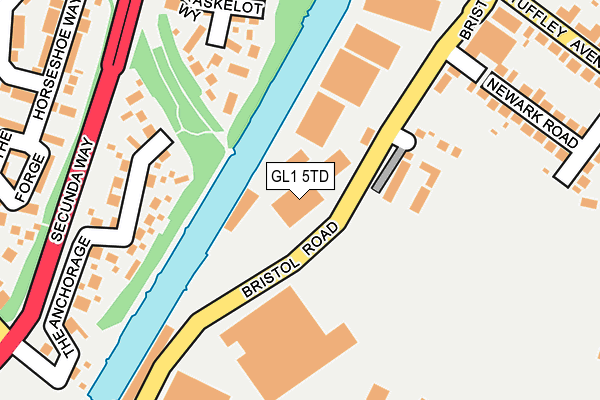
GL1 5TD is located in the Podsmead electoral ward, within the local authority district of Gloucester and the English Parliamentary constituency of Gloucester. The Sub Integrated Care Board (ICB) Location is NHS Gloucestershire ICB - 11M and the police force is Gloucestershire. This postcode has been in use since January 1980.


GetTheData
Source: OS OpenMap – Local (Ordnance Survey)
Source: OS VectorMap District (Ordnance Survey)
Licence: Open Government Licence (requires attribution)
| Easting | 382117 |
| Northing | 216608 |
| Latitude | 51.847779 |
| Longitude | -2.261011 |
GetTheData
Source: Open Postcode Geo
Licence: Open Government Licence
| Country | England |
| Postcode District | GL1 |
➜ See where GL1 is on a map ➜ Where is Gloucester? | |
GetTheData
Source: Land Registry Price Paid Data
Licence: Open Government Licence
Elevation or altitude of GL1 5TD as distance above sea level:
| Metres | Feet | |
|---|---|---|
| Elevation | 20m | 66ft |
Elevation is measured from the approximate centre of the postcode, to the nearest point on an OS contour line from OS Terrain 50, which has contour spacing of ten vertical metres.
➜ How high above sea level am I? Find the elevation of your current position using your device's GPS.
GetTheData
Source: Open Postcode Elevation
Licence: Open Government Licence
| Ward | Podsmead |
| Constituency | Gloucester |
GetTheData
Source: ONS Postcode Database
Licence: Open Government Licence
| Hempsted Lane (Bristol Road) | Gloucester | 222m |
| Newark Road (Bristol Road) | Gloucester | 227m |
| The Anchorage (Secunda Way) | Hempsted | 232m |
| The Forge | Hempsted | 242m |
| Tuffley Avenue (Bristol Road) | Gloucester | 310m |
| Gloucester Station | 2.5km |
GetTheData
Source: NaPTAN
Licence: Open Government Licence
GetTheData
Source: ONS Postcode Database
Licence: Open Government Licence


➜ Get more ratings from the Food Standards Agency
GetTheData
Source: Food Standards Agency
Licence: FSA terms & conditions
| Last Collection | |||
|---|---|---|---|
| Location | Mon-Fri | Sat | Distance |
| Bristol Road | 17:45 | 12:30 | 223m |
| Elmgrove | 17:00 | 12:00 | 364m |
| Tuffley Avenue | 17:30 | 12:45 | 449m |
GetTheData
Source: Dracos
Licence: Creative Commons Attribution-ShareAlike
The below table lists the International Territorial Level (ITL) codes (formerly Nomenclature of Territorial Units for Statistics (NUTS) codes) and Local Administrative Units (LAU) codes for GL1 5TD:
| ITL 1 Code | Name |
|---|---|
| TLK | South West (England) |
| ITL 2 Code | Name |
| TLK1 | Gloucestershire, Wiltshire and Bath/Bristol area |
| ITL 3 Code | Name |
| TLK13 | Gloucestershire CC |
| LAU 1 Code | Name |
| E07000081 | Gloucester |
GetTheData
Source: ONS Postcode Directory
Licence: Open Government Licence
The below table lists the Census Output Area (OA), Lower Layer Super Output Area (LSOA), and Middle Layer Super Output Area (MSOA) for GL1 5TD:
| Code | Name | |
|---|---|---|
| OA | E00113521 | |
| LSOA | E01022333 | Gloucester 009E |
| MSOA | E02004644 | Gloucester 009 |
GetTheData
Source: ONS Postcode Directory
Licence: Open Government Licence
| GL1 5TE | Canada Wharf | 167m |
| GL2 5DR | Kaskelot Way | 176m |
| GL2 5JW | The Anchorage | 186m |
| GL1 5TL | Bristol Road | 225m |
| GL1 5TW | Newark Road | 241m |
| GL2 5DL | Soren Larsen Way | 295m |
| GL2 5GH | The Forge | 300m |
| GL1 5LT | Tuffley Avenue | 304m |
| GL2 5EU | Ashville Road | 315m |
| GL2 5GD | Horseshoe Way | 323m |
GetTheData
Source: Open Postcode Geo; Land Registry Price Paid Data
Licence: Open Government Licence