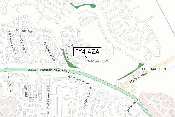
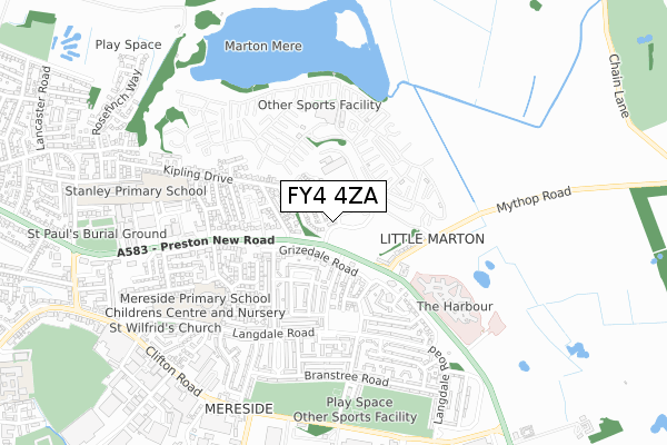
FY4 4ZA is located in the Marton electoral ward, within the unitary authority of Blackpool and the English Parliamentary constituency of Blackpool South. The Sub Integrated Care Board (ICB) Location is NHS Lancashire and South Cumbria ICB - 00R and the police force is Lancashire. This postcode has been in use since September 2018.


GetTheData
Source: OS Open Zoomstack (Ordnance Survey)
Licence: Open Government Licence (requires attribution)
Attribution: Contains OS data © Crown copyright and database right 2024
Source: Open Postcode Geo
Licence: Open Government Licence (requires attribution)
Attribution: Contains OS data © Crown copyright and database right 2024; Contains Royal Mail data © Royal Mail copyright and database right 2024; Source: Office for National Statistics licensed under the Open Government Licence v.3.0
| Easting | 334538 |
| Northing | 434587 |
| Latitude | 53.803457 |
| Longitude | -2.995451 |
GetTheData
Source: Open Postcode Geo
Licence: Open Government Licence
| Country | England |
| Postcode District | FY4 |
| ➜ FY4 open data dashboard ➜ See where FY4 is on a map ➜ Where is Blackpool? | |
GetTheData
Source: Land Registry Price Paid Data
Licence: Open Government Licence
| Ward | Marton |
| Constituency | Blackpool South |
GetTheData
Source: ONS Postcode Database
Licence: Open Government Licence
25, MARPLES DRIVE, BLACKPOOL, FY4 4ZA 2021 18 FEB £273,995 |
1, MARPLES DRIVE, BLACKPOOL, FY4 4ZA 2021 12 FEB £243,995 |
27, MARPLES DRIVE, BLACKPOOL, FY4 4ZA 2020 11 DEC £273,995 |
23, MARPLES DRIVE, BLACKPOOL, FY4 4ZA 2020 11 DEC £253,495 |
19, MARPLES DRIVE, BLACKPOOL, FY4 4ZA 2020 4 DEC £279,995 |
2020 20 NOV £252,995 |
15, MARPLES DRIVE, BLACKPOOL, FY4 4ZA 2018 31 AUG £229,995 |
9, MARPLES DRIVE, BLACKPOOL, FY4 4ZA 2018 31 AUG £184,995 |
11, MARPLES DRIVE, BLACKPOOL, FY4 4ZA 2018 30 AUG £249,995 |
17, MARPLES DRIVE, BLACKPOOL, FY4 4ZA 2018 27 JUL £278,995 |
GetTheData
Source: HM Land Registry Price Paid Data
Licence: Contains HM Land Registry data © Crown copyright and database right 2024. This data is licensed under the Open Government Licence v3.0.
| January 2024 | Violence and sexual offences | On or near Rossett Avenue | 378m |
| January 2024 | Violence and sexual offences | On or near Rossett Avenue | 378m |
| December 2023 | Violence and sexual offences | On or near Rossett Avenue | 378m |
| ➜ Get more crime data in our Crime section | |||
GetTheData
Source: data.police.uk
Licence: Open Government Licence
| Clifton Arms (Preston New Road) | Marton | 147m |
| Clifton Arms (Preston New Road) | Marton | 154m |
| Paddock Drive (Preston New Road) | Little Marton | 210m |
| Paddock Drive | Little Marton | 258m |
| Paddock Drive (Preston New Road) | Mereside | 269m |
| Blackpool South Station | 3.6km |
| Blackpool North Station | 4.1km |
| Layton (Lancs) Station | 4.2km |
GetTheData
Source: NaPTAN
Licence: Open Government Licence
| Percentage of properties with Next Generation Access | 100.0% |
| Percentage of properties with Superfast Broadband | 100.0% |
| Percentage of properties with Ultrafast Broadband | 100.0% |
| Percentage of properties with Full Fibre Broadband | 100.0% |
Superfast Broadband is between 30Mbps and 300Mbps
Ultrafast Broadband is > 300Mbps
| Percentage of properties unable to receive 2Mbps | 0.0% |
| Percentage of properties unable to receive 5Mbps | 0.0% |
| Percentage of properties unable to receive 10Mbps | 0.0% |
| Percentage of properties unable to receive 30Mbps | 0.0% |
GetTheData
Source: Ofcom
Licence: Ofcom Terms of Use (requires attribution)
GetTheData
Source: ONS Postcode Database
Licence: Open Government Licence


➜ Get more ratings from the Food Standards Agency
GetTheData
Source: Food Standards Agency
Licence: FSA terms & conditions
| Last Collection | |||
|---|---|---|---|
| Location | Mon-Fri | Sat | Distance |
| Paddock Drive | 17:00 | 11:00 | 215m |
| Mereside Post Office | 17:30 | 12:00 | 432m |
| Clifton Avenue | 17:00 | 12:30 | 531m |
GetTheData
Source: Dracos
Licence: Creative Commons Attribution-ShareAlike
| Facility | Distance |
|---|---|
| Mereside Bowness Avenue, Blackpool Grass Pitches, Cycling | 623m |
| Stanley Primary School Wordsworth Avenue, Blackpool Grass Pitches | 891m |
| Universe Gym (Closed) Binwell Road, Blackpool Health and Fitness Gym, Studio | 1.1km |
GetTheData
Source: Active Places
Licence: Open Government Licence
| School | Phase of Education | Distance |
|---|---|---|
| Lotus School Langdale Road, Blackpool, FY4 4RR | Not applicable | 571m |
| Mereside Primary Academy Langdale Road, Blackpool, FY4 4RR | Primary | 636m |
| Stanley Primary School Wordsworth Avenue, Blackpool, FY3 9UT | Primary | 891m |
GetTheData
Source: Edubase
Licence: Open Government Licence
The below table lists the International Territorial Level (ITL) codes (formerly Nomenclature of Territorial Units for Statistics (NUTS) codes) and Local Administrative Units (LAU) codes for FY4 4ZA:
| ITL 1 Code | Name |
|---|---|
| TLD | North West (England) |
| ITL 2 Code | Name |
| TLD4 | Lancashire |
| ITL 3 Code | Name |
| TLD42 | Blackpool |
| LAU 1 Code | Name |
| E06000009 | Blackpool |
GetTheData
Source: ONS Postcode Directory
Licence: Open Government Licence
The below table lists the Census Output Area (OA), Lower Layer Super Output Area (LSOA), and Middle Layer Super Output Area (MSOA) for FY4 4ZA:
| Code | Name | |
|---|---|---|
| OA | E00064099 | |
| LSOA | E01012714 | Blackpool 014E |
| MSOA | E02002646 | Blackpool 014 |
GetTheData
Source: ONS Postcode Directory
Licence: Open Government Licence
| FY4 4TL | Grizedale Road | 174m |
| FY4 4UU | Mythop Road | 197m |
| FY3 9TY | Preston New Road | 215m |
| FY4 4UZ | Mythop Road | 233m |
| FY4 4RN | Castlerigg Place | 248m |
| FY3 9UD | Wheatlands Crescent | 257m |
| FY4 4TW | Kentmere Drive | 258m |
| FY4 4SQ | Bowfell Close | 270m |
| FY4 4UT | Preston New Road | 270m |
| FY3 9TZ | Paddock Drive | 281m |
GetTheData
Source: Open Postcode Geo; Land Registry Price Paid Data
Licence: Open Government Licence