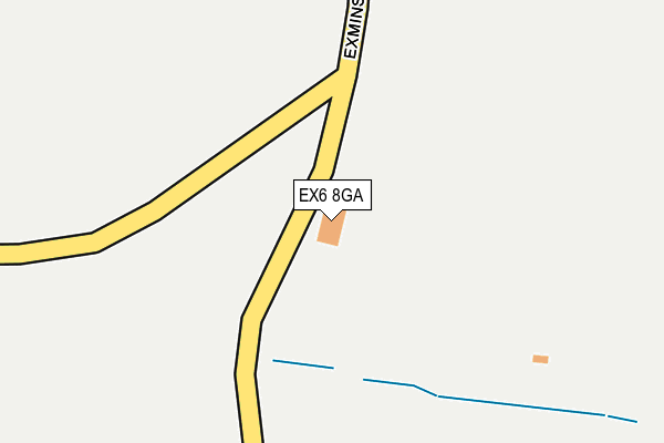
EX6 8GA is located in the Kenn Valley electoral ward, within the local authority district of Teignbridge and the English Parliamentary constituency of Central Devon. The Sub Integrated Care Board (ICB) Location is NHS Devon ICB - 15N and the police force is Devon & Cornwall. This postcode has been in use since August 2004.


GetTheData
Source: OS OpenMap – Local (Ordnance Survey)
Source: OS VectorMap District (Ordnance Survey)
Licence: Open Government Licence (requires attribution)
| Easting | 294545 |
| Northing | 86783 |
| Latitude | 50.671119 |
| Longitude | -3.493700 |
GetTheData
Source: Open Postcode Geo
Licence: Open Government Licence
| Country | England |
| Postcode District | EX6 |
➜ See where EX6 is on a map | |
GetTheData
Source: Land Registry Price Paid Data
Licence: Open Government Licence
Elevation or altitude of EX6 8GA as distance above sea level:
| Metres | Feet | |
|---|---|---|
| Elevation | 30m | 98ft |
Elevation is measured from the approximate centre of the postcode, to the nearest point on an OS contour line from OS Terrain 50, which has contour spacing of ten vertical metres.
➜ How high above sea level am I? Find the elevation of your current position using your device's GPS.
GetTheData
Source: Open Postcode Elevation
Licence: Open Government Licence
| Ward | Kenn Valley |
| Constituency | Central Devon |
GetTheData
Source: ONS Postcode Database
Licence: Open Government Licence
| Royal Oak (Main Road) | Exminster | 503m |
| Royal Oak (Main Road) | Exminster | 524m |
| Swans Nest Roundabout (A379) | Exminster | 623m |
| Swans Nest Roundabout (A379) | Exminster | 627m |
| Higher Marshrow (A379) | Exminster | 651m |
| Topsham Station | 2.7km |
| Exton Station | 3.5km |
| Lympstone Commando Station | 3.9km |
GetTheData
Source: NaPTAN
Licence: Open Government Licence
GetTheData
Source: ONS Postcode Database
Licence: Open Government Licence


➜ Get more ratings from the Food Standards Agency
GetTheData
Source: Food Standards Agency
Licence: FSA terms & conditions
| Last Collection | |||
|---|---|---|---|
| Location | Mon-Fri | Sat | Distance |
| Strand | 18:00 | 11:30 | 2,345m |
| Topsham Post Office | 19:00 | 11:45 | 2,420m |
| The Retreat | 18:00 | 11:15 | 2,457m |
GetTheData
Source: Dracos
Licence: Creative Commons Attribution-ShareAlike
The below table lists the International Territorial Level (ITL) codes (formerly Nomenclature of Territorial Units for Statistics (NUTS) codes) and Local Administrative Units (LAU) codes for EX6 8GA:
| ITL 1 Code | Name |
|---|---|
| TLK | South West (England) |
| ITL 2 Code | Name |
| TLK4 | Devon |
| ITL 3 Code | Name |
| TLK43 | Devon CC |
| LAU 1 Code | Name |
| E07000045 | Teignbridge |
GetTheData
Source: ONS Postcode Directory
Licence: Open Government Licence
The below table lists the Census Output Area (OA), Lower Layer Super Output Area (LSOA), and Middle Layer Super Output Area (MSOA) for EX6 8GA:
| Code | Name | |
|---|---|---|
| OA | E00102521 | |
| LSOA | E01020240 | Teignbridge 002A |
| MSOA | E02004202 | Teignbridge 002 |
GetTheData
Source: ONS Postcode Directory
Licence: Open Government Licence
| EX6 8DW | Exminster Hill | 322m |
| EX6 8BW | Higher Aboveway | 363m |
| EX6 8DP | Westfield | 368m |
| EX6 8DU | Riverview Terrace | 413m |
| EX6 8UD | Sentrys Orchard | 425m |
| EX6 8DT | Aboveway | 464m |
| EX6 8UE | Sentrys Orchard | 489m |
| EX6 8DS | Riviera Terrace | 497m |
| EX6 8BR | Milestone Cottages | 500m |
| EX6 8DR | Dawlish Road | 505m |
GetTheData
Source: Open Postcode Geo; Land Registry Price Paid Data
Licence: Open Government Licence