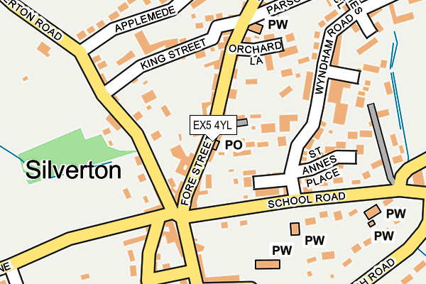
EX5 4YL is located in the Silverton electoral ward, within the local authority district of Mid Devon and the English Parliamentary constituency of Central Devon. The Sub Integrated Care Board (ICB) Location is NHS Devon ICB - 15N and the police force is Devon & Cornwall. This postcode has been in use since June 2006.


GetTheData
Source: OS OpenMap – Local (Ordnance Survey)
Source: OS VectorMap District (Ordnance Survey)
Licence: Open Government Licence (requires attribution)
| Easting | 295598 |
| Northing | 102967 |
| Latitude | 50.816808 |
| Longitude | -3.483382 |
GetTheData
Source: Open Postcode Geo
Licence: Open Government Licence
| Country | England |
| Postcode District | EX5 |
➜ See where EX5 is on a map ➜ Where is Silverton? | |
GetTheData
Source: Land Registry Price Paid Data
Licence: Open Government Licence
Elevation or altitude of EX5 4YL as distance above sea level:
| Metres | Feet | |
|---|---|---|
| Elevation | 80m | 262ft |
Elevation is measured from the approximate centre of the postcode, to the nearest point on an OS contour line from OS Terrain 50, which has contour spacing of ten vertical metres.
➜ How high above sea level am I? Find the elevation of your current position using your device's GPS.
GetTheData
Source: Open Postcode Elevation
Licence: Open Government Licence
| Ward | Silverton |
| Constituency | Central Devon |
GetTheData
Source: ONS Postcode Database
Licence: Open Government Licence
| Square (Upexe Lane) | Silverton | 117m |
| Meadow Lea (Wyndham Road) | Silverton | 174m |
| Coach Road | Silverton | 282m |
| Hillcrest (Coach Road) | Silverton | 385m |
| Silverton Turn (A396) | Up Exe | 984m |
GetTheData
Source: NaPTAN
Licence: Open Government Licence
GetTheData
Source: ONS Postcode Database
Licence: Open Government Licence


➜ Get more ratings from the Food Standards Agency
GetTheData
Source: Food Standards Agency
Licence: FSA terms & conditions
| Last Collection | |||
|---|---|---|---|
| Location | Mon-Fri | Sat | Distance |
| Silverton Post Office | 18:00 | 11:00 | 2m |
| The Square | 18:00 | 10:30 | 130m |
| Latchmore | 17:45 | 07:20 | 2,154m |
GetTheData
Source: Dracos
Licence: Creative Commons Attribution-ShareAlike
The below table lists the International Territorial Level (ITL) codes (formerly Nomenclature of Territorial Units for Statistics (NUTS) codes) and Local Administrative Units (LAU) codes for EX5 4YL:
| ITL 1 Code | Name |
|---|---|
| TLK | South West (England) |
| ITL 2 Code | Name |
| TLK4 | Devon |
| ITL 3 Code | Name |
| TLK43 | Devon CC |
| LAU 1 Code | Name |
| E07000042 | Mid Devon |
GetTheData
Source: ONS Postcode Directory
Licence: Open Government Licence
The below table lists the Census Output Area (OA), Lower Layer Super Output Area (LSOA), and Middle Layer Super Output Area (MSOA) for EX5 4YL:
| Code | Name | |
|---|---|---|
| OA | E00101632 | |
| LSOA | E01020071 | Mid Devon 008D |
| MSOA | E02004171 | Mid Devon 008 |
GetTheData
Source: ONS Postcode Directory
Licence: Open Government Licence
| EX5 4HP | Fore Street | 40m |
| EX5 4HZ | Fore Street | 85m |
| EX5 4HH | St Marys View | 102m |
| EX5 4JQ | Tiverton Road | 132m |
| EX5 4JZ | Wyndham Road | 157m |
| EX5 4JG | King Street | 159m |
| EX5 4NH | St Annes Place | 179m |
| EX5 4JH | School Road | 185m |
| EX5 4HL | Wyndham Road | 187m |
| EX5 4HR | Newcourt Road | 196m |
GetTheData
Source: Open Postcode Geo; Land Registry Price Paid Data
Licence: Open Government Licence