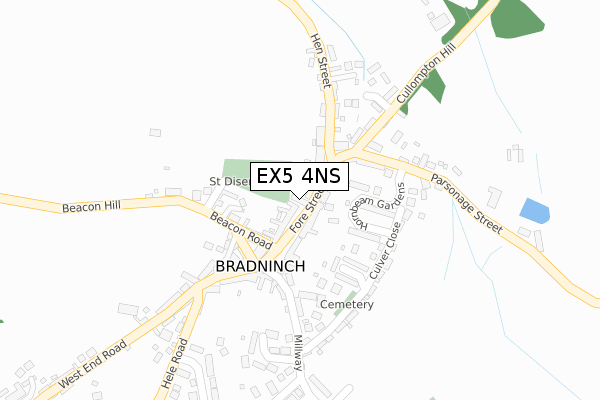
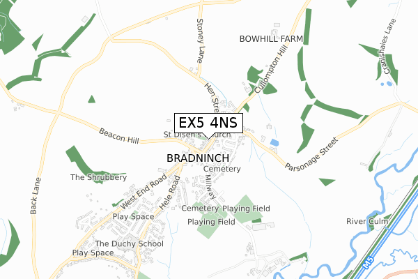
EX5 4NS lies on Church Street in Bradninch, Exeter. EX5 4NS is located in the Bradninch electoral ward, within the local authority district of Mid Devon and the English Parliamentary constituency of Central Devon. The Sub Integrated Care Board (ICB) Location is NHS Devon ICB - 15N and the police force is Devon & Cornwall. This postcode has been in use since January 1980.


GetTheData
Source: OS Open Zoomstack (Ordnance Survey)
Licence: Open Government Licence (requires attribution)
Attribution: Contains OS data © Crown copyright and database right 2025
Source: Open Postcode Geo
Licence: Open Government Licence (requires attribution)
Attribution: Contains OS data © Crown copyright and database right 2025; Contains Royal Mail data © Royal Mail copyright and database right 2025; Source: Office for National Statistics licensed under the Open Government Licence v.3.0
| Easting | 299999 |
| Northing | 104106 |
| Latitude | 50.827816 |
| Longitude | -3.421254 |
GetTheData
Source: Open Postcode Geo
Licence: Open Government Licence
| Street | Church Street |
| Locality | Bradninch |
| Town/City | Exeter |
| Country | England |
| Postcode District | EX5 |
➜ See where EX5 is on a map ➜ Where is Bradninch? | |
GetTheData
Source: Land Registry Price Paid Data
Licence: Open Government Licence
Elevation or altitude of EX5 4NS as distance above sea level:
| Metres | Feet | |
|---|---|---|
| Elevation | 80m | 262ft |
Elevation is measured from the approximate centre of the postcode, to the nearest point on an OS contour line from OS Terrain 50, which has contour spacing of ten vertical metres.
➜ How high above sea level am I? Find the elevation of your current position using your device's GPS.
GetTheData
Source: Open Postcode Elevation
Licence: Open Government Licence
| Ward | Bradninch |
| Constituency | Central Devon |
GetTheData
Source: ONS Postcode Database
Licence: Open Government Licence
| Guildhall (Fore Street) | Bradninch | 99m |
| Guildhall (Fore Street) | Bradninch | 120m |
| Parsonage Street (Cullompton Hill) | Bradninch | 122m |
| Parsonage Street (Cullompton Hill) | Bradninch | 122m |
| Townlands (Hele Road) | Bradninch | 539m |
GetTheData
Source: NaPTAN
Licence: Open Government Licence
| Percentage of properties with Next Generation Access | 100.0% |
| Percentage of properties with Superfast Broadband | 100.0% |
| Percentage of properties with Ultrafast Broadband | 0.0% |
| Percentage of properties with Full Fibre Broadband | 0.0% |
Superfast Broadband is between 30Mbps and 300Mbps
Ultrafast Broadband is > 300Mbps
| Percentage of properties unable to receive 2Mbps | 0.0% |
| Percentage of properties unable to receive 5Mbps | 0.0% |
| Percentage of properties unable to receive 10Mbps | 0.0% |
| Percentage of properties unable to receive 30Mbps | 0.0% |
GetTheData
Source: Ofcom
Licence: Ofcom Terms of Use (requires attribution)
GetTheData
Source: ONS Postcode Database
Licence: Open Government Licence


➜ Get more ratings from the Food Standards Agency
GetTheData
Source: Food Standards Agency
Licence: FSA terms & conditions
| Last Collection | |||
|---|---|---|---|
| Location | Mon-Fri | Sat | Distance |
| Hele | 17:45 | 10:25 | 1,788m |
| Motterton | 10:00 | 10:00 | 3,065m |
| Ellerhayes | 17:45 | 10:25 | 3,356m |
GetTheData
Source: Dracos
Licence: Creative Commons Attribution-ShareAlike
The below table lists the International Territorial Level (ITL) codes (formerly Nomenclature of Territorial Units for Statistics (NUTS) codes) and Local Administrative Units (LAU) codes for EX5 4NS:
| ITL 1 Code | Name |
|---|---|
| TLK | South West (England) |
| ITL 2 Code | Name |
| TLK4 | Devon |
| ITL 3 Code | Name |
| TLK43 | Devon CC |
| LAU 1 Code | Name |
| E07000042 | Mid Devon |
GetTheData
Source: ONS Postcode Directory
Licence: Open Government Licence
The below table lists the Census Output Area (OA), Lower Layer Super Output Area (LSOA), and Middle Layer Super Output Area (MSOA) for EX5 4NS:
| Code | Name | |
|---|---|---|
| OA | E00101461 | |
| LSOA | E01020043 | Mid Devon 008A |
| MSOA | E02004171 | Mid Devon 008 |
GetTheData
Source: ONS Postcode Directory
Licence: Open Government Licence
| EX5 4NN | Fore Street | 16m |
| EX5 4NT | Beacon Road | 106m |
| EX5 4NZ | Hornbeam Gardens | 122m |
| EX5 4NX | Peter Street | 129m |
| EX5 4NJ | High Street | 162m |
| EX5 4NY | Culver Close | 163m |
| EX5 4NP | Cullompton Hill | 177m |
| EX5 4NL | Millway | 190m |
| EX5 4NR | Hen Street | 190m |
| EX5 4QL | High Street | 201m |
GetTheData
Source: Open Postcode Geo; Land Registry Price Paid Data
Licence: Open Government Licence