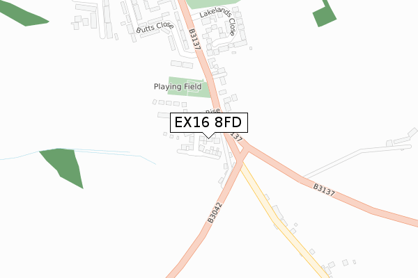
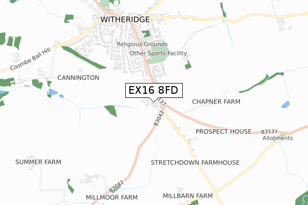
EX16 8FD is located in the Witheridge electoral ward, within the local authority district of North Devon and the English Parliamentary constituency of North Devon. The Sub Integrated Care Board (ICB) Location is NHS Devon ICB - 15N and the police force is Devon & Cornwall. This postcode has been in use since December 2019.


GetTheData
Source: OS Open Zoomstack (Ordnance Survey)
Licence: Open Government Licence (requires attribution)
Attribution: Contains OS data © Crown copyright and database right 2024
Source: Open Postcode Geo
Licence: Open Government Licence (requires attribution)
Attribution: Contains OS data © Crown copyright and database right 2024; Contains Royal Mail data © Royal Mail copyright and database right 2024; Source: Office for National Statistics licensed under the Open Government Licence v.3.0
| Easting | 280612 |
| Northing | 113858 |
| Latitude | 50.911797 |
| Longitude | -3.699593 |
GetTheData
Source: Open Postcode Geo
Licence: Open Government Licence
| Country | England |
| Postcode District | EX16 |
| ➜ EX16 open data dashboard ➜ See where EX16 is on a map ➜ Where is Witheridge? | |
GetTheData
Source: Land Registry Price Paid Data
Licence: Open Government Licence
| Ward | Witheridge |
| Constituency | North Devon |
GetTheData
Source: ONS Postcode Database
Licence: Open Government Licence
2023 20 DEC £440,000 |
37, WILLOW RISE, WITHERIDGE, TIVERTON, EX16 8FD 2023 18 DEC £275,000 |
64, WILLOW RISE, WITHERIDGE, TIVERTON, EX16 8FD 2022 30 AUG £290,000 |
2022 24 AUG £400,000 |
2021 30 SEP £402,500 |
51, WILLOW RISE, WITHERIDGE, TIVERTON, EX16 8FD 2021 27 AUG £255,000 |
50, WILLOW RISE, WITHERIDGE, TIVERTON, EX16 8FD 2021 27 AUG £250,000 |
54, WILLOW RISE, WITHERIDGE, TIVERTON, EX16 8FD 2021 30 JUN £320,000 |
53, WILLOW RISE, WITHERIDGE, TIVERTON, EX16 8FD 2021 30 JUN £290,000 |
52, WILLOW RISE, WITHERIDGE, TIVERTON, EX16 8FD 2021 30 JUN £290,000 |
GetTheData
Source: HM Land Registry Price Paid Data
Licence: Contains HM Land Registry data © Crown copyright and database right 2024. This data is licensed under the Open Government Licence v3.0.
| June 2022 | Violence and sexual offences | On or near East Close | 288m |
| May 2022 | Violence and sexual offences | On or near Ansteys Court | 500m |
| March 2022 | Violence and sexual offences | On or near East Close | 288m |
| ➜ Get more crime data in our Crime section | |||
GetTheData
Source: data.police.uk
Licence: Open Government Licence
| Butts Close (B3137) | Witheridge | 164m |
| Lakelands Close (B3137) | Witheridge | 240m |
| School (B3137) | Witheridge | 321m |
| School (B3137) | Witheridge | 338m |
| The Mitre Inn (Church Street) | Witheridge | 691m |
GetTheData
Source: NaPTAN
Licence: Open Government Licence
GetTheData
Source: ONS Postcode Database
Licence: Open Government Licence


➜ Get more ratings from the Food Standards Agency
GetTheData
Source: Food Standards Agency
Licence: FSA terms & conditions
| Last Collection | |||
|---|---|---|---|
| Location | Mon-Fri | Sat | Distance |
| Thelbridge Cross | 15:30 | 08:00 | 2,445m |
GetTheData
Source: Dracos
Licence: Creative Commons Attribution-ShareAlike
| Facility | Distance |
|---|---|
| Witheridge Sports Field Fore Street, Witheridge Grass Pitches | 307m |
| Witheridge Incorrigibles Cricket Club (Closed) Nomansland, Tiverton Grass Pitches | 2.8km |
GetTheData
Source: Active Places
Licence: Open Government Licence
| School | Phase of Education | Distance |
|---|---|---|
| Witheridge Church of England Primary Academy Fore Street, Witheridge, Tiverton, EX16 8AH | Primary | 344m |
| East Worlington Primary School East Worlington, Crediton, EX17 4TS | Primary | 3.1km |
| Rackenford Church of England Primary School Rackenford, Tiverton, EX16 8DU | Primary | 6.2km |
GetTheData
Source: Edubase
Licence: Open Government Licence
The below table lists the International Territorial Level (ITL) codes (formerly Nomenclature of Territorial Units for Statistics (NUTS) codes) and Local Administrative Units (LAU) codes for EX16 8FD:
| ITL 1 Code | Name |
|---|---|
| TLK | South West (England) |
| ITL 2 Code | Name |
| TLK4 | Devon |
| ITL 3 Code | Name |
| TLK43 | Devon CC |
| LAU 1 Code | Name |
| E07000043 | North Devon |
GetTheData
Source: ONS Postcode Directory
Licence: Open Government Licence
The below table lists the Census Output Area (OA), Lower Layer Super Output Area (LSOA), and Middle Layer Super Output Area (MSOA) for EX16 8FD:
| Code | Name | |
|---|---|---|
| OA | E00101978 | |
| LSOA | E01020138 | North Devon 014C |
| MSOA | E02004188 | North Devon 014 |
GetTheData
Source: ONS Postcode Directory
Licence: Open Government Licence
| EX16 8AN | 165m | |
| EX16 8DD | Lakelands Close | 227m |
| EX16 8AJ | Butts Close | 268m |
| EX16 8AX | Greenslade Road | 317m |
| EX16 8AZ | Melhuish Close | 326m |
| EX16 8PB | Stretchdown | 376m |
| EX16 8DB | Chapple Road | 394m |
| EX16 8AY | Shortridge Close | 416m |
| EX16 8EQ | Wiriga Way | 436m |
| EX16 8AS | Chapple Road | 482m |
GetTheData
Source: Open Postcode Geo; Land Registry Price Paid Data
Licence: Open Government Licence