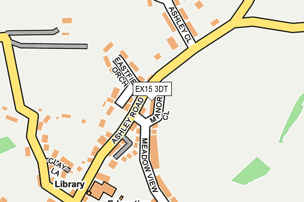
EX15 3DT lies on Manor Close in Uffculme, Cullompton. EX15 3DT is located in the Lower Culm electoral ward, within the local authority district of Mid Devon and the English Parliamentary constituency of Tiverton and Honiton. The Sub Integrated Care Board (ICB) Location is NHS Devon ICB - 15N and the police force is Devon & Cornwall. This postcode has been in use since January 1991.


GetTheData
Source: OS OpenMap – Local (Ordnance Survey)
Source: OS VectorMap District (Ordnance Survey)
Licence: Open Government Licence (requires attribution)
| Easting | 307003 |
| Northing | 113069 |
| Latitude | 50.909565 |
| Longitude | -3.324117 |
GetTheData
Source: Open Postcode Geo
Licence: Open Government Licence
| Street | Manor Close |
| Locality | Uffculme |
| Town/City | Cullompton |
| Country | England |
| Postcode District | EX15 |
➜ See where EX15 is on a map ➜ Where is Uffculme? | |
GetTheData
Source: Land Registry Price Paid Data
Licence: Open Government Licence
Elevation or altitude of EX15 3DT as distance above sea level:
| Metres | Feet | |
|---|---|---|
| Elevation | 100m | 328ft |
Elevation is measured from the approximate centre of the postcode, to the nearest point on an OS contour line from OS Terrain 50, which has contour spacing of ten vertical metres.
➜ How high above sea level am I? Find the elevation of your current position using your device's GPS.
GetTheData
Source: Open Postcode Elevation
Licence: Open Government Licence
| Ward | Lower Culm |
| Constituency | Tiverton And Honiton |
GetTheData
Source: ONS Postcode Database
Licence: Open Government Licence
2023 31 OCT £299,250 |
2018 21 FEB £310,000 |
2016 10 AUG £260,000 |
2015 5 JUN £265,000 |
2014 18 AUG £250,000 |
2008 7 MAY £240,000 |
2002 25 NOV £167,500 |
1999 12 NOV £94,000 |
1999 4 NOV £84,000 |
9, MANOR CLOSE, UFFCULME, CULLOMPTON, EX15 3DT 1997 1 JUL £79,950 |
GetTheData
Source: HM Land Registry Price Paid Data
Licence: Contains HM Land Registry data © Crown copyright and database right 2025. This data is licensed under the Open Government Licence v3.0.
| Ashley Close (Ashley Road) | Uffculme | 109m |
| Ashley Close (Ashley Road) | Uffculme | 111m |
| Square (The Square) | Uffculme | 434m |
| Ostler Inn (Commercial Road) | Uffculme | 490m |
| Ostler Inn (Commercial Road) | Uffculme | 499m |
| Tiverton Parkway Station | 2.6km |
GetTheData
Source: NaPTAN
Licence: Open Government Licence
| Percentage of properties with Next Generation Access | 100.0% |
| Percentage of properties with Superfast Broadband | 100.0% |
| Percentage of properties with Ultrafast Broadband | 0.0% |
| Percentage of properties with Full Fibre Broadband | 0.0% |
Superfast Broadband is between 30Mbps and 300Mbps
Ultrafast Broadband is > 300Mbps
| Median download speed | 55.0Mbps |
| Average download speed | 46.3Mbps |
| Maximum download speed | 68.84Mbps |
| Median upload speed | 8.2Mbps |
| Average upload speed | 7.1Mbps |
| Maximum upload speed | 9.83Mbps |
| Percentage of properties unable to receive 2Mbps | 0.0% |
| Percentage of properties unable to receive 5Mbps | 0.0% |
| Percentage of properties unable to receive 10Mbps | 0.0% |
| Percentage of properties unable to receive 30Mbps | 0.0% |
GetTheData
Source: Ofcom
Licence: Ofcom Terms of Use (requires attribution)
GetTheData
Source: ONS Postcode Database
Licence: Open Government Licence


➜ Get more ratings from the Food Standards Agency
GetTheData
Source: Food Standards Agency
Licence: FSA terms & conditions
| Last Collection | |||
|---|---|---|---|
| Location | Mon-Fri | Sat | Distance |
| Tiverton Parkway | 10:00 | 10:00 | 2,642m |
| Ayshford | 09:00 | 07:00 | 2,984m |
| Croyle | 16:30 | 11:00 | 3,606m |
GetTheData
Source: Dracos
Licence: Creative Commons Attribution-ShareAlike
The below table lists the International Territorial Level (ITL) codes (formerly Nomenclature of Territorial Units for Statistics (NUTS) codes) and Local Administrative Units (LAU) codes for EX15 3DT:
| ITL 1 Code | Name |
|---|---|
| TLK | South West (England) |
| ITL 2 Code | Name |
| TLK4 | Devon |
| ITL 3 Code | Name |
| TLK43 | Devon CC |
| LAU 1 Code | Name |
| E07000042 | Mid Devon |
GetTheData
Source: ONS Postcode Directory
Licence: Open Government Licence
The below table lists the Census Output Area (OA), Lower Layer Super Output Area (LSOA), and Middle Layer Super Output Area (MSOA) for EX15 3DT:
| Code | Name | |
|---|---|---|
| OA | E00101577 | |
| LSOA | E01020063 | Mid Devon 003A |
| MSOA | E02004166 | Mid Devon 003 |
GetTheData
Source: ONS Postcode Directory
Licence: Open Government Licence
| EX15 3PB | The Spinney | 78m |
| EX15 3AS | Eastfield Orchard | 81m |
| EX15 3AY | Ashley Road | 102m |
| EX15 3DS | Meadow View | 152m |
| EX15 3BW | Ashley Close | 174m |
| EX15 3FE | Clay Court | 212m |
| EX15 3AH | Ashley Road | 257m |
| EX15 3AJ | Clay Lane | 259m |
| EX15 3AL | East Street | 270m |
| EX15 3AT | 278m |
GetTheData
Source: Open Postcode Geo; Land Registry Price Paid Data
Licence: Open Government Licence