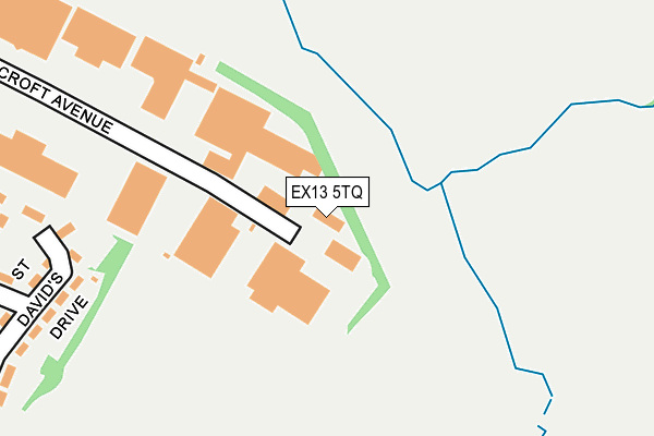
EX13 5TQ is located in the Axminster electoral ward, within the local authority district of East Devon and the English Parliamentary constituency of Tiverton and Honiton. The Sub Integrated Care Board (ICB) Location is NHS Devon ICB - 15N and the police force is Devon & Cornwall. This postcode has been in use since January 2014.


GetTheData
Source: OS OpenMap – Local (Ordnance Survey)
Source: OS VectorMap District (Ordnance Survey)
Licence: Open Government Licence (requires attribution)
| Easting | 331112 |
| Northing | 99310 |
| Latitude | 50.789238 |
| Longitude | -2.978669 |
GetTheData
Source: Open Postcode Geo
Licence: Open Government Licence
| Country | England |
| Postcode District | EX13 |
➜ See where EX13 is on a map ➜ Where is Axminster? | |
GetTheData
Source: Land Registry Price Paid Data
Licence: Open Government Licence
Elevation or altitude of EX13 5TQ as distance above sea level:
| Metres | Feet | |
|---|---|---|
| Elevation | 60m | 197ft |
Elevation is measured from the approximate centre of the postcode, to the nearest point on an OS contour line from OS Terrain 50, which has contour spacing of ten vertical metres.
➜ How high above sea level am I? Find the elevation of your current position using your device's GPS.
GetTheData
Source: Open Postcode Elevation
Licence: Open Government Licence
| Ward | Axminster |
| Constituency | Tiverton And Honiton |
GetTheData
Source: ONS Postcode Database
Licence: Open Government Licence
| Heal's Field (Second Avenue) | Axminster | 426m |
| Heal's Field (Second Avenue) | Axminster | 428m |
| Huntley Close (First Avenue) | Axminster | 524m |
| Huntley Close (First Avenue) | Axminster | 532m |
| Millwey Court (Second Avenue) | Axminster | 563m |
| Axminster Station | 2.1km |
GetTheData
Source: NaPTAN
Licence: Open Government Licence
GetTheData
Source: ONS Postcode Database
Licence: Open Government Licence


➜ Get more ratings from the Food Standards Agency
GetTheData
Source: Food Standards Agency
Licence: FSA terms & conditions
| Last Collection | |||
|---|---|---|---|
| Location | Mon-Fri | Sat | Distance |
| Weycroft | 13:00 | 12:45 | 725m |
| Coles Lane | 12:00 | 12:00 | 1,174m |
| Lyme Road | 17:15 | 12:30 | 1,306m |
GetTheData
Source: Dracos
Licence: Creative Commons Attribution-ShareAlike
The below table lists the International Territorial Level (ITL) codes (formerly Nomenclature of Territorial Units for Statistics (NUTS) codes) and Local Administrative Units (LAU) codes for EX13 5TQ:
| ITL 1 Code | Name |
|---|---|
| TLK | South West (England) |
| ITL 2 Code | Name |
| TLK4 | Devon |
| ITL 3 Code | Name |
| TLK43 | Devon CC |
| LAU 1 Code | Name |
| E07000040 | East Devon |
GetTheData
Source: ONS Postcode Directory
Licence: Open Government Licence
The below table lists the Census Output Area (OA), Lower Layer Super Output Area (LSOA), and Middle Layer Super Output Area (MSOA) for EX13 5TQ:
| Code | Name | |
|---|---|---|
| OA | E00100630 | |
| LSOA | E01019886 | East Devon 005A |
| MSOA | E02004133 | East Devon 005 |
GetTheData
Source: ONS Postcode Directory
Licence: Open Government Licence
| EX13 5HG | St Davids Close | 268m |
| EX13 5HF | St Davids Drive | 275m |
| EX13 5HB | St Andrews Drive | 336m |
| EX13 5HA | St Andrews Drive | 341m |
| EX13 5HD | St Andrews Drive | 391m |
| EX13 5HE | Cunningham Avenue | 393m |
| EX13 5HQ | St Andrews Drive | 400m |
| EX13 5EZ | St Andrews Drive | 411m |
| EX13 5HH | Second Avenue | 418m |
| EX13 5ER | St Georges Avenue | 428m |
GetTheData
Source: Open Postcode Geo; Land Registry Price Paid Data
Licence: Open Government Licence