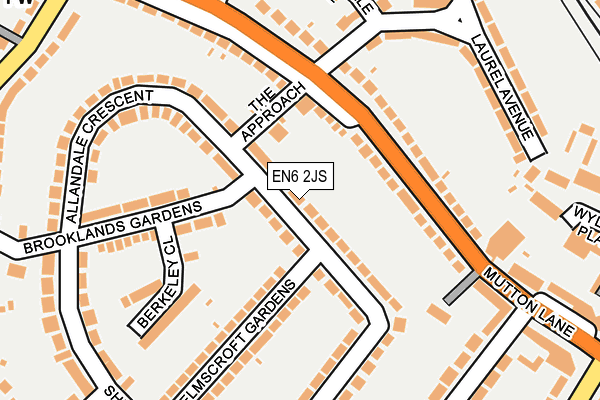
EN6 2JS lies on Aberdale Gardens in Potters Bar. EN6 2JS is located in the Bentley Heath & The Royds electoral ward, within the local authority district of Hertsmere and the English Parliamentary constituency of Hertsmere. The Sub Integrated Care Board (ICB) Location is NHS Hertfordshire and West Essex ICB - 06N and the police force is Hertfordshire. This postcode has been in use since January 1980.


GetTheData
Source: OS OpenMap – Local (Ordnance Survey)
Source: OS VectorMap District (Ordnance Survey)
Licence: Open Government Licence (requires attribution)
| Easting | 524639 |
| Northing | 201295 |
| Latitude | 51.696573 |
| Longitude | -0.197994 |
GetTheData
Source: Open Postcode Geo
Licence: Open Government Licence
| Street | Aberdale Gardens |
| Town/City | Potters Bar |
| Country | England |
| Postcode District | EN6 |
➜ See where EN6 is on a map ➜ Where is Potters Bar? | |
GetTheData
Source: Land Registry Price Paid Data
Licence: Open Government Licence
Elevation or altitude of EN6 2JS as distance above sea level:
| Metres | Feet | |
|---|---|---|
| Elevation | 100m | 328ft |
Elevation is measured from the approximate centre of the postcode, to the nearest point on an OS contour line from OS Terrain 50, which has contour spacing of ten vertical metres.
➜ How high above sea level am I? Find the elevation of your current position using your device's GPS.
GetTheData
Source: Open Postcode Elevation
Licence: Open Government Licence
| Ward | Bentley Heath & The Royds |
| Constituency | Hertsmere |
GetTheData
Source: ONS Postcode Database
Licence: Open Government Licence
| Laurel Avenue (Mutton Lane) | Potters Bar | 122m |
| Laurel Avenue (Mutton Lane) | Potters Bar | 155m |
| Darkes Lane (Mutton Lane) | Potters Bar | 284m |
| Mutton Lane (Dugdale Hill Lane) | Potters Bar | 311m |
| Daleside Drive (Baker Street) | Potters Bar | 354m |
| Potters Bar Station | 0.4km |
| Brookmans Park Station | 2.8km |
| Hadley Wood Station | 3.5km |
GetTheData
Source: NaPTAN
Licence: Open Government Licence
| Percentage of properties with Next Generation Access | 100.0% |
| Percentage of properties with Superfast Broadband | 100.0% |
| Percentage of properties with Ultrafast Broadband | 100.0% |
| Percentage of properties with Full Fibre Broadband | 0.0% |
Superfast Broadband is between 30Mbps and 300Mbps
Ultrafast Broadband is > 300Mbps
| Median download speed | 78.1Mbps |
| Average download speed | 89.8Mbps |
| Maximum download speed | 350.00Mbps |
| Median upload speed | 9.6Mbps |
| Average upload speed | 10.2Mbps |
| Maximum upload speed | 20.00Mbps |
| Percentage of properties unable to receive 2Mbps | 0.0% |
| Percentage of properties unable to receive 5Mbps | 0.0% |
| Percentage of properties unable to receive 10Mbps | 0.0% |
| Percentage of properties unable to receive 30Mbps | 0.0% |
GetTheData
Source: Ofcom
Licence: Ofcom Terms of Use (requires attribution)
Estimated total energy consumption in EN6 2JS by fuel type, 2015.
| Consumption (kWh) | 393,601 |
|---|---|
| Meter count | 23 |
| Mean (kWh/meter) | 17,113 |
| Median (kWh/meter) | 16,630 |
| Consumption (kWh) | 69,046 |
|---|---|
| Meter count | 21 |
| Mean (kWh/meter) | 3,288 |
| Median (kWh/meter) | 3,174 |
GetTheData
Source: Postcode level gas estimates: 2015 (experimental)
Source: Postcode level electricity estimates: 2015 (experimental)
Licence: Open Government Licence
GetTheData
Source: ONS Postcode Database
Licence: Open Government Licence


➜ Get more ratings from the Food Standards Agency
GetTheData
Source: Food Standards Agency
Licence: FSA terms & conditions
| Last Collection | |||
|---|---|---|---|
| Location | Mon-Fri | Sat | Distance |
| Strafford Gate | 17:45 | 12:00 | 694m |
| The Walk | 18:15 | 12:00 | 960m |
| Willow Way | 17:30 | 12:00 | 1,218m |
GetTheData
Source: Dracos
Licence: Creative Commons Attribution-ShareAlike
The below table lists the International Territorial Level (ITL) codes (formerly Nomenclature of Territorial Units for Statistics (NUTS) codes) and Local Administrative Units (LAU) codes for EN6 2JS:
| ITL 1 Code | Name |
|---|---|
| TLH | East |
| ITL 2 Code | Name |
| TLH2 | Bedfordshire and Hertfordshire |
| ITL 3 Code | Name |
| TLH23 | Hertfordshire CC |
| LAU 1 Code | Name |
| E07000098 | Hertsmere |
GetTheData
Source: ONS Postcode Directory
Licence: Open Government Licence
The below table lists the Census Output Area (OA), Lower Layer Super Output Area (LSOA), and Middle Layer Super Output Area (MSOA) for EN6 2JS:
| Code | Name | |
|---|---|---|
| OA | E00119707 | |
| LSOA | E01023568 | Hertsmere 002B |
| MSOA | E02004897 | Hertsmere 002 |
GetTheData
Source: ONS Postcode Directory
Licence: Open Government Licence
| EN6 2JT | The Approach | 69m |
| EN6 2AU | Mutton Lane | 91m |
| EN6 2JW | Aberdale Gardens | 106m |
| EN6 2AT | Mutton Lane | 134m |
| EN6 2JY | Allandale Crescent | 149m |
| EN6 2JP | Elmscroft Gardens | 158m |
| EN6 2JN | Aberdale Gardens | 159m |
| EN6 2LA | Brooklands Gardens | 160m |
| EN6 2JR | Elmscroft Gardens | 169m |
| EN6 2AY | Mutton Lane | 170m |
GetTheData
Source: Open Postcode Geo; Land Registry Price Paid Data
Licence: Open Government Licence