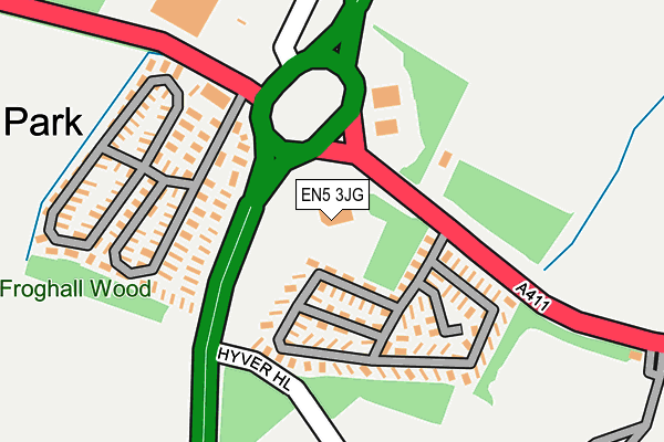
EN5 3JG is located in the High Barnet electoral ward, within the London borough of Barnet and the English Parliamentary constituency of Chipping Barnet. The Sub Integrated Care Board (ICB) Location is NHS North Central London ICB - 93C and the police force is Metropolitan Police. This postcode has been in use since January 1980.


GetTheData
Source: OS OpenMap – Local (Ordnance Survey)
Source: OS VectorMap District (Ordnance Survey)
Licence: Open Government Licence (requires attribution)
| Easting | 520926 |
| Northing | 195262 |
| Latitude | 51.643169 |
| Longitude | -0.253752 |
GetTheData
Source: Open Postcode Geo
Licence: Open Government Licence
| Country | England |
| Postcode District | EN5 |
➜ See where EN5 is on a map ➜ Where is London? | |
GetTheData
Source: Land Registry Price Paid Data
Licence: Open Government Licence
Elevation or altitude of EN5 3JG as distance above sea level:
| Metres | Feet | |
|---|---|---|
| Elevation | 120m | 394ft |
Elevation is measured from the approximate centre of the postcode, to the nearest point on an OS contour line from OS Terrain 50, which has contour spacing of ten vertical metres.
➜ How high above sea level am I? Find the elevation of your current position using your device's GPS.
GetTheData
Source: Open Postcode Elevation
Licence: Open Government Licence
| Ward | High Barnet |
| Constituency | Chipping Barnet |
GetTheData
Source: ONS Postcode Database
Licence: Open Government Licence
| Stirling Corner Barnet Way (Barnet Road) | Barnet Gate | 120m |
| Stirling Corner (Barnet Lane) | Borehamwood | 145m |
| Stirling Corner Barnet Way | Barnet Gate | 183m |
| Stirling Corner (Barnet Lane) | Borehamwood | 240m |
| Dales Path (Farriers Way) | Borehamwood | 343m |
| Elstree & Borehamwood Station | 2.1km |
| Mill Hill Broadway Station | 3.4km |
| Radlett Station | 6.4km |
GetTheData
Source: NaPTAN
Licence: Open Government Licence
GetTheData
Source: ONS Postcode Database
Licence: Open Government Licence


➜ Get more ratings from the Food Standards Agency
GetTheData
Source: Food Standards Agency
Licence: FSA terms & conditions
| Last Collection | |||
|---|---|---|---|
| Location | Mon-Fri | Sat | Distance |
| Arkley Park | 17:30 | 11:45 | 128m |
| Barnet Gate | 17:00 | 11:45 | 850m |
| Eldon Avenue | 18:30 | 11:30 | 881m |
GetTheData
Source: Dracos
Licence: Creative Commons Attribution-ShareAlike
The below table lists the International Territorial Level (ITL) codes (formerly Nomenclature of Territorial Units for Statistics (NUTS) codes) and Local Administrative Units (LAU) codes for EN5 3JG:
| ITL 1 Code | Name |
|---|---|
| TLI | London |
| ITL 2 Code | Name |
| TLI7 | Outer London - West and North West |
| ITL 3 Code | Name |
| TLI71 | Barnet |
| LAU 1 Code | Name |
| E09000003 | Barnet |
GetTheData
Source: ONS Postcode Directory
Licence: Open Government Licence
The below table lists the Census Output Area (OA), Lower Layer Super Output Area (LSOA), and Middle Layer Super Output Area (MSOA) for EN5 3JG:
| Code | Name | |
|---|---|---|
| OA | E00001254 | |
| LSOA | E01000253 | Barnet 007B |
| MSOA | E02000030 | Barnet 007 |
GetTheData
Source: ONS Postcode Directory
Licence: Open Government Licence
| WD6 2RN | Froghall Cottages | 151m |
| WD6 2SX | Shetland Close | 289m |
| WD6 2ST | Saddlers Close | 325m |
| WD6 2SU | Saddlers Path | 334m |
| WD6 2SR | Percheron Road | 360m |
| WD6 2BT | Stirling Way | 367m |
| EN5 3JA | Barnet Gate | 379m |
| WD6 2SG | Dales Road | 380m |
| WD6 2FR | Stirling Way | 393m |
| WD6 2SS | Pinto Close | 394m |
GetTheData
Source: Open Postcode Geo; Land Registry Price Paid Data
Licence: Open Government Licence