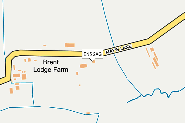
EN5 2AG is located in the Underhill electoral ward, within the London borough of Barnet and the English Parliamentary constituency of Chipping Barnet. The Sub Integrated Care Board (ICB) Location is NHS North Central London ICB - 93C and the police force is Metropolitan Police. This postcode has been in use since January 1980.


GetTheData
Source: OS OpenMap – Local (Ordnance Survey)
Source: OS VectorMap District (Ordnance Survey)
Licence: Open Government Licence (requires attribution)
| Easting | 522680 |
| Northing | 194776 |
| Latitude | 51.638422 |
| Longitude | -0.228585 |
GetTheData
Source: Open Postcode Geo
Licence: Open Government Licence
| Country | England |
| Postcode District | EN5 |
➜ See where EN5 is on a map | |
GetTheData
Source: Land Registry Price Paid Data
Licence: Open Government Licence
Elevation or altitude of EN5 2AG as distance above sea level:
| Metres | Feet | |
|---|---|---|
| Elevation | 100m | 328ft |
Elevation is measured from the approximate centre of the postcode, to the nearest point on an OS contour line from OS Terrain 50, which has contour spacing of ten vertical metres.
➜ How high above sea level am I? Find the elevation of your current position using your device's GPS.
GetTheData
Source: Open Postcode Elevation
Licence: Open Government Licence
| Ward | Underhill |
| Constituency | Chipping Barnet |
GetTheData
Source: ONS Postcode Database
Licence: Open Government Licence
| St Edward's College (Totteridge Common) | Barnet Gate | 834m |
| Ellern Mede (Totteridge Common) | Totteridge | 846m |
| St Edward's College (Totteridge Common) | Barnet Gate | 849m |
| West End House | Barnet Gate | 879m |
| West End House | Barnet Gate | 884m |
| Mill Hill Broadway Station | 3.2km |
| Elstree & Borehamwood Station | 3.9km |
| New Barnet Station | 4km |
GetTheData
Source: NaPTAN
Licence: Open Government Licence
| Percentage of properties with Next Generation Access | 100.0% |
| Percentage of properties with Superfast Broadband | 0.0% |
| Percentage of properties with Ultrafast Broadband | 0.0% |
| Percentage of properties with Full Fibre Broadband | 0.0% |
Superfast Broadband is between 30Mbps and 300Mbps
Ultrafast Broadband is > 300Mbps
| Percentage of properties unable to receive 2Mbps | 0.0% |
| Percentage of properties unable to receive 5Mbps | 0.0% |
| Percentage of properties unable to receive 10Mbps | 0.0% |
| Percentage of properties unable to receive 30Mbps | 100.0% |
GetTheData
Source: Ofcom
Licence: Ofcom Terms of Use (requires attribution)
GetTheData
Source: ONS Postcode Database
Licence: Open Government Licence


➜ Get more ratings from the Food Standards Agency
GetTheData
Source: Food Standards Agency
Licence: FSA terms & conditions
| Last Collection | |||
|---|---|---|---|
| Location | Mon-Fri | Sat | Distance |
| Hendon Wood Lane | 13:00 | 12:00 | 681m |
| St Edwards College | 17:30 | 12:00 | 834m |
| Stanhope Road | 17:30 | 12:00 | 975m |
GetTheData
Source: Dracos
Licence: Creative Commons Attribution-ShareAlike
The below table lists the International Territorial Level (ITL) codes (formerly Nomenclature of Territorial Units for Statistics (NUTS) codes) and Local Administrative Units (LAU) codes for EN5 2AG:
| ITL 1 Code | Name |
|---|---|
| TLI | London |
| ITL 2 Code | Name |
| TLI7 | Outer London - West and North West |
| ITL 3 Code | Name |
| TLI71 | Barnet |
| LAU 1 Code | Name |
| E09000003 | Barnet |
GetTheData
Source: ONS Postcode Directory
Licence: Open Government Licence
The below table lists the Census Output Area (OA), Lower Layer Super Output Area (LSOA), and Middle Layer Super Output Area (MSOA) for EN5 2AG:
| Code | Name | |
|---|---|---|
| OA | E00001423 | |
| LSOA | E01000290 | Barnet 007F |
| MSOA | E02000030 | Barnet 007 |
GetTheData
Source: ONS Postcode Directory
Licence: Open Government Licence
| EN5 2AY | Althorp Close | 482m |
| EN5 2AX | Barnet Gate Lane | 505m |
| NW7 4HR | Hendon Wood Lane | 628m |
| EN5 2AD | Barnet Gate Lane | 673m |
| EN5 2DT | Partridge Close | 766m |
| EN5 3JL | Wylo Drive | 784m |
| N20 8ND | Totteridge Common | 784m |
| EN5 2AH | Mays Lane | 789m |
| NW7 4HS | Hendon Wood Lane | 814m |
| EN5 3JJ | Rockways | 838m |
GetTheData
Source: Open Postcode Geo; Land Registry Price Paid Data
Licence: Open Government Licence