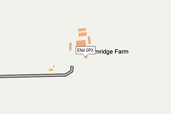
EN4 0PX is located in the Cockfosters electoral ward, within the London borough of Enfield and the English Parliamentary constituency of Enfield, Southgate. The Sub Integrated Care Board (ICB) Location is NHS North Central London ICB - 93C and the police force is Metropolitan Police. This postcode has been in use since January 1980.


GetTheData
Source: OS OpenMap – Local (Ordnance Survey)
Source: OS VectorMap District (Ordnance Survey)
Licence: Open Government Licence (requires attribution)
| Easting | 527676 |
| Northing | 199035 |
| Latitude | 51.675582 |
| Longitude | -0.154901 |
GetTheData
Source: Open Postcode Geo
Licence: Open Government Licence
| Country | England |
| Postcode District | EN4 |
➜ See where EN4 is on a map | |
GetTheData
Source: Land Registry Price Paid Data
Licence: Open Government Licence
Elevation or altitude of EN4 0PX as distance above sea level:
| Metres | Feet | |
|---|---|---|
| Elevation | 70m | 230ft |
Elevation is measured from the approximate centre of the postcode, to the nearest point on an OS contour line from OS Terrain 50, which has contour spacing of ten vertical metres.
➜ How high above sea level am I? Find the elevation of your current position using your device's GPS.
GetTheData
Source: Open Postcode Elevation
Licence: Open Government Licence
| Ward | Cockfosters |
| Constituency | Enfield, Southgate |
GetTheData
Source: ONS Postcode Database
Licence: Open Government Licence
| Slopers Pond Farm | Hadley Wood | 534m |
| Slopers Pond Farm | Hadley Wood | 535m |
| Waggon Road | Hadley Wood | 593m |
| Waggon Road | Hadley Wood | 630m |
| St John's Senior School | Botany Bay | 756m |
| Hadley Wood Station | 1.7km |
| New Barnet Station | 3.3km |
| Crews Hill Station | 3.5km |
GetTheData
Source: NaPTAN
Licence: Open Government Licence
GetTheData
Source: ONS Postcode Database
Licence: Open Government Licence


➜ Get more ratings from the Food Standards Agency
GetTheData
Source: Food Standards Agency
Licence: FSA terms & conditions
| Last Collection | |||
|---|---|---|---|
| Location | Mon-Fri | Sat | Distance |
| Waggon Road | 17:30 | 12:00 | 628m |
| Waggon Road | 17:30 | 12:00 | 1,299m |
| Hill Rise | 17:30 | 11:45 | 1,937m |
GetTheData
Source: Dracos
Licence: Creative Commons Attribution-ShareAlike
The below table lists the International Territorial Level (ITL) codes (formerly Nomenclature of Territorial Units for Statistics (NUTS) codes) and Local Administrative Units (LAU) codes for EN4 0PX:
| ITL 1 Code | Name |
|---|---|
| TLI | London |
| ITL 2 Code | Name |
| TLI5 | Outer London - East and North East |
| ITL 3 Code | Name |
| TLI54 | Enfield |
| LAU 1 Code | Name |
| E09000010 | Enfield |
GetTheData
Source: ONS Postcode Directory
Licence: Open Government Licence
The below table lists the Census Output Area (OA), Lower Layer Super Output Area (LSOA), and Middle Layer Super Output Area (MSOA) for EN4 0PX:
| Code | Name | |
|---|---|---|
| OA | E00171166 | |
| LSOA | E01001417 | Enfield 011B |
| MSOA | E02000287 | Enfield 011 |
GetTheData
Source: ONS Postcode Directory
Licence: Open Government Licence
| EN4 0PU | Cockfosters Road | 632m |
| EN4 0HJ | Cockfosters Road | 673m |
| EN4 0HB | Sandridge Close | 710m |
| EN4 0HE | Warner Close | 753m |
| EN4 0HL | Waggon Road | 806m |
| EN2 8AE | The Ridgeway | 812m |
| EN2 8AF | The Ridgeway | 822m |
| EN4 0HH | Cockfosters Road | 848m |
| EN4 0ES | Lancaster Avenue | 895m |
| EN4 0EU | Lancaster Avenue | 904m |
GetTheData
Source: Open Postcode Geo; Land Registry Price Paid Data
Licence: Open Government Licence