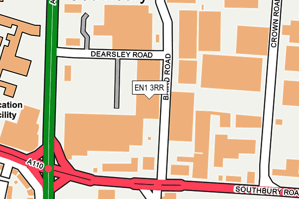
EN1 3RR is located in the Carterhatch electoral ward, within the London borough of Enfield and the English Parliamentary constituency of Enfield North. The Sub Integrated Care Board (ICB) Location is NHS North Central London ICB - 93C and the police force is Metropolitan Police. This postcode has been in use since June 1997.


GetTheData
Source: OS OpenMap – Local (Ordnance Survey)
Source: OS VectorMap District (Ordnance Survey)
Licence: Open Government Licence (requires attribution)
| Easting | 534462 |
| Northing | 196412 |
| Latitude | 51.650432 |
| Longitude | -0.057800 |
GetTheData
Source: Open Postcode Geo
Licence: Open Government Licence
| Country | England |
| Postcode District | EN1 |
➜ See where EN1 is on a map ➜ Where is London? | |
GetTheData
Source: Land Registry Price Paid Data
Licence: Open Government Licence
Elevation or altitude of EN1 3RR as distance above sea level:
| Metres | Feet | |
|---|---|---|
| Elevation | 20m | 66ft |
Elevation is measured from the approximate centre of the postcode, to the nearest point on an OS contour line from OS Terrain 50, which has contour spacing of ten vertical metres.
➜ How high above sea level am I? Find the elevation of your current position using your device's GPS.
GetTheData
Source: Open Postcode Elevation
Licence: Open Government Licence
| Ward | Carterhatch |
| Constituency | Enfield North |
GetTheData
Source: ONS Postcode Database
Licence: Open Government Licence
| Dearsley Road (Baird Road) | Enfield | 79m |
| Dearsley Road (Baird Road) | Enfield | 86m |
| Baird Road | Enfield | 133m |
| Baird Road | Enfield | 151m |
| Southbury Rd Gt Cambridge Rd (Great Cambridge Road) | Enfield | 179m |
| Southbury Station | 0.4km |
| Bush Hill Park Station | 1.3km |
| Enfield Town Station | 1.5km |
GetTheData
Source: NaPTAN
Licence: Open Government Licence
GetTheData
Source: ONS Postcode Database
Licence: Open Government Licence


➜ Get more ratings from the Food Standards Agency
GetTheData
Source: Food Standards Agency
Licence: FSA terms & conditions
| Last Collection | |||
|---|---|---|---|
| Location | Mon-Fri | Sat | Distance |
| Baird Way | 133m | ||
| Cuckoo Hall Lane/Turin Road | 17:30 | 12:00 | 242m |
| Great Cambridge Road P.o. | 17:30 | 12:00 | 554m |
GetTheData
Source: Dracos
Licence: Creative Commons Attribution-ShareAlike
The below table lists the International Territorial Level (ITL) codes (formerly Nomenclature of Territorial Units for Statistics (NUTS) codes) and Local Administrative Units (LAU) codes for EN1 3RR:
| ITL 1 Code | Name |
|---|---|
| TLI | London |
| ITL 2 Code | Name |
| TLI5 | Outer London - East and North East |
| ITL 3 Code | Name |
| TLI54 | Enfield |
| LAU 1 Code | Name |
| E09000010 | Enfield |
GetTheData
Source: ONS Postcode Directory
Licence: Open Government Licence
The below table lists the Census Output Area (OA), Lower Layer Super Output Area (LSOA), and Middle Layer Super Output Area (MSOA) for EN1 3RR:
| Code | Name | |
|---|---|---|
| OA | E00007499 | |
| LSOA | E01001513 | Enfield 012F |
| MSOA | E02000288 | Enfield 012 |
GetTheData
Source: ONS Postcode Directory
Licence: Open Government Licence
| EN1 1TR | Southbury Road | 111m |
| EN1 1TS | Southbury Road | 155m |
| EN1 1RQ | Southbury Road | 251m |
| EN1 1RG | Southbury Road | 316m |
| EN1 1RJ | Southbury Avenue | 333m |
| EN1 1TH | Crown Road | 344m |
| EN1 1SQ | Great Cambridge Road | 349m |
| EN1 1RN | Southbury Avenue | 360m |
| EN1 1RF | Clive Road | 399m |
| EN1 1QZ | Southbury Road | 404m |
GetTheData
Source: Open Postcode Geo; Land Registry Price Paid Data
Licence: Open Government Licence