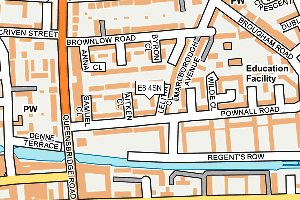
E8 4SN lies on Lelitia Close in London. E8 4SN is located in the Haggerston electoral ward, within the London borough of Hackney and the English Parliamentary constituency of Hackney South and Shoreditch. The Sub Integrated Care Board (ICB) Location is NHS North East London ICB - A3A8R and the police force is Metropolitan Police. This postcode has been in use since March 1983.


GetTheData
Source: OS OpenMap – Local (Ordnance Survey)
Source: OS VectorMap District (Ordnance Survey)
Licence: Open Government Licence (requires attribution)
| Easting | 534103 |
| Northing | 183761 |
| Latitude | 51.536831 |
| Longitude | -0.067844 |
GetTheData
Source: Open Postcode Geo
Licence: Open Government Licence
| Street | Lelitia Close |
| Town/City | London |
| Country | England |
| Postcode District | E8 |
➜ See where E8 is on a map ➜ Where is London? | |
GetTheData
Source: Land Registry Price Paid Data
Licence: Open Government Licence
Elevation or altitude of E8 4SN as distance above sea level:
| Metres | Feet | |
|---|---|---|
| Elevation | 20m | 66ft |
Elevation is measured from the approximate centre of the postcode, to the nearest point on an OS contour line from OS Terrain 50, which has contour spacing of ten vertical metres.
➜ How high above sea level am I? Find the elevation of your current position using your device's GPS.
GetTheData
Source: Open Postcode Elevation
Licence: Open Government Licence
| Ward | Haggerston |
| Constituency | Hackney South And Shoreditch |
GetTheData
Source: ONS Postcode Database
Licence: Open Government Licence
| Pownall Road Regents Court (Pownall Road) | Haggerston | 94m |
| Pownall Road Laxfield Court (Pownall Road) | Haggerston | 161m |
| Regents Court (Pownall Road) | Haggerston | 162m |
| Brownlow Road (E8) (Queensbridge Road) | Haggerston | 197m |
| Laxfield Court (Pownall Road) | Haggerston | 198m |
| Bethnal Green Underground Station | Bethnal Green | 1,370m |
| Old Street Underground Station | Old Street | 1,844m |
| Haggerston Station | 0.6km |
| Hoxton Station | 0.8km |
| London Fields Station | 0.8km |
GetTheData
Source: NaPTAN
Licence: Open Government Licence
| Percentage of properties with Next Generation Access | 100.0% |
| Percentage of properties with Superfast Broadband | 100.0% |
| Percentage of properties with Ultrafast Broadband | 100.0% |
| Percentage of properties with Full Fibre Broadband | 0.0% |
Superfast Broadband is between 30Mbps and 300Mbps
Ultrafast Broadband is > 300Mbps
| Percentage of properties unable to receive 2Mbps | 0.0% |
| Percentage of properties unable to receive 5Mbps | 0.0% |
| Percentage of properties unable to receive 10Mbps | 0.0% |
| Percentage of properties unable to receive 30Mbps | 0.0% |
GetTheData
Source: Ofcom
Licence: Ofcom Terms of Use (requires attribution)
Estimated total energy consumption in E8 4SN by fuel type, 2015.
| Consumption (kWh) | 41,628 |
|---|---|
| Meter count | 6 |
| Mean (kWh/meter) | 6,938 |
| Median (kWh/meter) | 6,408 |
GetTheData
Source: Postcode level gas estimates: 2015 (experimental)
Source: Postcode level electricity estimates: 2015 (experimental)
Licence: Open Government Licence
GetTheData
Source: ONS Postcode Database
Licence: Open Government Licence


➜ Get more ratings from the Food Standards Agency
GetTheData
Source: Food Standards Agency
Licence: FSA terms & conditions
| Last Collection | |||
|---|---|---|---|
| Location | Mon-Fri | Sat | Distance |
| Pownall Road | 18:30 | 11:30 | 200m |
| Queensbridge Road | 18:30 | 11:30 | 205m |
| Shrubland Road | 18:30 | 11:30 | 260m |
GetTheData
Source: Dracos
Licence: Creative Commons Attribution-ShareAlike
The below table lists the International Territorial Level (ITL) codes (formerly Nomenclature of Territorial Units for Statistics (NUTS) codes) and Local Administrative Units (LAU) codes for E8 4SN:
| ITL 1 Code | Name |
|---|---|
| TLI | London |
| ITL 2 Code | Name |
| TLI4 | Inner London - East |
| ITL 3 Code | Name |
| TLI41 | Hackney and Newham |
| LAU 1 Code | Name |
| E09000012 | Hackney |
GetTheData
Source: ONS Postcode Directory
Licence: Open Government Licence
The below table lists the Census Output Area (OA), Lower Layer Super Output Area (LSOA), and Middle Layer Super Output Area (MSOA) for E8 4SN:
| Code | Name | |
|---|---|---|
| OA | E00009045 | |
| LSOA | E01001820 | Hackney 024E |
| MSOA | E02000368 | Hackney 024 |
GetTheData
Source: ONS Postcode Directory
Licence: Open Government Licence
| E8 4JR | Marlborough Avenue | 37m |
| E8 4SJ | Broke Walk | 57m |
| E8 4SQ | Aitken Close | 64m |
| E8 4SW | Rochemont Walk | 66m |
| E8 4JZ | Osborn Close | 66m |
| E8 4QA | Pownall Road | 70m |
| E8 4SL | Marlborough Avenue | 70m |
| E8 4SH | Broke Walk | 73m |
| E8 4NT | Byron Close | 88m |
| E8 4PZ | Pownall Road | 96m |
GetTheData
Source: Open Postcode Geo; Land Registry Price Paid Data
Licence: Open Government Licence