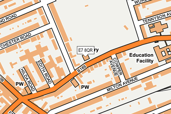
E7 8QR is located in the Plashet electoral ward, within the London borough of Newham and the English Parliamentary constituency of East Ham. The Sub Integrated Care Board (ICB) Location is NHS North East London ICB - A3A8R and the police force is Metropolitan Police. This postcode has been in use since January 2006.


GetTheData
Source: OS OpenMap – Local (Ordnance Survey)
Source: OS VectorMap District (Ordnance Survey)
Licence: Open Government Licence (requires attribution)
| Easting | 541945 |
| Northing | 184281 |
| Latitude | 51.539588 |
| Longitude | 0.045360 |
GetTheData
Source: Open Postcode Geo
Licence: Open Government Licence
| Country | England |
| Postcode District | E7 |
➜ See where E7 is on a map ➜ Where is London? | |
GetTheData
Source: Land Registry Price Paid Data
Licence: Open Government Licence
Elevation or altitude of E7 8QR as distance above sea level:
| Metres | Feet | |
|---|---|---|
| Elevation | 10m | 33ft |
Elevation is measured from the approximate centre of the postcode, to the nearest point on an OS contour line from OS Terrain 50, which has contour spacing of ten vertical metres.
➜ How high above sea level am I? Find the elevation of your current position using your device's GPS.
GetTheData
Source: Open Postcode Elevation
Licence: Open Government Licence
| Ward | Plashet |
| Constituency | East Ham |
GetTheData
Source: ONS Postcode Database
Licence: Open Government Licence
| Shrewsbury Road Plashet Grove (Plashet Grove) | Plashet | 27m |
| Shrewsbury Road Plashet Grove (Plashet Grove) | Plashet | 86m |
| Plashet School | Plashet | 174m |
| Katherine Road Plashet (Plashet Grove) | Plashet | 213m |
| St Stephen's Road | Upton Park | 304m |
| East Ham Underground Station | East Ham | 410m |
| Upton Park Underground Station | Upton Park | 845m |
| Woodgrange Park Station | 1.1km |
| Manor Park Station | 1.4km |
| Forest Gate Station | 1.8km |
GetTheData
Source: NaPTAN
Licence: Open Government Licence
GetTheData
Source: ONS Postcode Database
Licence: Open Government Licence


➜ Get more ratings from the Food Standards Agency
GetTheData
Source: Food Standards Agency
Licence: FSA terms & conditions
| Last Collection | |||
|---|---|---|---|
| Location | Mon-Fri | Sat | Distance |
| Shrewsbury Road | 17:30 | 11:30 | 95m |
| Milton Avenue | 17:30 | 11:30 | 174m |
| Rutland Road | 17:30 | 11:30 | 233m |
GetTheData
Source: Dracos
Licence: Creative Commons Attribution-ShareAlike
The below table lists the International Territorial Level (ITL) codes (formerly Nomenclature of Territorial Units for Statistics (NUTS) codes) and Local Administrative Units (LAU) codes for E7 8QR:
| ITL 1 Code | Name |
|---|---|
| TLI | London |
| ITL 2 Code | Name |
| TLI4 | Inner London - East |
| ITL 3 Code | Name |
| TLI41 | Hackney and Newham |
| LAU 1 Code | Name |
| E09000025 | Newham |
GetTheData
Source: ONS Postcode Directory
Licence: Open Government Licence
The below table lists the Census Output Area (OA), Lower Layer Super Output Area (LSOA), and Middle Layer Super Output Area (MSOA) for E7 8QR:
| Code | Name | |
|---|---|---|
| OA | E00017843 | |
| LSOA | E01003531 | Newham 010C |
| MSOA | E02000723 | Newham 010 |
GetTheData
Source: ONS Postcode Directory
Licence: Open Government Licence
| E6 1DQ | Plashet Grove | 68m |
| E7 8QU | Shrewsbury Road | 108m |
| E6 1BJ | Cowper Avenue | 122m |
| E6 1BL | Milton Avenue | 142m |
| E6 1BN | Milton Avenue | 158m |
| E6 1DA | Plashet Grove | 160m |
| E6 1DE | Edith Road | 170m |
| E6 1BX | Plashet Grove | 189m |
| E6 1DB | Hilda Road | 207m |
| E7 8QP | Shrewsbury Road | 207m |
GetTheData
Source: Open Postcode Geo; Land Registry Price Paid Data
Licence: Open Government Licence