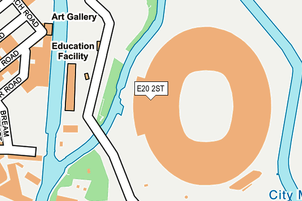
E20 2ST is located in the Stratford Olympic Park electoral ward, within the London borough of Newham and the English Parliamentary constituency of West Ham. The Sub Integrated Care Board (ICB) Location is NHS North East London ICB - A3A8R and the police force is Metropolitan Police. This postcode has been in use since May 2011.


GetTheData
Source: OS OpenMap – Local (Ordnance Survey)
Source: OS VectorMap District (Ordnance Survey)
Licence: Open Government Licence (requires attribution)
| Easting | 537663 |
| Northing | 184057 |
| Latitude | 51.538636 |
| Longitude | -0.016403 |
GetTheData
Source: Open Postcode Geo
Licence: Open Government Licence
| Country | England |
| Postcode District | E20 |
➜ Where is London? | |
GetTheData
Source: Land Registry Price Paid Data
Licence: Open Government Licence
Elevation or altitude of E20 2ST as distance above sea level:
| Metres | Feet | |
|---|---|---|
| Elevation | 10m | 33ft |
Elevation is measured from the approximate centre of the postcode, to the nearest point on an OS contour line from OS Terrain 50, which has contour spacing of ten vertical metres.
➜ How high above sea level am I? Find the elevation of your current position using your device's GPS.
GetTheData
Source: Open Postcode Elevation
Licence: Open Government Licence
| Ward | Stratford Olympic Park |
| Constituency | West Ham |
GetTheData
Source: ONS Postcode Database
Licence: Open Government Licence
| Carpenters Road | Stratford | 437m |
| Kings Yard | Hackney Wick | 496m |
| Kings Yard | Hackney Wick | 498m |
| Carpenters Road | Stratford | 505m |
| Fish Island (Wick Lane) | Old Ford | 524m |
| Pudding Mill Lane Dlr Station (Pudding Mill Lane) | Pudding Mill Lane | 545m |
| Stratford International Dlr Station | Stratford | 875m |
| Stratford Underground Station | Stratford | 967m |
| Stratford Dlr Station (Station Street) | Stratford | 976m |
| Stratford High Street Dlr Station | Stratford | 1,066m |
| Hackney Wick Station | 0.8km |
| Stratford International Station | 0.9km |
| Stratford (London) Station | 1km |
GetTheData
Source: NaPTAN
Licence: Open Government Licence
GetTheData
Source: ONS Postcode Database
Licence: Open Government Licence


➜ Get more ratings from the Food Standards Agency
GetTheData
Source: Food Standards Agency
Licence: FSA terms & conditions
| Last Collection | |||
|---|---|---|---|
| Location | Mon-Fri | Sat | Distance |
| Monier Road | 17:30 | 11:30 | 529m |
| Wick Lane | 17:30 | 11:30 | 558m |
| Dace Road | 17:30 | 592m | |
GetTheData
Source: Dracos
Licence: Creative Commons Attribution-ShareAlike
The below table lists the International Territorial Level (ITL) codes (formerly Nomenclature of Territorial Units for Statistics (NUTS) codes) and Local Administrative Units (LAU) codes for E20 2ST:
| ITL 1 Code | Name |
|---|---|
| TLI | London |
| ITL 2 Code | Name |
| TLI4 | Inner London - East |
| ITL 3 Code | Name |
| TLI41 | Hackney and Newham |
| LAU 1 Code | Name |
| E09000025 | Newham |
GetTheData
Source: ONS Postcode Directory
Licence: Open Government Licence
The below table lists the Census Output Area (OA), Lower Layer Super Output Area (LSOA), and Middle Layer Super Output Area (MSOA) for E20 2ST:
| Code | Name | |
|---|---|---|
| OA | E00175067 | |
| LSOA | E01033578 | Newham 013E |
| MSOA | E02000726 | Newham 013 |
GetTheData
Source: ONS Postcode Directory
Licence: Open Government Licence
| E3 2NW | Dace Road | 334m |
| E3 2PA | Roach Road | 375m |
| E3 2GY | Roach Road | 406m |
| E3 2GZ | Roach Road | 406m |
| E3 2LX | Roach Road | 406m |
| E3 2NY | Roach Road | 406m |
| E3 2NZ | Roach Road | 406m |
| E3 2NX | Dace Road | 424m |
| E3 2TT | Autumn Street | 444m |
| E3 2PS | Monier Road | 458m |
GetTheData
Source: Open Postcode Geo; Land Registry Price Paid Data
Licence: Open Government Licence