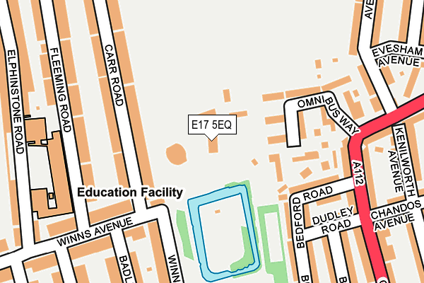
E17 5EQ is located in the Chapel End electoral ward, within the London borough of Waltham Forest and the English Parliamentary constituency of Walthamstow. The Sub Integrated Care Board (ICB) Location is NHS North East London ICB - A3A8R and the police force is Metropolitan Police. This postcode has been in use since July 2020.


GetTheData
Source: OS OpenMap – Local (Ordnance Survey)
Source: OS VectorMap District (Ordnance Survey)
Licence: Open Government Licence (requires attribution)
| Easting | 537166 |
| Northing | 190156 |
| Latitude | 51.593562 |
| Longitude | -0.021188 |
GetTheData
Source: Open Postcode Geo
Licence: Open Government Licence
| Country | England |
| Postcode District | E17 |
➜ See where E17 is on a map ➜ Where is Walthamstow? | |
GetTheData
Source: Land Registry Price Paid Data
Licence: Open Government Licence
Elevation or altitude of E17 5EQ as distance above sea level:
| Metres | Feet | |
|---|---|---|
| Elevation | 20m | 66ft |
Elevation is measured from the approximate centre of the postcode, to the nearest point on an OS contour line from OS Terrain 50, which has contour spacing of ten vertical metres.
➜ How high above sea level am I? Find the elevation of your current position using your device's GPS.
GetTheData
Source: Open Postcode Elevation
Licence: Open Government Licence
| Ward | Chapel End |
| Constituency | Walthamstow |
GetTheData
Source: ONS Postcode Database
Licence: Open Government Licence
| Aveling Park Road (Chingford Road) | Walthamstow | 260m |
| Lloyd Park William Morris Gallery (Forest Road) | Walthamstow | 300m |
| Aveling Park Road (Chingford Road) | Walthamstow | 305m |
| Lloyd Park William Morris Gallery (Forest Road) | Walthamstow | 351m |
| Bromley Road (E17) (Forest Road) | Walthamstow | 380m |
| Walthamstow Central Underground Station | Walthamstow Central | 1,183m |
| Blackhorse Road Underground Station | Blackhorse Road | 1,567m |
| Walthamstow Central Station | 1.2km |
| Walthamstow Queens Road Station | 1.4km |
| Wood Street Station | 1.5km |
GetTheData
Source: NaPTAN
Licence: Open Government Licence
GetTheData
Source: ONS Postcode Database
Licence: Open Government Licence


➜ Get more ratings from the Food Standards Agency
GetTheData
Source: Food Standards Agency
Licence: FSA terms & conditions
| Last Collection | |||
|---|---|---|---|
| Location | Mon-Fri | Sat | Distance |
| Winns Avenue | 17:30 | 11:30 | 149m |
| Chingford Road | 17:30 | 11:30 | 220m |
| 143 Carr Road E17 | 18:30 | 12:00 | 337m |
GetTheData
Source: Dracos
Licence: Creative Commons Attribution-ShareAlike
The below table lists the International Territorial Level (ITL) codes (formerly Nomenclature of Territorial Units for Statistics (NUTS) codes) and Local Administrative Units (LAU) codes for E17 5EQ:
| ITL 1 Code | Name |
|---|---|
| TLI | London |
| ITL 2 Code | Name |
| TLI5 | Outer London - East and North East |
| ITL 3 Code | Name |
| TLI53 | Redbridge and Waltham Forest |
| LAU 1 Code | Name |
| E09000031 | Waltham Forest |
GetTheData
Source: ONS Postcode Directory
Licence: Open Government Licence
The below table lists the Census Output Area (OA), Lower Layer Super Output Area (LSOA), and Middle Layer Super Output Area (MSOA) for E17 5EQ:
| Code | Name | |
|---|---|---|
| OA | E00021865 | |
| LSOA | E01004347 | Waltham Forest 011C |
| MSOA | E02000905 | Waltham Forest 011 |
GetTheData
Source: ONS Postcode Directory
Licence: Open Government Licence
| E17 5EN | Carr Road | 98m |
| E17 5ER | Carr Road | 145m |
| E17 4PU | Bedford Road | 159m |
| E17 5ES | Fleeming Road | 183m |
| E17 4PN | Chingford Road | 188m |
| E17 5EL | Winns Avenue | 198m |
| E17 4PT | Dudley Road | 202m |
| E17 5EJ | Winns Terrace | 207m |
| E17 5EW | Carr Road | 221m |
| E17 4PL | Chingford Road | 232m |
GetTheData
Source: Open Postcode Geo; Land Registry Price Paid Data
Licence: Open Government Licence