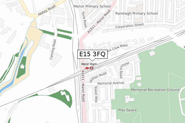
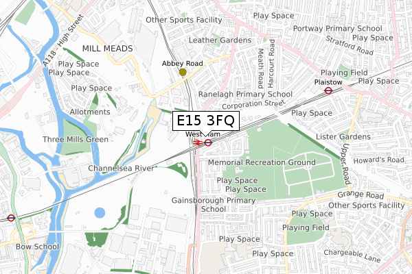
E15 3FQ is located in the West Ham electoral ward, within the London borough of Newham and the English Parliamentary constituency of West Ham. The Sub Integrated Care Board (ICB) Location is NHS North East London ICB - A3A8R and the police force is Metropolitan Police. This postcode has been in use since August 2019.


GetTheData
Source: OS Open Zoomstack (Ordnance Survey)
Licence: Open Government Licence (requires attribution)
Attribution: Contains OS data © Crown copyright and database right 2024
Source: Open Postcode Geo
Licence: Open Government Licence (requires attribution)
Attribution: Contains OS data © Crown copyright and database right 2024; Contains Royal Mail data © Royal Mail copyright and database right 2024; Source: Office for National Statistics licensed under the Open Government Licence v.3.0
| Easting | 539196 |
| Northing | 183001 |
| Latitude | 51.528771 |
| Longitude | 0.005269 |
GetTheData
Source: Open Postcode Geo
Licence: Open Government Licence
| Country | England |
| Postcode District | E15 |
| ➜ E15 open data dashboard ➜ See where E15 is on a map ➜ Where is West Ham? | |
GetTheData
Source: Land Registry Price Paid Data
Licence: Open Government Licence
| Ward | West Ham |
| Constituency | West Ham |
GetTheData
Source: ONS Postcode Database
Licence: Open Government Licence
| January 2024 | Violence and sexual offences | On or near Corporation Street | 438m |
| January 2024 | Violence and sexual offences | On or near Corporation Street | 438m |
| January 2024 | Public order | On or near Corporation Street | 438m |
| ➜ Get more crime data in our Crime section | |||
GetTheData
Source: data.police.uk
Licence: Open Government Licence
| West Ham | West Ham | 98m |
| West Ham | West Ham | 162m |
| Milner Road Canning Town (Manor Road) | Canning Town | 278m |
| Leywick Street (Manor Road) | Stratford | 284m |
| Corporation Street (Manor Road) | Stratford | 316m |
| West Ham Underground Station | West Ham | 72m |
| West Ham Dlr Station | West Ham | 111m |
| Abbey Road Dlr Station | Stratford | 366m |
| Star Lane Dlr Station | Canning Town | 891m |
| Plaistow Underground Station | Plaistow | 894m |
| West Ham Station | 0km |
| Stratford (London) Station | 1.6km |
| Maryland Station | 1.9km |
GetTheData
Source: NaPTAN
Licence: Open Government Licence
GetTheData
Source: ONS Postcode Database
Licence: Open Government Licence


➜ Get more ratings from the Food Standards Agency
GetTheData
Source: Food Standards Agency
Licence: FSA terms & conditions
| Last Collection | |||
|---|---|---|---|
| Location | Mon-Fri | Sat | Distance |
| Memorial Avenue E15 | 17:30 | 12:00 | 122m |
| Rokeby Street | 17:30 | 11:30 | 695m |
| Corporation Street | 17:30 | 11:30 | 703m |
GetTheData
Source: Dracos
Licence: Creative Commons Attribution-ShareAlike
| Facility | Distance |
|---|---|
| East London Rfc Holland Road, London Grass Pitches | 351m |
| West Ham Memorial Recreation Ground Ronald Avenue, Stratford, London Grass Pitches, Artificial Grass Pitch | 499m |
| Eastlea Community School Pretoria Road, London Health and Fitness Gym, Grass Pitches, Sports Hall, Studio | 723m |
GetTheData
Source: Active Places
Licence: Open Government Licence
| School | Phase of Education | Distance |
|---|---|---|
| Ranelagh Primary School Corporation Street, Stratford, London, E15 3DN | Primary | 393m |
| Gainsborough Primary School Gainsborough Road, London, E15 3AF | Primary | 415m |
| Stratford Manor Primary School & Nursery Richardson Road, London, E15 3BA | Primary | 452m |
GetTheData
Source: Edubase
Licence: Open Government Licence
| Risk of E15 3FQ flooding from rivers and sea | Very Low |
| ➜ E15 3FQ flood map | |
GetTheData
Source: Open Flood Risk by Postcode
Licence: Open Government Licence
The below table lists the International Territorial Level (ITL) codes (formerly Nomenclature of Territorial Units for Statistics (NUTS) codes) and Local Administrative Units (LAU) codes for E15 3FQ:
| ITL 1 Code | Name |
|---|---|
| TLI | London |
| ITL 2 Code | Name |
| TLI4 | Inner London - East |
| ITL 3 Code | Name |
| TLI41 | Hackney and Newham |
| LAU 1 Code | Name |
| E09000025 | Newham |
GetTheData
Source: ONS Postcode Directory
Licence: Open Government Licence
The below table lists the Census Output Area (OA), Lower Layer Super Output Area (LSOA), and Middle Layer Super Output Area (MSOA) for E15 3FQ:
| Code | Name | |
|---|---|---|
| OA | E00018324 | |
| LSOA | E01003631 | Newham 020A |
| MSOA | E02000733 | Newham 020 |
GetTheData
Source: ONS Postcode Directory
Licence: Open Government Licence
| E15 3AT | Alan Hocken Way | 79m |
| E15 3BW | Durban Road | 99m |
| E15 3BT | Memorial Avenue | 101m |
| E15 3AU | Tom Nolan Close | 109m |
| E15 3AS | Jack Clow Road | 155m |
| E15 3BS | Memorial Avenue | 168m |
| E15 3DE | Celandine Way | 192m |
| E15 3AA | Teasel Way | 197m |
| E15 3BP | Holland Road | 204m |
| E15 3BL | Manor Road | 225m |
GetTheData
Source: Open Postcode Geo; Land Registry Price Paid Data
Licence: Open Government Licence