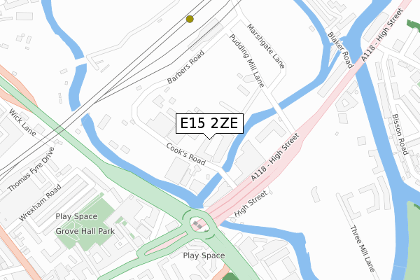
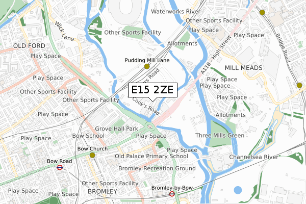
E15 2ZE is located in the Stratford electoral ward, within the London borough of Newham and the English Parliamentary constituency of West Ham. The Sub Integrated Care Board (ICB) Location is NHS North East London ICB - A3A8R and the police force is Metropolitan Police. This postcode has been in use since August 2022.


GetTheData
Source: OS Open Zoomstack (Ordnance Survey)
Licence: Open Government Licence (requires attribution)
Attribution: Contains OS data © Crown copyright and database right 2024
Source: Open Postcode Geo
Licence: Open Government Licence (requires attribution)
Attribution: Contains OS data © Crown copyright and database right 2024; Contains Royal Mail data © Royal Mail copyright and database right 2024; Source: Office for National Statistics licensed under the Open Government Licence v.3.0
| Easting | 537880 |
| Northing | 183271 |
| Latitude | 51.531520 |
| Longitude | -0.013584 |
GetTheData
Source: Open Postcode Geo
Licence: Open Government Licence
| Country | England |
| Postcode District | E15 |
| ➜ E15 open data dashboard ➜ See where E15 is on a map ➜ Where is London? | |
GetTheData
Source: Land Registry Price Paid Data
Licence: Open Government Licence
| Ward | Stratford |
| Constituency | West Ham |
GetTheData
Source: ONS Postcode Database
Licence: Open Government Licence
| January 2024 | Criminal damage and arson | On or near Brymay Close | 390m |
| October 2023 | Anti-social behaviour | On or near Brymay Close | 390m |
| October 2023 | Burglary | On or near Brymay Close | 390m |
| ➜ Get more crime data in our Crime section | |||
GetTheData
Source: data.police.uk
Licence: Open Government Licence
| Marshgate Lane (Stratford High Street) | Stratford | 169m |
| Bow Flyover (Stratford High Street) | Bow | 171m |
| Bow Interchange (Bromley High Street) | Bromley | 306m |
| St Leonards Street (Bromley High Street) | Bromley | 364m |
| Bow Church (Bow Road) | Bow | 365m |
| Pudding Mill Lane Dlr Station (Pudding Mill Lane) | Pudding Mill Lane | 315m |
| Bow Church Dlr Station (Bow Road) | Bow | 651m |
| Bromley-by-bow Underground Station | Bromley | 757m |
| Bow Road Underground Station | Bow | 948m |
| Devons Road Dlr Station (Devons Road) | Devons Road | 1,023m |
| Stratford (London) Station | 1.4km |
| West Ham Station | 1.4km |
| Stratford International Station | 1.5km |
GetTheData
Source: NaPTAN
Licence: Open Government Licence
GetTheData
Source: ONS Postcode Database
Licence: Open Government Licence


➜ Get more ratings from the Food Standards Agency
GetTheData
Source: Food Standards Agency
Licence: FSA terms & conditions
| Last Collection | |||
|---|---|---|---|
| Location | Mon-Fri | Sat | Distance |
| Franklin Street | 17:30 | 11:30 | 460m |
| Abbey Lane | 18:30 | 11:30 | 476m |
| O/S Bow Mspo | 18:30 | 12:00 | 500m |
GetTheData
Source: Dracos
Licence: Creative Commons Attribution-ShareAlike
| Facility | Distance |
|---|---|
| Bow School Of Maths And Computing (Closed) Paton Close, Fairfield Road, London Health and Fitness Gym, Sports Hall | 598m |
| London Marathon Community Track Pudding Mill Lane, Pudding Mill Lane, Stratford, London Athletics, Grass Pitches | 630m |
| Anytime Fitness (London Stratford) High Street, High Street, London Health and Fitness Gym | 663m |
GetTheData
Source: Active Places
Licence: Open Government Licence
| School | Phase of Education | Distance |
|---|---|---|
| School 360 5 Sugar House Lane, London, E15 2QS | Primary | 321m |
| Old Palace Primary School St Leonard's Street, Bow, London, E3 3BT | Primary | 434m |
| Bobby Moore Academy 1 Siding Street, Queen Elizabeth Olympic Park, London, E20 2AE | All-through | 525m |
GetTheData
Source: Edubase
Licence: Open Government Licence
| Risk of E15 2ZE flooding from rivers and sea | Medium |
| ➜ E15 2ZE flood map | |
GetTheData
Source: Open Flood Risk by Postcode
Licence: Open Government Licence
The below table lists the International Territorial Level (ITL) codes (formerly Nomenclature of Territorial Units for Statistics (NUTS) codes) and Local Administrative Units (LAU) codes for E15 2ZE:
| ITL 1 Code | Name |
|---|---|
| TLI | London |
| ITL 2 Code | Name |
| TLI4 | Inner London - East |
| ITL 3 Code | Name |
| TLI41 | Hackney and Newham |
| LAU 1 Code | Name |
| E09000025 | Newham |
GetTheData
Source: ONS Postcode Directory
Licence: Open Government Licence
The below table lists the Census Output Area (OA), Lower Layer Super Output Area (LSOA), and Middle Layer Super Output Area (MSOA) for E15 2ZE:
| Code | Name | |
|---|---|---|
| OA | E00175073 | |
| LSOA | E01033579 | Newham 013F |
| MSOA | E02000726 | Newham 013 |
GetTheData
Source: ONS Postcode Directory
Licence: Open Government Licence
| E15 2PW | Cooks Road | 40m |
| E15 2PL | High Street | 90m |
| E15 2PR | High Street | 90m |
| E15 2PS | High Street | 91m |
| E15 2PP | High Street | 119m |
| E15 2NS | High Street | 148m |
| E15 2NY | High Street | 148m |
| E15 2NZ | High Street | 148m |
| E15 2QQ | High Street | 199m |
| E3 2FX | Payne Road | 213m |
GetTheData
Source: Open Postcode Geo; Land Registry Price Paid Data
Licence: Open Government Licence