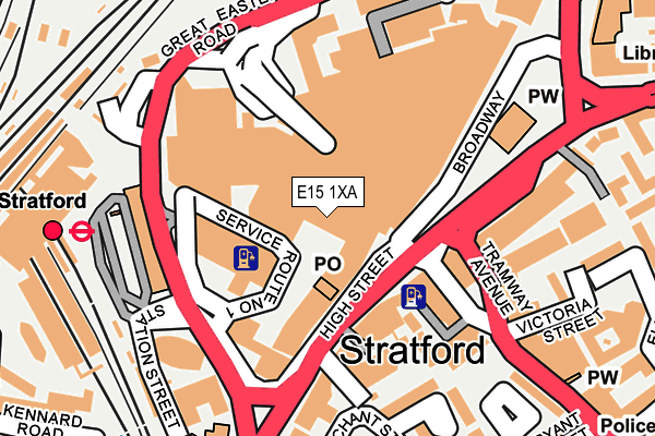
E15 1XA is located in the Stratford electoral ward, within the London borough of Newham and the English Parliamentary constituency of West Ham. The Sub Integrated Care Board (ICB) Location is NHS North East London ICB - A3A8R and the police force is Metropolitan Police. This postcode has been in use since January 1980.


GetTheData
Source: OS OpenMap – Local (Ordnance Survey)
Source: OS VectorMap District (Ordnance Survey)
Licence: Open Government Licence (requires attribution)
| Easting | 538831 |
| Northing | 184369 |
| Latitude | 51.541152 |
| Longitude | 0.000522 |
GetTheData
Source: Open Postcode Geo
Licence: Open Government Licence
| Country | England |
| Postcode District | E15 |
➜ See where E15 is on a map ➜ Where is London? | |
GetTheData
Source: Land Registry Price Paid Data
Licence: Open Government Licence
Elevation or altitude of E15 1XA as distance above sea level:
| Metres | Feet | |
|---|---|---|
| Elevation | 10m | 33ft |
Elevation is measured from the approximate centre of the postcode, to the nearest point on an OS contour line from OS Terrain 50, which has contour spacing of ten vertical metres.
➜ How high above sea level am I? Find the elevation of your current position using your device's GPS.
GetTheData
Source: Open Postcode Elevation
Licence: Open Government Licence
| Ward | Stratford |
| Constituency | West Ham |
GetTheData
Source: ONS Postcode Database
Licence: Open Government Licence
| Stratford Centre Burtons Court | Stratford | 84m |
| Stratford Centre Burtons Court (Broadway) | Stratford | 95m |
| Stratford Centre Burtons Court (Broadway) | Stratford | 145m |
| Stratford Broadway | Stratford | 153m |
| Stratford Bus Station | Stratford | 168m |
| Stratford Dlr Station (Station Street) | Stratford | 273m |
| Stratford Underground Station | Stratford | 285m |
| Stratford High Street Dlr Station | Stratford | 347m |
| Stratford International Dlr Station | Stratford | 840m |
| Abbey Road Dlr Station | Stratford | 1,050m |
| Stratford (London) Station | 0.3km |
| Maryland Station | 0.7km |
| Stratford International Station | 0.8km |
GetTheData
Source: NaPTAN
Licence: Open Government Licence
| Median download speed | 19.4Mbps |
| Average download speed | 17.0Mbps |
| Maximum download speed | 23.24Mbps |
| Median upload speed | 1.0Mbps |
| Average upload speed | 1.0Mbps |
| Maximum upload speed | 1.23Mbps |
GetTheData
Source: Ofcom
Licence: Ofcom Terms of Use (requires attribution)
GetTheData
Source: ONS Postcode Database
Licence: Open Government Licence


➜ Get more ratings from the Food Standards Agency
GetTheData
Source: Food Standards Agency
Licence: FSA terms & conditions
| Last Collection | |||
|---|---|---|---|
| Location | Mon-Fri | Sat | Distance |
| 26/28 Broadway E15 | 17:30 | 12:00 | 70m |
| O/S Stratford Ifpo | 17:30 | 12:00 | 70m |
| Broadway | 17:30 | 11:30 | 187m |
GetTheData
Source: Dracos
Licence: Creative Commons Attribution-ShareAlike
The below table lists the International Territorial Level (ITL) codes (formerly Nomenclature of Territorial Units for Statistics (NUTS) codes) and Local Administrative Units (LAU) codes for E15 1XA:
| ITL 1 Code | Name |
|---|---|
| TLI | London |
| ITL 2 Code | Name |
| TLI4 | Inner London - East |
| ITL 3 Code | Name |
| TLI41 | Hackney and Newham |
| LAU 1 Code | Name |
| E09000025 | Newham |
GetTheData
Source: ONS Postcode Directory
Licence: Open Government Licence
The below table lists the Census Output Area (OA), Lower Layer Super Output Area (LSOA), and Middle Layer Super Output Area (MSOA) for E15 1XA:
| Code | Name | |
|---|---|---|
| OA | E00174988 | |
| LSOA | E01003617 | Newham 012B |
| MSOA | E02000725 | Newham 012 |
GetTheData
Source: ONS Postcode Directory
Licence: Open Government Licence
| E15 1DL | Great Eastern Road | 134m |
| E15 4BQ | Broadway | 141m |
| E15 1DX | Great Eastern Road | 144m |
| E15 1BG | Gerry Raffles Square | 161m |
| E15 1BQ | Gerry Raffles Square | 161m |
| E15 1DA | Station Street | 186m |
| E15 4PN | Tramway Avenue | 189m |
| E15 4PP | Victoria Street | 222m |
| E15 4QZ | High Street | 241m |
| E15 1NR | The Grove | 264m |
GetTheData
Source: Open Postcode Geo; Land Registry Price Paid Data
Licence: Open Government Licence