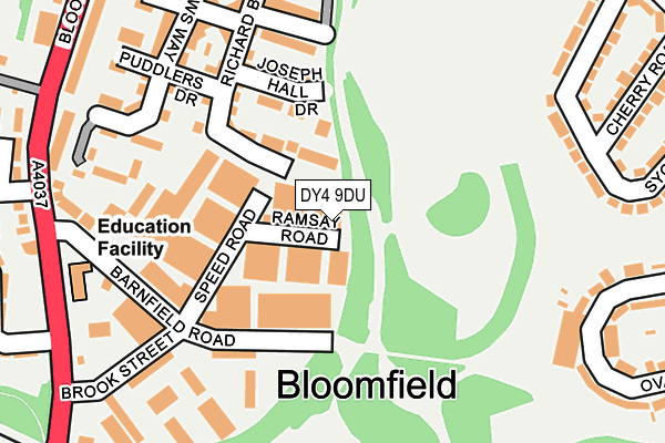
DY4 9DU is located in the Tipton Green electoral ward, within the metropolitan district of Sandwell and the English Parliamentary constituency of West Bromwich West. The Sub Integrated Care Board (ICB) Location is NHS Black Country ICB - D2P2L and the police force is West Midlands. This postcode has been in use since February 1984.


GetTheData
Source: OS OpenMap – Local (Ordnance Survey)
Source: OS VectorMap District (Ordnance Survey)
Licence: Open Government Licence (requires attribution)
| Easting | 395329 |
| Northing | 293053 |
| Latitude | 52.535334 |
| Longitude | -2.070288 |
GetTheData
Source: Open Postcode Geo
Licence: Open Government Licence
| Country | England |
| Postcode District | DY4 |
➜ See where DY4 is on a map ➜ Where is Tipton? | |
GetTheData
Source: Land Registry Price Paid Data
Licence: Open Government Licence
Elevation or altitude of DY4 9DU as distance above sea level:
| Metres | Feet | |
|---|---|---|
| Elevation | 150m | 492ft |
Elevation is measured from the approximate centre of the postcode, to the nearest point on an OS contour line from OS Terrain 50, which has contour spacing of ten vertical metres.
➜ How high above sea level am I? Find the elevation of your current position using your device's GPS.
GetTheData
Source: Open Postcode Elevation
Licence: Open Government Licence
| Ward | Tipton Green |
| Constituency | West Bromwich West |
GetTheData
Source: ONS Postcode Database
Licence: Open Government Licence
| William Barrows Way (Bloomfield Rd) | Bloomfield | 297m |
| William Barrows Way (Bloomfield Rd) | Bloomfield | 348m |
| Railway Bridge (Bloomfield Rd) | Bloomfield | 350m |
| Railway Bridge (Bloomfield Rd) | Bloomfield | 359m |
| Salter Rd (Central Ave) | Summer Hill | 375m |
| Tipton Station | 0.6km |
| Coseley Station | 1.5km |
| Dudley Port Station | 1.8km |
GetTheData
Source: NaPTAN
Licence: Open Government Licence
GetTheData
Source: ONS Postcode Database
Licence: Open Government Licence


➜ Get more ratings from the Food Standards Agency
GetTheData
Source: Food Standards Agency
Licence: FSA terms & conditions
| Last Collection | |||
|---|---|---|---|
| Location | Mon-Fri | Sat | Distance |
| Newhall Street | 17:30 | 11:00 | 514m |
| Union Street | 18:15 | 12:00 | 755m |
| Dimmocks Avenue | 17:00 | 11:00 | 887m |
GetTheData
Source: Dracos
Licence: Creative Commons Attribution-ShareAlike
The below table lists the International Territorial Level (ITL) codes (formerly Nomenclature of Territorial Units for Statistics (NUTS) codes) and Local Administrative Units (LAU) codes for DY4 9DU:
| ITL 1 Code | Name |
|---|---|
| TLG | West Midlands (England) |
| ITL 2 Code | Name |
| TLG3 | West Midlands |
| ITL 3 Code | Name |
| TLG37 | Sandwell |
| LAU 1 Code | Name |
| E08000028 | Sandwell |
GetTheData
Source: ONS Postcode Directory
Licence: Open Government Licence
The below table lists the Census Output Area (OA), Lower Layer Super Output Area (LSOA), and Middle Layer Super Output Area (MSOA) for DY4 9DU:
| Code | Name | |
|---|---|---|
| OA | E00050940 | |
| LSOA | E01010074 | Sandwell 014E |
| MSOA | E02002056 | Sandwell 014 |
GetTheData
Source: ONS Postcode Directory
Licence: Open Government Licence
| DY4 9EF | Joseph Hall Drive | 109m |
| DY4 9DX | Speed Road | 126m |
| DY4 9DD | Brook Street | 193m |
| DY4 9EL | Parkers Way | 193m |
| DY4 9AX | Rollers Way | 206m |
| DY4 9EQ | Puddlers Drive | 212m |
| DY4 9FD | Richard Bradley Way | 229m |
| DY4 9ED | William Barrows Way | 233m |
| DY4 9EA | William Barrows Way | 235m |
| DY4 9EJ | Shinglers Drive | 255m |
GetTheData
Source: Open Postcode Geo; Land Registry Price Paid Data
Licence: Open Government Licence