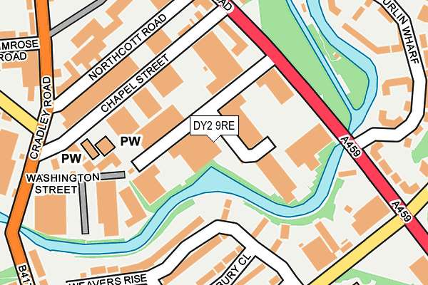
DY2 9RE is located in the Netherton, Woodside and St Andrews electoral ward, within the metropolitan district of Dudley and the English Parliamentary constituency of Dudley South. The Sub Integrated Care Board (ICB) Location is NHS Black Country ICB - D2P2L and the police force is West Midlands. This postcode has been in use since January 1980.


GetTheData
Source: OS OpenMap – Local (Ordnance Survey)
Source: OS VectorMap District (Ordnance Survey)
Licence: Open Government Licence (requires attribution)
| Easting | 394788 |
| Northing | 287489 |
| Latitude | 52.485294 |
| Longitude | -2.078180 |
GetTheData
Source: Open Postcode Geo
Licence: Open Government Licence
| Country | England |
| Postcode District | DY2 |
➜ See where DY2 is on a map ➜ Where is Dudley? | |
GetTheData
Source: Land Registry Price Paid Data
Licence: Open Government Licence
Elevation or altitude of DY2 9RE as distance above sea level:
| Metres | Feet | |
|---|---|---|
| Elevation | 140m | 459ft |
Elevation is measured from the approximate centre of the postcode, to the nearest point on an OS contour line from OS Terrain 50, which has contour spacing of ten vertical metres.
➜ How high above sea level am I? Find the elevation of your current position using your device's GPS.
GetTheData
Source: Open Postcode Elevation
Licence: Open Government Licence
| Ward | Netherton, Woodside And St Andrews |
| Constituency | Dudley South |
GetTheData
Source: ONS Postcode Database
Licence: Open Government Licence
| Washington St (Halesowen Rd) | Darby End | 138m |
| Washington St (Halesowen Rd) | Darby End | 150m |
| Halesowen Rd (Saltwells Rd) | Darby End | 242m |
| Washington St (Cradley Rd) | Netherton | 248m |
| Halesowen Rd (Saltwells Rd) | Darby End | 255m |
| Cradley Heath Station | 1.9km |
| Old Hill Station | 2.2km |
| Rowley Regis Station | 3.3km |
GetTheData
Source: NaPTAN
Licence: Open Government Licence
GetTheData
Source: ONS Postcode Database
Licence: Open Government Licence


➜ Get more ratings from the Food Standards Agency
GetTheData
Source: Food Standards Agency
Licence: FSA terms & conditions
| Last Collection | |||
|---|---|---|---|
| Location | Mon-Fri | Sat | Distance |
| Lombard Avenue | 17:30 | 11:00 | 344m |
| Molyneux Road | 17:30 | 11:00 | 546m |
| Chester Road | 17:30 | 11:00 | 590m |
GetTheData
Source: Dracos
Licence: Creative Commons Attribution-ShareAlike
The below table lists the International Territorial Level (ITL) codes (formerly Nomenclature of Territorial Units for Statistics (NUTS) codes) and Local Administrative Units (LAU) codes for DY2 9RE:
| ITL 1 Code | Name |
|---|---|
| TLG | West Midlands (England) |
| ITL 2 Code | Name |
| TLG3 | West Midlands |
| ITL 3 Code | Name |
| TLG36 | Dudley |
| LAU 1 Code | Name |
| E08000027 | Dudley |
GetTheData
Source: ONS Postcode Directory
Licence: Open Government Licence
The below table lists the Census Output Area (OA), Lower Layer Super Output Area (LSOA), and Middle Layer Super Output Area (MSOA) for DY2 9RE:
| Code | Name | |
|---|---|---|
| OA | E00049777 | |
| LSOA | E01009843 | Dudley 018C |
| MSOA | E02002017 | Dudley 018 |
GetTheData
Source: ONS Postcode Directory
Licence: Open Government Licence
| DY2 9PN | Chapel Street | 127m |
| DY2 9QL | Weavers Rise | 158m |
| DY2 9QJ | Fladbury Close | 185m |
| DY2 9PD | Tromans Industrial Estate | 209m |
| DY2 9PR | Northcott Road | 218m |
| DY2 9QH | Evesham Rise | 240m |
| DY2 9PT | Quayside Walk | 252m |
| DY2 9PQ | Purlin Wharf | 255m |
| DY2 9PG | Purlin Wharf | 272m |
| DY2 9RN | Abingdon Road | 285m |
GetTheData
Source: Open Postcode Geo; Land Registry Price Paid Data
Licence: Open Government Licence