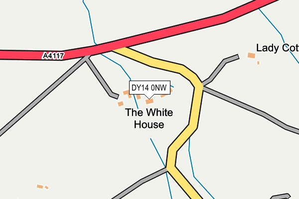
DY14 0NW is in Doddington, Kidderminster. DY14 0NW is located in the Cleobury Mortimer electoral ward, within the unitary authority of Shropshire and the English Parliamentary constituency of Ludlow. The Sub Integrated Care Board (ICB) Location is NHS Shropshire, Telford and Wrekin ICB - M2L0M and the police force is West Mercia. This postcode has been in use since January 1980.


GetTheData
Source: OS OpenMap – Local (Ordnance Survey)
Source: OS VectorMap District (Ordnance Survey)
Licence: Open Government Licence (requires attribution)
| Easting | 360898 |
| Northing | 275735 |
| Latitude | 52.378247 |
| Longitude | -2.575845 |
GetTheData
Source: Open Postcode Geo
Licence: Open Government Licence
| Locality | Doddington |
| Town/City | Kidderminster |
| Country | England |
| Postcode District | DY14 |
➜ See where DY14 is on a map | |
GetTheData
Source: Land Registry Price Paid Data
Licence: Open Government Licence
Elevation or altitude of DY14 0NW as distance above sea level:
| Metres | Feet | |
|---|---|---|
| Elevation | 320m | 1,050ft |
Elevation is measured from the approximate centre of the postcode, to the nearest point on an OS contour line from OS Terrain 50, which has contour spacing of ten vertical metres.
➜ How high above sea level am I? Find the elevation of your current position using your device's GPS.
GetTheData
Source: Open Postcode Elevation
Licence: Open Government Licence
| Ward | Cleobury Mortimer |
| Constituency | Ludlow |
GetTheData
Source: ONS Postcode Database
Licence: Open Government Licence
| Coreley Jct (A4117) | Cornbrook | 127m |
| Coreley Jct (A4117) | Cornbrook | 133m |
| Faulkners Fold (Hints Meadow) | Hints | 584m |
| Faulkners Fold (Hints Meadow) | Hints | 599m |
| Church (A4117) | Doddington | 699m |
GetTheData
Source: NaPTAN
Licence: Open Government Licence
| Percentage of properties with Next Generation Access | 100.0% |
| Percentage of properties with Superfast Broadband | 100.0% |
| Percentage of properties with Ultrafast Broadband | 0.0% |
| Percentage of properties with Full Fibre Broadband | 0.0% |
Superfast Broadband is between 30Mbps and 300Mbps
Ultrafast Broadband is > 300Mbps
| Percentage of properties unable to receive 2Mbps | 0.0% |
| Percentage of properties unable to receive 5Mbps | 0.0% |
| Percentage of properties unable to receive 10Mbps | 0.0% |
| Percentage of properties unable to receive 30Mbps | 0.0% |
GetTheData
Source: Ofcom
Licence: Ofcom Terms of Use (requires attribution)
GetTheData
Source: ONS Postcode Database
Licence: Open Government Licence


➜ Get more ratings from the Food Standards Agency
GetTheData
Source: Food Standards Agency
Licence: FSA terms & conditions
| Last Collection | |||
|---|---|---|---|
| Location | Mon-Fri | Sat | Distance |
| Clee Hill Post Office | 16:30 | 11:30 | 1,625m |
| Royal Oak | 11:30 | 11:30 | 2,747m |
| Clee Stanton | 11:30 | 11:30 | 4,994m |
GetTheData
Source: Dracos
Licence: Creative Commons Attribution-ShareAlike
The below table lists the International Territorial Level (ITL) codes (formerly Nomenclature of Territorial Units for Statistics (NUTS) codes) and Local Administrative Units (LAU) codes for DY14 0NW:
| ITL 1 Code | Name |
|---|---|
| TLG | West Midlands (England) |
| ITL 2 Code | Name |
| TLG2 | Shropshire and Staffordshire |
| ITL 3 Code | Name |
| TLG22 | Shropshire |
| LAU 1 Code | Name |
| E06000051 | Shropshire |
GetTheData
Source: ONS Postcode Directory
Licence: Open Government Licence
The below table lists the Census Output Area (OA), Lower Layer Super Output Area (LSOA), and Middle Layer Super Output Area (MSOA) for DY14 0NW:
| Code | Name | |
|---|---|---|
| OA | E00147690 | |
| LSOA | E01029000 | Shropshire 039D |
| MSOA | E02006046 | Shropshire 039 |
GetTheData
Source: ONS Postcode Directory
Licence: Open Government Licence
| SY8 3QX | 342m | |
| SY8 3QN | 388m | |
| SY8 3QJ | Furnace Lane | 445m |
| SY8 3QU | 513m | |
| SY8 3QQ | Cornbrook | 558m |
| SY8 3QS | Hints Meadow | 661m |
| SY8 3BE | The Orchard | 688m |
| SY8 3BD | Badgers Rise | 701m |
| SY8 3QP | The Poplars | 736m |
| SY8 3QG | Cornbrook | 756m |
GetTheData
Source: Open Postcode Geo; Land Registry Price Paid Data
Licence: Open Government Licence