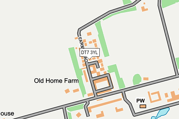
DT7 3YL lies on Old Home Farm in Rousdon, Lyme Regis. DT7 3YL is located in the Trinity electoral ward, within the local authority district of East Devon and the English Parliamentary constituency of Tiverton and Honiton. The Sub Integrated Care Board (ICB) Location is NHS Devon ICB - 15N and the police force is Devon & Cornwall. This postcode has been in use since March 2005.


GetTheData
Source: OS OpenMap – Local (Ordnance Survey)
Source: OS VectorMap District (Ordnance Survey)
Licence: Open Government Licence (requires attribution)
| Easting | 329216 |
| Northing | 90653 |
| Latitude | 50.711182 |
| Longitude | -3.003890 |
GetTheData
Source: Open Postcode Geo
Licence: Open Government Licence
| Street | Old Home Farm |
| Locality | Rousdon |
| Town/City | Lyme Regis |
| Country | England |
| Postcode District | DT7 |
➜ See where DT7 is on a map | |
GetTheData
Source: Land Registry Price Paid Data
Licence: Open Government Licence
Elevation or altitude of DT7 3YL as distance above sea level:
| Metres | Feet | |
|---|---|---|
| Elevation | 150m | 492ft |
Elevation is measured from the approximate centre of the postcode, to the nearest point on an OS contour line from OS Terrain 50, which has contour spacing of ten vertical metres.
➜ How high above sea level am I? Find the elevation of your current position using your device's GPS.
GetTheData
Source: Open Postcode Elevation
Licence: Open Government Licence
| Ward | Trinity |
| Constituency | Tiverton And Honiton |
GetTheData
Source: ONS Postcode Database
Licence: Open Government Licence
| Garage (A3052) | Rousdon | 715m |
| Garage (A3052) | Rousdon | 727m |
| Charton Cross (A3052) | Rousdon | 1,275m |
| Westhayes Caravan Site (Boshill Hill) | Combpyne | 1,281m |
| Westhayes Caravan Site (Boshill Hill) | Combpyne | 1,290m |
GetTheData
Source: NaPTAN
Licence: Open Government Licence
| Percentage of properties with Next Generation Access | 100.0% |
| Percentage of properties with Superfast Broadband | 82.6% |
| Percentage of properties with Ultrafast Broadband | 0.0% |
| Percentage of properties with Full Fibre Broadband | 0.0% |
Superfast Broadband is between 30Mbps and 300Mbps
Ultrafast Broadband is > 300Mbps
| Median download speed | 26.0Mbps |
| Average download speed | 25.3Mbps |
| Maximum download speed | 47.28Mbps |
| Median upload speed | 6.2Mbps |
| Average upload speed | 5.7Mbps |
| Maximum upload speed | 8.92Mbps |
| Percentage of properties unable to receive 2Mbps | 0.0% |
| Percentage of properties unable to receive 5Mbps | 0.0% |
| Percentage of properties unable to receive 10Mbps | 0.0% |
| Percentage of properties unable to receive 30Mbps | 17.4% |
GetTheData
Source: Ofcom
Licence: Ofcom Terms of Use (requires attribution)
Estimated total energy consumption in DT7 3YL by fuel type, 2015.
| Consumption (kWh) | 78,362 |
|---|---|
| Meter count | 22 |
| Mean (kWh/meter) | 3,562 |
| Median (kWh/meter) | 3,598 |
GetTheData
Source: Postcode level gas estimates: 2015 (experimental)
Source: Postcode level electricity estimates: 2015 (experimental)
Licence: Open Government Licence
GetTheData
Source: ONS Postcode Database
Licence: Open Government Licence


➜ Get more ratings from the Food Standards Agency
GetTheData
Source: Food Standards Agency
Licence: FSA terms & conditions
| Last Collection | |||
|---|---|---|---|
| Location | Mon-Fri | Sat | Distance |
| Rousdon | 10:00 | 09:00 | 821m |
| Axmouth Post Office | 16:00 | 09:15 | 3,238m |
| Harbour Road | 17:30 | 11:30 | 4,318m |
GetTheData
Source: Dracos
Licence: Creative Commons Attribution-ShareAlike
The below table lists the International Territorial Level (ITL) codes (formerly Nomenclature of Territorial Units for Statistics (NUTS) codes) and Local Administrative Units (LAU) codes for DT7 3YL:
| ITL 1 Code | Name |
|---|---|
| TLK | South West (England) |
| ITL 2 Code | Name |
| TLK4 | Devon |
| ITL 3 Code | Name |
| TLK43 | Devon CC |
| LAU 1 Code | Name |
| E07000040 | East Devon |
GetTheData
Source: ONS Postcode Directory
Licence: Open Government Licence
The below table lists the Census Output Area (OA), Lower Layer Super Output Area (LSOA), and Middle Layer Super Output Area (MSOA) for DT7 3YL:
| Code | Name | |
|---|---|---|
| OA | E00101040 | |
| LSOA | E01019961 | East Devon 007E |
| MSOA | E02004135 | East Devon 007 |
GetTheData
Source: ONS Postcode Directory
Licence: Open Government Licence
| DT7 3RE | 42m | |
| DT7 3XT | 55m | |
| DT7 3YA | Home Farm North | 84m |
| DT7 3YD | The Bothy | 109m |
| DT7 3YB | Home Farm South | 119m |
| DT7 3XS | The Gardens | 155m |
| DT7 3XR | 200m | |
| DT7 3RA | Stable Courtyard | 246m |
| DT7 3XP | 491m | |
| DT7 3XU | 518m |
GetTheData
Source: Open Postcode Geo; Land Registry Price Paid Data
Licence: Open Government Licence