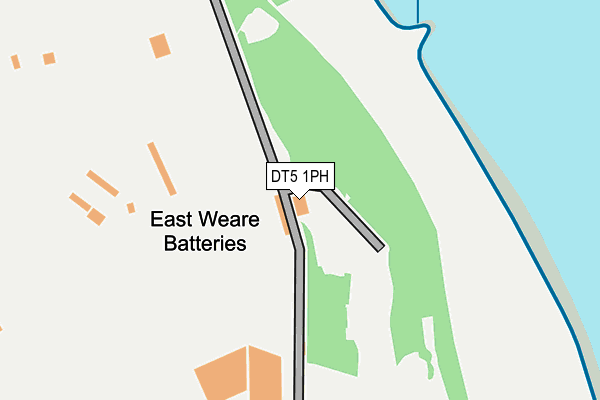
DT5 1PH is located in the Portland electoral ward, within the unitary authority of Dorset and the English Parliamentary constituency of South Dorset. The Sub Integrated Care Board (ICB) Location is NHS Dorset ICB - 11J and the police force is Dorset. This postcode has been in use since June 2002.


GetTheData
Source: OS OpenMap – Local (Ordnance Survey)
Source: OS VectorMap District (Ordnance Survey)
Licence: Open Government Licence (requires attribution)
| Easting | 369883 |
| Northing | 73672 |
| Latitude | 50.562018 |
| Longitude | -2.426560 |
GetTheData
Source: Open Postcode Geo
Licence: Open Government Licence
| Country | England |
| Postcode District | DT5 |
➜ See where DT5 is on a map | |
GetTheData
Source: Land Registry Price Paid Data
Licence: Open Government Licence
Elevation or altitude of DT5 1PH as distance above sea level:
| Metres | Feet | |
|---|---|---|
| Elevation | 50m | 164ft |
Elevation is measured from the approximate centre of the postcode, to the nearest point on an OS contour line from OS Terrain 50, which has contour spacing of ten vertical metres.
➜ How high above sea level am I? Find the elevation of your current position using your device's GPS.
GetTheData
Source: Open Postcode Elevation
Licence: Open Government Licence
| Ward | Portland |
| Constituency | South Dorset |
GetTheData
Source: ONS Postcode Database
Licence: Open Government Licence
| Verne View Point (Verne Common Road) | Fortuneswell | 883m |
| Verne Common Road | Fortuneswell | 1,061m |
| Amelia Close (East Weare Road) | Fortuneswell | 1,077m |
| Youth Club (Leet Close) | Fortuneswell | 1,080m |
| Britannia Inn (Fortuneswell) | Fortuneswell | 1,145m |
GetTheData
Source: NaPTAN
Licence: Open Government Licence
GetTheData
Source: ONS Postcode Database
Licence: Open Government Licence


➜ Get more ratings from the Food Standards Agency
GetTheData
Source: Food Standards Agency
Licence: FSA terms & conditions
| Last Collection | |||
|---|---|---|---|
| Location | Mon-Fri | Sat | Distance |
| High Street | 17:30 | 11:15 | 1,123m |
| Fortuneswell P.o. | 17:30 | 12:15 | 1,199m |
| Verne Common | 16:15 | 11:15 | 1,325m |
GetTheData
Source: Dracos
Licence: Creative Commons Attribution-ShareAlike
The below table lists the International Territorial Level (ITL) codes (formerly Nomenclature of Territorial Units for Statistics (NUTS) codes) and Local Administrative Units (LAU) codes for DT5 1PH:
| ITL 1 Code | Name |
|---|---|
| TLK | South West (England) |
| ITL 2 Code | Name |
| TLK2 | Dorset and Somerset |
| ITL 3 Code | Name |
| TLK25 | Dorset |
| LAU 1 Code | Name |
| E06000059 | Dorset |
GetTheData
Source: ONS Postcode Directory
Licence: Open Government Licence
The below table lists the Census Output Area (OA), Lower Layer Super Output Area (LSOA), and Middle Layer Super Output Area (MSOA) for DT5 1PH:
| Code | Name | |
|---|---|---|
| OA | E00104298 | |
| LSOA | E01020563 | Weymouth and Portland 008A |
| MSOA | E02004288 | Weymouth and Portland 008 |
GetTheData
Source: ONS Postcode Directory
Licence: Open Government Licence
| DT5 1EG | The Verne | 632m |
| DT5 1LF | Tillycombe Road | 876m |
| DT5 1LG | Tillycombe Road | 892m |
| DT5 1HE | Amelia Close | 962m |
| DT5 1HD | Beel Close | 972m |
| DT5 1LL | Tillycombe Road | 1013m |
| DT5 1HB | Leet Close | 1015m |
| DT5 1ET | East Weare Road | 1032m |
| DT5 1EX | East Weare Road | 1055m |
| DT5 1LP | Fortuneswell | 1073m |
GetTheData
Source: Open Postcode Geo; Land Registry Price Paid Data
Licence: Open Government Licence