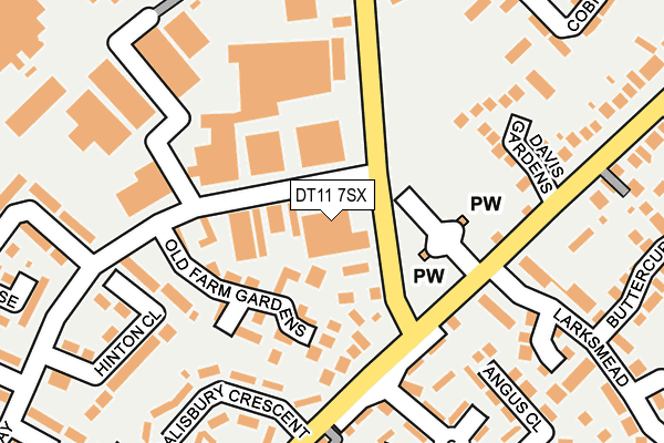
DT11 7SX is located in the Blandford electoral ward, within the unitary authority of Dorset and the English Parliamentary constituency of North Dorset. The Sub Integrated Care Board (ICB) Location is NHS Dorset ICB - 11J and the police force is Dorset. This postcode has been in use since December 1995.


GetTheData
Source: OS OpenMap – Local (Ordnance Survey)
Source: OS VectorMap District (Ordnance Survey)
Licence: Open Government Licence (requires attribution)
| Easting | 389125 |
| Northing | 107425 |
| Latitude | 50.866218 |
| Longitude | -2.155898 |
GetTheData
Source: Open Postcode Geo
Licence: Open Government Licence
| Country | England |
| Postcode District | DT11 |
➜ See where DT11 is on a map ➜ Where is Blandford Forum? | |
GetTheData
Source: Land Registry Price Paid Data
Licence: Open Government Licence
Elevation or altitude of DT11 7SX as distance above sea level:
| Metres | Feet | |
|---|---|---|
| Elevation | 80m | 262ft |
Elevation is measured from the approximate centre of the postcode, to the nearest point on an OS contour line from OS Terrain 50, which has contour spacing of ten vertical metres.
➜ How high above sea level am I? Find the elevation of your current position using your device's GPS.
GetTheData
Source: Open Postcode Elevation
Licence: Open Government Licence
| Ward | Blandford |
| Constituency | North Dorset |
GetTheData
Source: ONS Postcode Database
Licence: Open Government Licence
| Industrial Estate | Blandford Forum | 32m |
| Industrial Estate | Blandford Forum | 43m |
| Salisbury Road Cemetery (Salisbury Road) | Blandford Forum | 125m |
| Hunt Road (Salisbury Road) | Blandford Forum | 157m |
| Post Office (Salisbury Road) | Blandford Forum | 166m |
GetTheData
Source: NaPTAN
Licence: Open Government Licence
GetTheData
Source: ONS Postcode Database
Licence: Open Government Licence


➜ Get more ratings from the Food Standards Agency
GetTheData
Source: Food Standards Agency
Licence: FSA terms & conditions
| Last Collection | |||
|---|---|---|---|
| Location | Mon-Fri | Sat | Distance |
| Queens Road | 16:00 | 11:30 | 464m |
| Blandford Heights Ind Est | 17:15 | 11:00 | 538m |
| Badger | 16:00 | 11:30 | 885m |
GetTheData
Source: Dracos
Licence: Creative Commons Attribution-ShareAlike
The below table lists the International Territorial Level (ITL) codes (formerly Nomenclature of Territorial Units for Statistics (NUTS) codes) and Local Administrative Units (LAU) codes for DT11 7SX:
| ITL 1 Code | Name |
|---|---|
| TLK | South West (England) |
| ITL 2 Code | Name |
| TLK2 | Dorset and Somerset |
| ITL 3 Code | Name |
| TLK25 | Dorset |
| LAU 1 Code | Name |
| E06000059 | Dorset |
GetTheData
Source: ONS Postcode Directory
Licence: Open Government Licence
The below table lists the Census Output Area (OA), Lower Layer Super Output Area (LSOA), and Middle Layer Super Output Area (MSOA) for DT11 7SX:
| Code | Name | |
|---|---|---|
| OA | E00171763 | |
| LSOA | E01020436 | North Dorset 007B |
| MSOA | E02004261 | North Dorset 007 |
GetTheData
Source: ONS Postcode Directory
Licence: Open Government Licence
| DT11 7GB | Holmlea | 68m |
| DT11 7UU | Old Farm Gardens | 102m |
| DT11 7LR | Salisbury Road | 124m |
| DT11 7LS | Salisbury Road | 145m |
| DT11 7UX | Davis Gardens | 191m |
| DT11 7LY | Hunt Road | 200m |
| DT11 7LP | Damory Mews | 208m |
| DT11 7NA | Stevens Close | 210m |
| DT11 7LX | Salisbury Crescent | 213m |
| DT11 7RS | Hinton Close | 224m |
GetTheData
Source: Open Postcode Geo; Land Registry Price Paid Data
Licence: Open Government Licence