DN9 2PR maps, stats, and open data
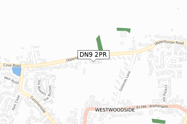
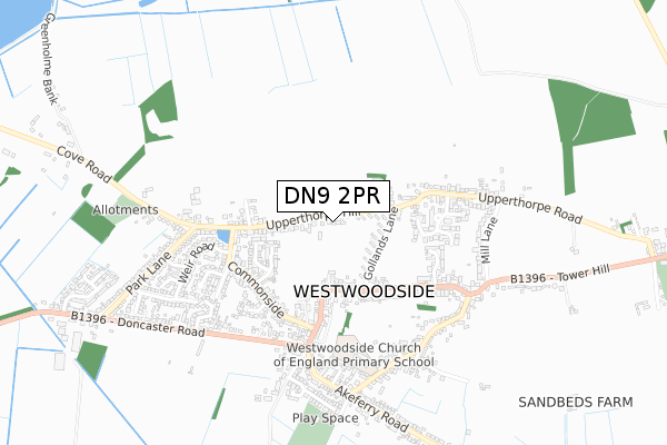
DN9 2PR lies on Tavella Court in Westwoodside, Doncaster. DN9 2PR is located in the Axholme South electoral ward, within the unitary authority of North Lincolnshire and the English Parliamentary constituency of Brigg and Goole. The Sub Integrated Care Board (ICB) Location is NHS Humber and North Yorkshire ICB - 03K and the police force is Humberside. This postcode has been in use since January 1993.
DN9 2PR maps


Licence: Open Government Licence (requires attribution)
Attribution: Contains OS data © Crown copyright and database right 2025
Source: Open Postcode Geo
Licence: Open Government Licence (requires attribution)
Attribution: Contains OS data © Crown copyright and database right 2025; Contains Royal Mail data © Royal Mail copyright and database right 2025; Source: Office for National Statistics licensed under the Open Government Licence v.3.0
DN9 2PR geodata
| Easting | 475229 |
| Northing | 399985 |
| Latitude | 53.491205 |
| Longitude | -0.867596 |
Where is DN9 2PR?
| Street | Tavella Court |
| Locality | Westwoodside |
| Town/City | Doncaster |
| Country | England |
| Postcode District | DN9 |
DN9 2PR Elevation
Elevation or altitude of DN9 2PR as distance above sea level:
| Metres | Feet | |
|---|---|---|
| Elevation | 20m | 66ft |
Elevation is measured from the approximate centre of the postcode, to the nearest point on an OS contour line from OS Terrain 50, which has contour spacing of ten vertical metres.
➜ How high above sea level am I? Find the elevation of your current position using your device's GPS.
Politics
| Ward | Axholme South |
|---|---|
| Constituency | Brigg And Goole |
House Prices
Sales of detached houses in DN9 2PR
2022 30 NOV £408,000 |
4, TAVELLA COURT, WESTWOODSIDE, DONCASTER, DN9 2PR 2021 8 SEP £360,000 |
4, TAVELLA COURT, WESTWOODSIDE, DONCASTER, DN9 2PR 2002 15 NOV £175,000 |
1, TAVELLA COURT, WESTWOODSIDE, DONCASTER, DN9 2PR 2001 18 APR £135,000 |
1, TAVELLA COURT, WESTWOODSIDE, DONCASTER, DN9 2PR 1995 1 SEP £117,000 |
1995 1 SEP £120,000 |
4, TAVELLA COURT, WESTWOODSIDE, DONCASTER, DN9 2PR 1995 27 APR £100,000 |
Licence: Contains HM Land Registry data © Crown copyright and database right 2025. This data is licensed under the Open Government Licence v3.0.
Transport
Nearest bus stops to DN9 2PR
| Upperthorpe Hill | Westwoodside | 55m |
| Newbigg | Westwoodside | 279m |
| Newbigg | Westwoodside | 308m |
| Pond (Commonside) | Westwoodside | 389m |
| Pond (Cove Road) | Westwoodside | 402m |
Broadband
Broadband access in DN9 2PR (2020 data)
| Percentage of properties with Next Generation Access | 100.0% |
| Percentage of properties with Superfast Broadband | 100.0% |
| Percentage of properties with Ultrafast Broadband | 100.0% |
| Percentage of properties with Full Fibre Broadband | 100.0% |
Superfast Broadband is between 30Mbps and 300Mbps
Ultrafast Broadband is > 300Mbps
Broadband limitations in DN9 2PR (2020 data)
| Percentage of properties unable to receive 2Mbps | 0.0% |
| Percentage of properties unable to receive 5Mbps | 0.0% |
| Percentage of properties unable to receive 10Mbps | 0.0% |
| Percentage of properties unable to receive 30Mbps | 0.0% |
Deprivation
9.7% of English postcodes are less deprived than DN9 2PR:Food Standards Agency
Three nearest food hygiene ratings to DN9 2PR (metres)


➜ Get more ratings from the Food Standards Agency
Nearest post box to DN9 2PR
| Last Collection | |||
|---|---|---|---|
| Location | Mon-Fri | Sat | Distance |
| Westwoodside Post Office | 17:00 | 11:15 | 359m |
| Nethergate | 17:00 | 11:15 | 515m |
| Cove Road | 16:15 | 11:00 | 531m |
DN9 2PR ITL and DN9 2PR LAU
The below table lists the International Territorial Level (ITL) codes (formerly Nomenclature of Territorial Units for Statistics (NUTS) codes) and Local Administrative Units (LAU) codes for DN9 2PR:
| ITL 1 Code | Name |
|---|---|
| TLE | Yorkshire and The Humber |
| ITL 2 Code | Name |
| TLE1 | East Yorkshire and Northern Lincolnshire |
| ITL 3 Code | Name |
| TLE13 | North and North East Lincolnshire |
| LAU 1 Code | Name |
| E06000013 | North Lincolnshire |
DN9 2PR census areas
The below table lists the Census Output Area (OA), Lower Layer Super Output Area (LSOA), and Middle Layer Super Output Area (MSOA) for DN9 2PR:
| Code | Name | |
|---|---|---|
| OA | E00066869 | |
| LSOA | E01013252 | North Lincolnshire 023C |
| MSOA | E02002771 | North Lincolnshire 023 |
Nearest postcodes to DN9 2PR
| DN9 2AJ | Upperthorpe Hill | 142m |
| DN9 2AX | Gollands Lane | 168m |
| DN9 2AL | Upperthorpe Road | 194m |
| DN9 2AU | Brethergate | 245m |
| DN9 2AH | Upperthorpe Road | 259m |
| DN9 2PH | The Birches | 260m |
| DN9 2PQ | The Rowans | 301m |
| DN9 2PD | Chapel Close | 302m |
| DN9 2AB | Brethergate Villas | 327m |
| DN9 2QN | Grange Court | 335m |