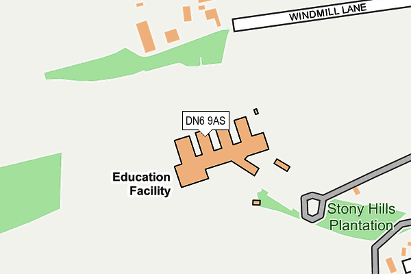
DN6 9AS is located in the Norton & Askern electoral ward, within the metropolitan district of Doncaster and the English Parliamentary constituency of Doncaster North. The Sub Integrated Care Board (ICB) Location is NHS South Yorkshire ICB - 02X and the police force is South Yorkshire. This postcode has been in use since January 1980.


GetTheData
Source: OS OpenMap – Local (Ordnance Survey)
Source: OS VectorMap District (Ordnance Survey)
Licence: Open Government Licence (requires attribution)
| Easting | 453870 |
| Northing | 414591 |
| Latitude | 53.625091 |
| Longitude | -1.186970 |
GetTheData
Source: Open Postcode Geo
Licence: Open Government Licence
| Country | England |
| Postcode District | DN6 |
➜ See where DN6 is on a map ➜ Where is Campsall? | |
GetTheData
Source: Land Registry Price Paid Data
Licence: Open Government Licence
Elevation or altitude of DN6 9AS as distance above sea level:
| Metres | Feet | |
|---|---|---|
| Elevation | 30m | 98ft |
Elevation is measured from the approximate centre of the postcode, to the nearest point on an OS contour line from OS Terrain 50, which has contour spacing of ten vertical metres.
➜ How high above sea level am I? Find the elevation of your current position using your device's GPS.
GetTheData
Source: Open Postcode Elevation
Licence: Open Government Licence
| Ward | Norton & Askern |
| Constituency | Doncaster North |
GetTheData
Source: ONS Postcode Database
Licence: Open Government Licence
| Campsmount High School (Ryecroft Road) | Campsall | 287m |
| Campsmount School (Ryecroft Road) | Campsall | 382m |
| Ryecroft Road | Campsall | 392m |
| Campsall Cemetery (Ryecroft Road) | Campsall | 491m |
| Church Field Road (Ryecroft Road) | Campsall | 500m |
GetTheData
Source: NaPTAN
Licence: Open Government Licence
GetTheData
Source: ONS Postcode Database
Licence: Open Government Licence


➜ Get more ratings from the Food Standards Agency
GetTheData
Source: Food Standards Agency
Licence: FSA terms & conditions
| Last Collection | |||
|---|---|---|---|
| Location | Mon-Fri | Sat | Distance |
| Campsall Estate | 16:30 | 09:30 | 578m |
| West End | 16:45 | 08:00 | 796m |
| Campsall P.o. | 16:30 | 11:30 | 807m |
GetTheData
Source: Dracos
Licence: Creative Commons Attribution-ShareAlike
The below table lists the International Territorial Level (ITL) codes (formerly Nomenclature of Territorial Units for Statistics (NUTS) codes) and Local Administrative Units (LAU) codes for DN6 9AS:
| ITL 1 Code | Name |
|---|---|
| TLE | Yorkshire and The Humber |
| ITL 2 Code | Name |
| TLE3 | South Yorkshire |
| ITL 3 Code | Name |
| TLE31 | Barnsley, Doncaster and Rotherham |
| LAU 1 Code | Name |
| E08000017 | Doncaster |
GetTheData
Source: ONS Postcode Directory
Licence: Open Government Licence
The below table lists the Census Output Area (OA), Lower Layer Super Output Area (LSOA), and Middle Layer Super Output Area (MSOA) for DN6 9AS:
| Code | Name | |
|---|---|---|
| OA | E00037974 | |
| LSOA | E01007493 | Doncaster 002G |
| MSOA | E02001540 | Doncaster 002 |
GetTheData
Source: ONS Postcode Directory
Licence: Open Government Licence
| DN6 9AT | Windmill Lane | 200m |
| DN6 9NL | Tennyson Avenue | 407m |
| DN6 9NJ | Tennyson Avenue | 419m |
| DN6 9NH | Shakespeare Avenue | 457m |
| DN6 9NN | Shakespeare Avenue | 483m |
| DN6 9NQ | Shakespeare Avenue | 485m |
| DN6 9NF | Wordsworth Avenue | 555m |
| DN6 9NG | Wordsworth Avenue | 568m |
| DN6 9NB | The Avenue | 571m |
| DN6 9DS | Prospect View | 600m |
GetTheData
Source: Open Postcode Geo; Land Registry Price Paid Data
Licence: Open Government Licence