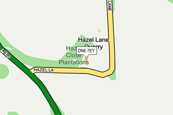
DN6 7EY is located in the Sprotbrough electoral ward, within the metropolitan district of Doncaster and the English Parliamentary constituency of Doncaster North. The Sub Integrated Care Board (ICB) Location is NHS South Yorkshire ICB - 02X and the police force is South Yorkshire. This postcode has been in use since June 1998.


GetTheData
Source: OS OpenMap – Local (Ordnance Survey)
Source: OS VectorMap District (Ordnance Survey)
Licence: Open Government Licence (requires attribution)
| Easting | 450110 |
| Northing | 410886 |
| Latitude | 53.592165 |
| Longitude | -1.244409 |
GetTheData
Source: Open Postcode Geo
Licence: Open Government Licence
| Country | England |
| Postcode District | DN6 |
➜ See where DN6 is on a map | |
GetTheData
Source: Land Registry Price Paid Data
Licence: Open Government Licence
Elevation or altitude of DN6 7EY as distance above sea level:
| Metres | Feet | |
|---|---|---|
| Elevation | 30m | 98ft |
Elevation is measured from the approximate centre of the postcode, to the nearest point on an OS contour line from OS Terrain 50, which has contour spacing of ten vertical metres.
➜ How high above sea level am I? Find the elevation of your current position using your device's GPS.
GetTheData
Source: Open Postcode Elevation
Licence: Open Government Licence
| Ward | Sprotbrough |
| Constituency | Doncaster North |
GetTheData
Source: ONS Postcode Database
Licence: Open Government Licence
| Leys Lane | Hampole | 796m |
| Doncaster Road | South Elmsall | 1,254m |
| Doncaster Road | South Elmsall | 1,261m |
| Bannister Lane (Straight Lane) | Skelbrooke | 1,547m |
| Field Lane Doncaster Rd (Field Lane) | South Elmsall | 1,564m |
| South Elmsall Station | 2.7km |
| Moorthorpe Station | 4km |
| Adwick Station | 4.8km |
GetTheData
Source: NaPTAN
Licence: Open Government Licence
GetTheData
Source: ONS Postcode Database
Licence: Open Government Licence

➜ Get more ratings from the Food Standards Agency
GetTheData
Source: Food Standards Agency
Licence: FSA terms & conditions
| Last Collection | |||
|---|---|---|---|
| Location | Mon-Fri | Sat | Distance |
| Hampole | 16:00 | 08:00 | 798m |
| Rectory Close | 16:00 | 09:00 | 1,515m |
| Howden Avenue | 16:15 | 09:30 | 2,207m |
GetTheData
Source: Dracos
Licence: Creative Commons Attribution-ShareAlike
The below table lists the International Territorial Level (ITL) codes (formerly Nomenclature of Territorial Units for Statistics (NUTS) codes) and Local Administrative Units (LAU) codes for DN6 7EY:
| ITL 1 Code | Name |
|---|---|
| TLE | Yorkshire and The Humber |
| ITL 2 Code | Name |
| TLE3 | South Yorkshire |
| ITL 3 Code | Name |
| TLE31 | Barnsley, Doncaster and Rotherham |
| LAU 1 Code | Name |
| E08000017 | Doncaster |
GetTheData
Source: ONS Postcode Directory
Licence: Open Government Licence
The below table lists the Census Output Area (OA), Lower Layer Super Output Area (LSOA), and Middle Layer Super Output Area (MSOA) for DN6 7EY:
| Code | Name | |
|---|---|---|
| OA | E00038427 | |
| LSOA | E01007587 | Doncaster 020C |
| MSOA | E02001558 | Doncaster 020 |
GetTheData
Source: ONS Postcode Directory
Licence: Open Government Licence
| DN6 7EX | Wakefield Road | 383m |
| DN6 7ET | Main Street | 749m |
| DN6 7EU | Wakefield Road | 803m |
| DN6 7ER | Station Cottages | 863m |
| DN6 7EP | Manor Cottages | 900m |
| DN6 8LX | Straight Lane | 1423m |
| DN6 8GA | Rectory Close | 1531m |
| DN6 7HA | Moorhouse Lane | 1540m |
| DN6 7EN | Wakefield Road | 1724m |
| DN6 8LU | Bannister Lane | 1792m |
GetTheData
Source: Open Postcode Geo; Land Registry Price Paid Data
Licence: Open Government Licence